

Hark! It’s that moment in February when the elements play tricks on sun-starved New Englanders by temporarily cranking up the heat to the low 60s; daring us to throw our down booties back into the closet. We know it won’t last—that this fleeting reverie of balmy afternoons and moist dusk will be succeeded by more hoarfrost, road salt, and angst. But you might as well enjoy this cruel mirage. I’ve decided to take advantage of the moment by plumping for a $10 MBTA weekend commuter rail pass and indulging in a self-started urban/suburban hiking challenge that I’ve called “Racing The Trains.”
Whenever I send out the annual Mind The Moss reader survey, in order to find out what all of you are digging and what you’d like to see more of in the newsletter, public transit-accessible hikes are always at the top of the list. Usually a transit-accessible trail is one that’s within short walking distance of a single train or bus stop. But in the Greater Boston metro area, there are several trails which allow you to hike between multiple transit stops on a single route. You hop off the train, crunch and crack your way through deciduous woods and wetlands for a couple of hours, and you emerge at the edge of a town where you can climb back onto another train, and head back in the direction from whence you came! That’s easy enough to pull off, but the race element comes down to the reality that in New England, the commuter rails sometimes run on more limited schedules: especially on the weekends, when most of us are free to hike.
This introduces some risk to your station-to-station hike. If you get to the second train station too early, you might find yourself bored, kicking an empty Dunks cup around the tracks, and listening for the brassy sound of the whistle. But if you get there too late and you miss the train, not only could you be stuck on some desolate station platform for an hour or two, but you might be stuck there altogether, if the train you missed was the last train home! So if you lose the race against the trains, your penalty might be a pricier Uber ride back home. It’s a bit silly, yes, but this form of gambling at least offers physiological benefits that you won’t experience on DraftKings. And unlike the exposure of climbing a scary mountain or paddling some river of frothing rapids, losing a race against trains will not put you in a dire, life-threatening situation. It’s an exercise in controlled nerve-jangling, and every proud transit hiker should try it.
Here’s what racing the trains looks like in practice. Let’s say you want to hike to some of Lincoln’s wooded oases like Mount Misery and Walden Pond, and you want to turn this hike into a train race. The first question to answer is whether this hike will work as a race course. How do you do this? First, you open up Google Maps or AllTrails, zoom into Lincoln—the starting line—and you search for trails that begin near the local train station. After confirming that you can walk from Lincoln Station to Mount Misery on the paths in the Codman Estate (16 acres of hayfields, forests, and bogs once owned by a wealthy shipping family), you visit the MBTA commuter rail website and look for the next station after Lincoln. It’s Concord. So the question becomes, can I get to the next station by way of other trails? And if there aren’t enough trails to connect the two stations, can I fill in the gaps by walking local roads? If the answer to either question is yes, congratulations. You’ve got yourself a race course! If not, then keep searching.

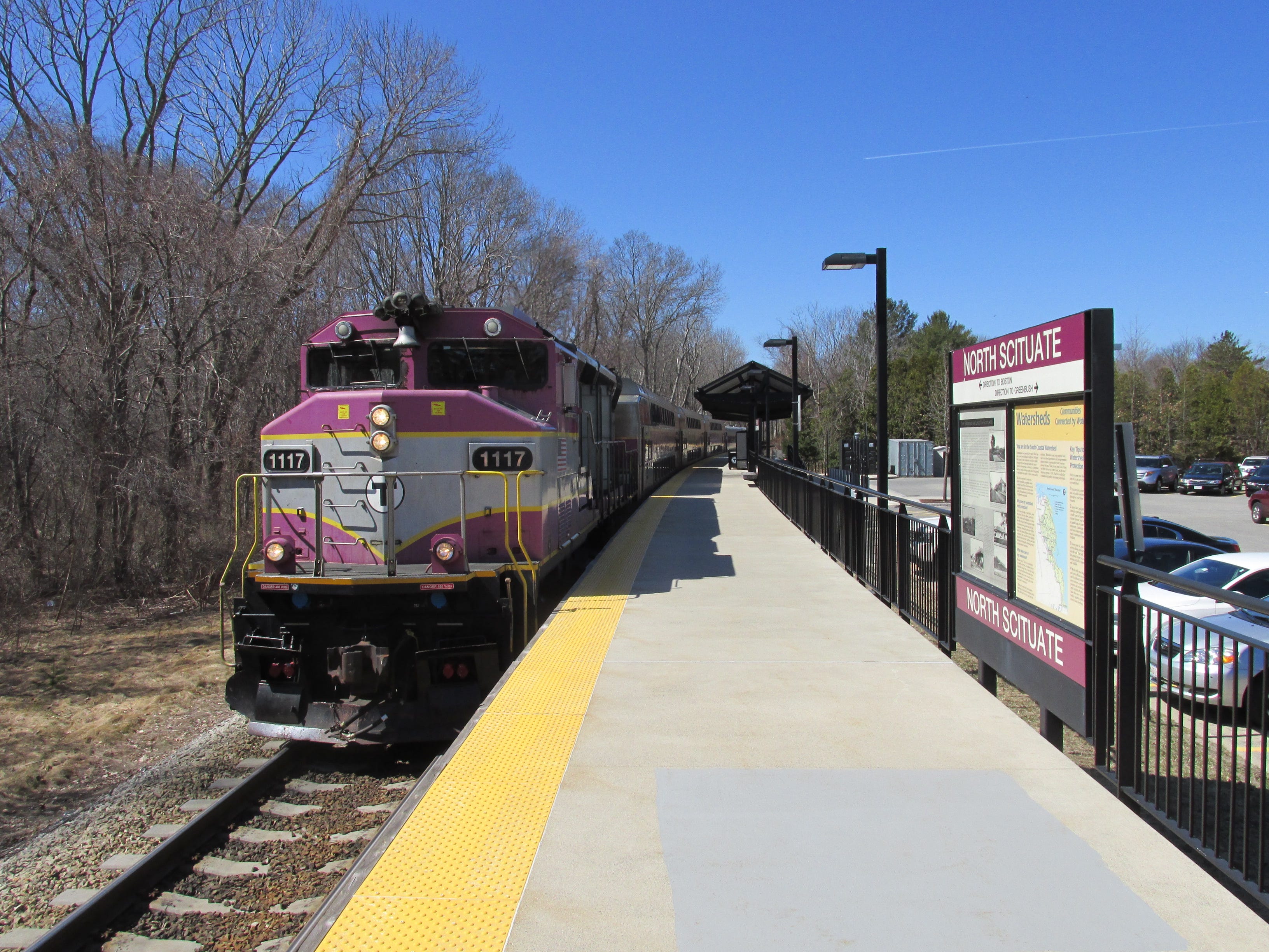
The reason why I singled out Lincoln and Concord is because the hike between the two towns and their adjacent train stations on the MBTA’s Fitchburg Line makes for a beautiful gateway race. The length is a solid 6.4 miles, elevation gain is modest, the scenic amenities are varied enough to make you feel like you’ve gone on a journey, and occasionally you’ll catch glimpses of the train tracks. You might even see a train hurtling along those tracks; a thrilling reminder of what you’re doing. But it might not necessarily be the train you’re racing. The final step to take before embarking on your race is looking at the train schedule and choosing the train that you will try to beat (and then catch.) If you’re hiking 6.4 miles from Lincoln to Concord, you will want to give yourself at least 2 to 3 hours to complete the traverse. If you’re disembarking at Lincoln at 10:54am from a Wachusett-bound train, you might decide to try and beat the Boston-bound train that reaches Concord at 1:20pm. Or maybe the 3:20pm train.
Things will probably get off to a squelchy start. The dirt road that takes you into the Codman Estate’s pastures from a small shopping plaza (directly across the road from the Lincoln train station) gets prodigiously muddy when it thaws on unusually warm winter mornings. As you dodge these muckholes, you’ll do so while following the railroad tracks of the Fitchburg Line on your left, with the pasture to your right—it’s practically European. But before long, you’ll take a hard left, cross above the train tracks on a wooden bridge, and you’ll enter a more verdant, twisting corridor of pine trees. And with that, the racers are off, chugging away on their respective courses!
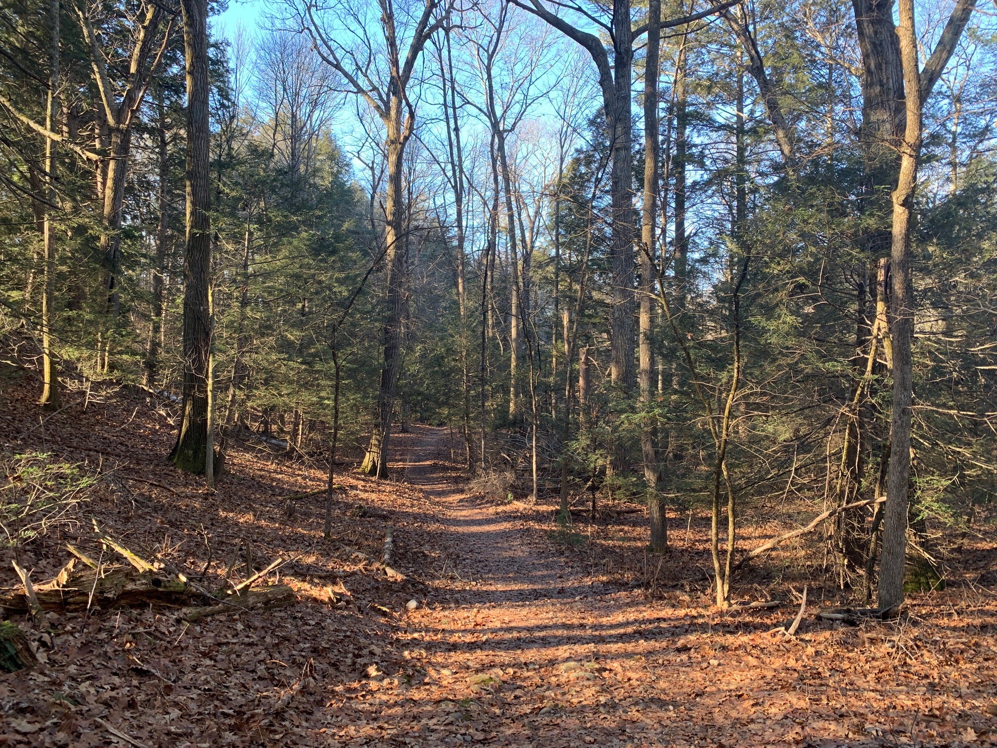
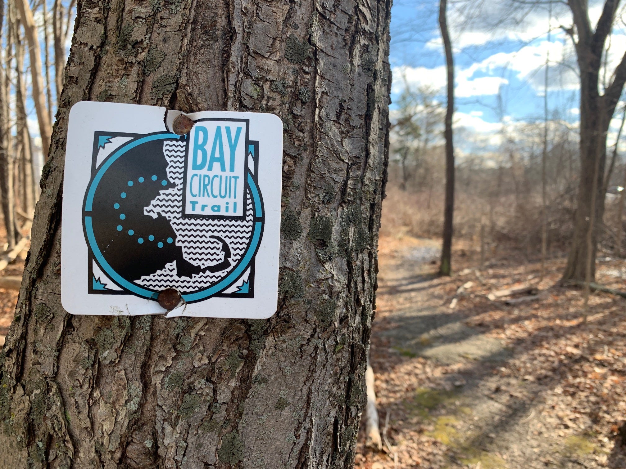
Racing the Fitchburg Line trains this way is also a good way to familiarize yourself with lesser known entrances to the destinations around Lincoln and Concord where parking in the conventional lots brings out the inner honey badger in tony MetroWest residents. Take Mount Misery, that little wooded hump of a mountain surrounded by farmlands, twittering forests, and the Sudbury River. From the western terminus of the Codman Estate, you can step into the agrarian realm of Mount Misery by walking up Concord Road, veering left onto the debonair Old Concord Road, and then making a sharp left over a stone wall. Here and in several other spots, you’ll see markers for the Bay Circuit Trail nailed to trees! For most of the hike, you’ll be following a tiny piece of the 230-mile trail that encircles Boston in a C-shape, from Plum Island to Duxbury.
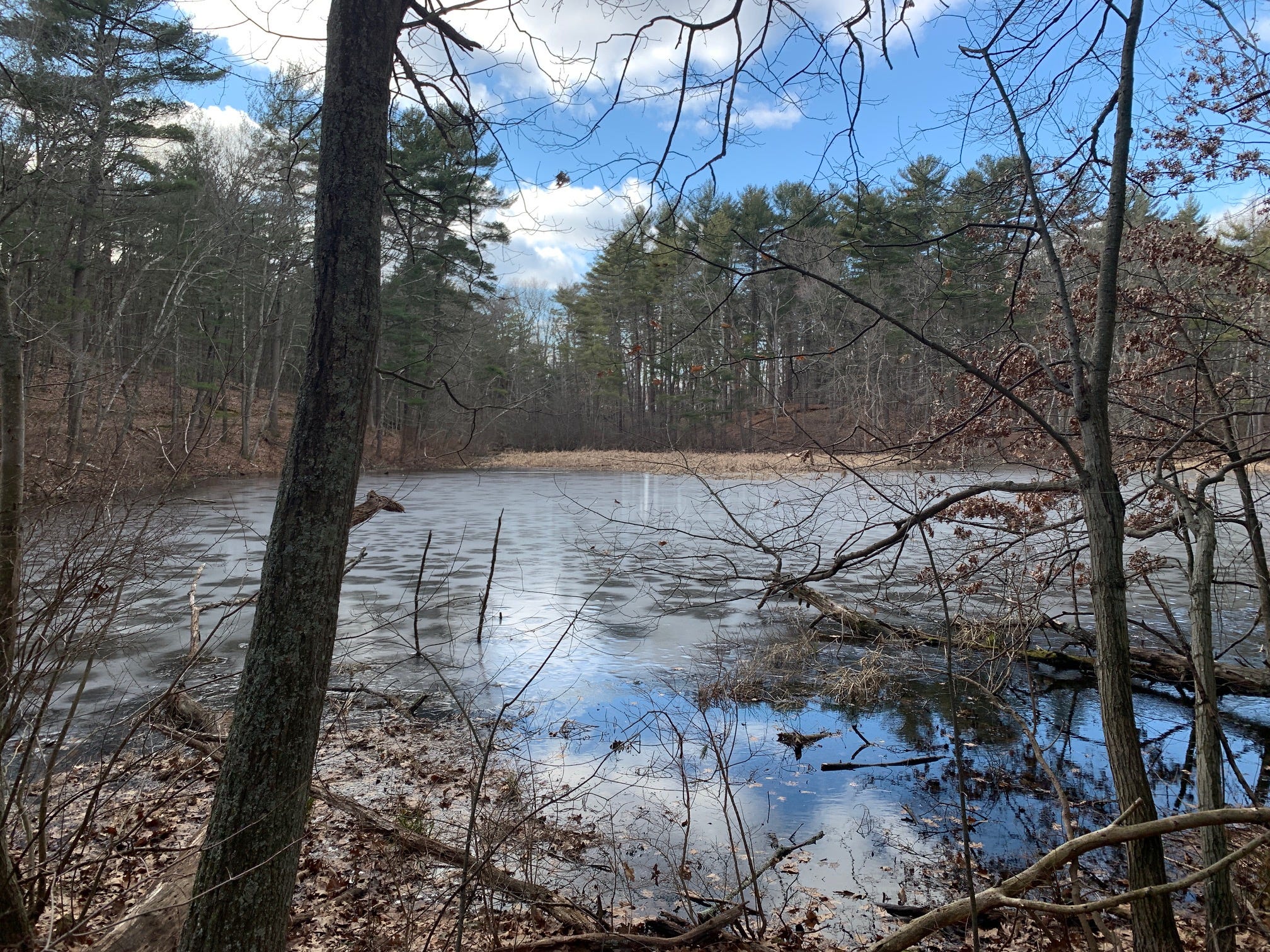
But a race against the train would be less pleasurable without ample scenic variation, and as you head north from Mount Misery through the woods that connect the land with Walden Pond, you’re going to leave the Bay Circuit Trail behind for a little while. Why? Because this way, you can visit the criminally overlooked wetlands that abut Walden Pond on the south side. This will also require a brief reunion with the railroad tracks, which you’ll cross over to descend to the fragrant bog. From there, it’s on to the big kahuna itself, as you walk around Walden Pond via the more remote western shores, visiting Thoreau’s Cove and also the site of his old beanfield before popping onto Rt. 2, where a rare pedestrian crossing allows you to pass through unscathed.
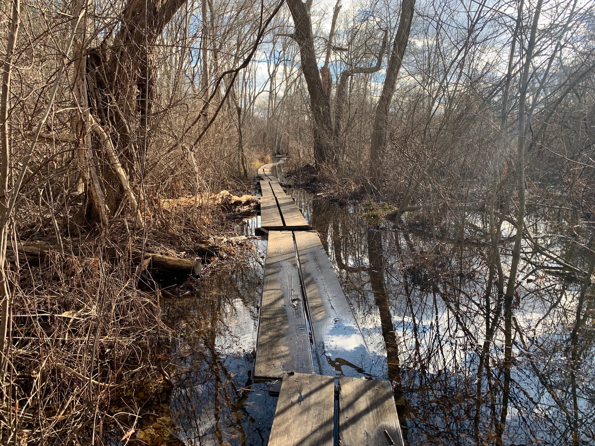
It’s the home stretch, but don’t let the audible traffic fool you. Rather than following Walden Street into nearby Concord, you are going to hop back on the Bay Circuit Trail and make a surprisingly steep descent into the Hapgood Wright Town Forest on a more rugged path. You’ll dart past the pithier but no less arresting Fairyland Pond (a moniker that underscores what’s already implicit here) and you’ll segue into a grove of towering hemlocks that feel borderline Redwood-esque. The trail you’re following here is known as the Emerson-Thoreau Amble—a connective pathway between the center of Concord and the pond where the two Transcendentalist friends spent many hours ambling and giving each other shit. But as you emerge from the woods into the reedy wetlands around Concord, the path becomes more of an Emerson-Thoreau Wobble. Because at this point, you’ll conclude the naturalistic portion of your race against the train by negotiating unstable bog bridges through the wetlands; some of which are partially swallowed by water. Yes, you might submerge a foot in the process, but soon you’ll be wringing out your socks on the train platform, shortly before your ride arrives.
Hopefully.
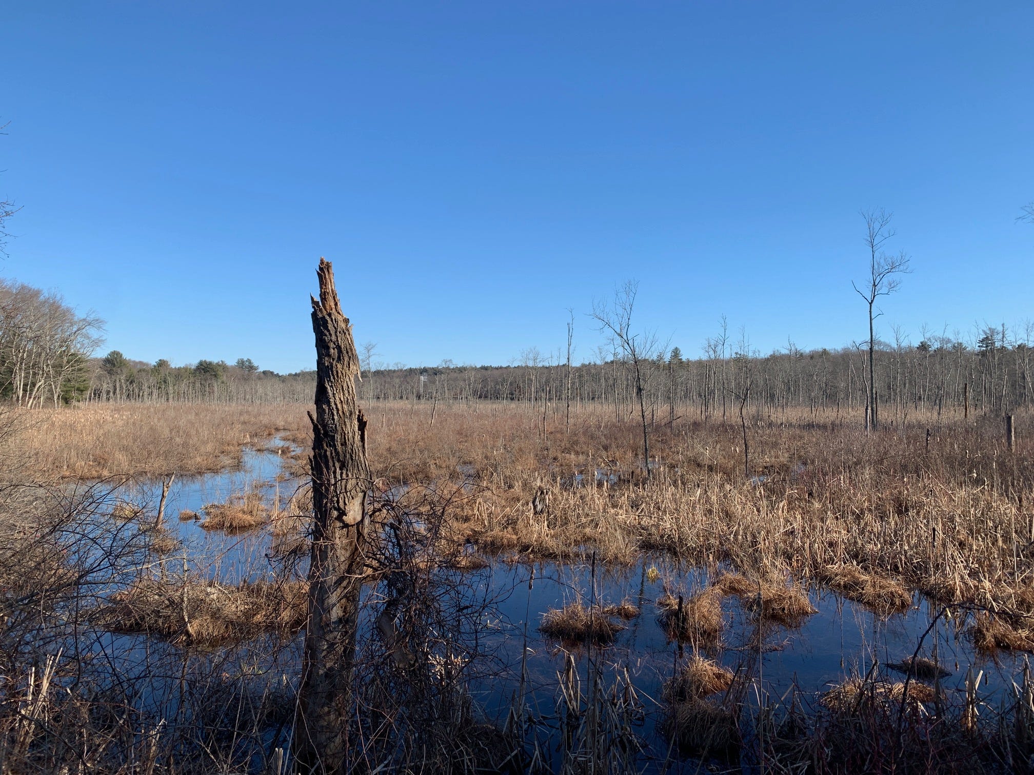
After passing behind the town fire station, the bog bridges deliver you to Heywood Meadows, just down the road from Louisa May Alcott’s Orchard House. A quick series of turns takes you into the palatial streets of residential Concord (which are rather fun to run through in grubby hiking gear) and soon, you’ll see the finish line straight ahead! The Concord MBTA commuter rail station is an open air landmark, steps away from Asian fusion food and Italian cuisine. If your gamble has paid off, you’ll have cause to celebrate. Hell, if the train you were racing isn’t the last train home, then you might as well recover from your race with some coconut shrimp or chicken marsala. And if you did happen to miss the final train of the day, then you can still drown your sorrows in coconut shrimp and chicken marsala. Or maybe just some spring rolls and a slice of pepperoni, since you’ll also need to buy a lift home. But there’s always your next race.
Lincoln Station to Concord Station via Mount Misery and Walden Pond
Hike distance: 6.4 miles point-to-point
Elevation gain: 213 feet
Click here for an AllTrails map of the route
And here’s the audio version of this week’s newsletter:
There’s a good Paleolithic horror movie in theaters, which is not something you get to say every week. It’s called Out Of Darkness and it’s about a group of early humans who’ve just crossed the ocean and arrived in what will become Scotland in tens of thousands of years. They appear to have the place to themselves, until the sun goes down and unseen presence stalks them on the edges of their campfires. The sense of place in this movie is really something, and narratively speaking, it has a sting in its tail that caught me off-guard. It’s also very refreshing to watch filmmakers taking the horror genre into territory that we’ve rarely seen before. Catch this one in the cinema.
Have any of you heard of the American Discovery Trail? Sure, the name is a bit cringe, but the trail is an enticing juggernaut of a hike. It stretches all the way from Delaware’s Cape Henlopen to the Point Reyes National Seashore of California, it passes through the backcountry and major cities, and it consists of trails and little-used roads, linked together to form the epic hiking route. And this year, Briana DeSanctis of Farmington, Maine is set to become the first woman to solo thru-hike the trail! The Portland Press Herald has a cool story about her journey, and it got me thinking good and hard about who might be willing to loan me $20,000 so that I could follow in her footsteps and spend the nights in trailside motels whenever the trail runs through commercial areas.
Oh and speaking of going for long hikes by yourself, the next time you’re thinking of warding off mid-hike body odor by slathering yourself with some deodorant….don’t! In the event that you get lost or immobilized in the wild, deodorant can cover up the odor that might help rescue dogs hone in on your location. Sarah Joseph has a story about this in The Manual, and the takeaway is pretty straightforward. Stay stinky, stay alive.
Inn-to-inn hikes have been on my mind, and I'm imaging this as an inn-to-inn meets S24O (sub 24h overnight, a bike touring concept) and I love it. As in, you head out, do the hike and then when you arrive in Concord, instead of rushing to the train (sorry story arc) you do the Best Beer Ever thing, then go to an Inn (still walkable in this case), take a shower, have a huge dinner, sleep in a nice bed, and then go home the next morning. One change of clothes, meds and a toothbrush won't weigh that much.