

This past spring, Outside Magazine did something that practically made me fall off the elliptical machine at the gym. I was warming up for my workout, casually scrolling through the 2023 roundup of the “Best Places to Visit in the U.S. for Adventure.” These award-like destination callouts were organized by recreational activity—with a “winning” destination and a runner-up for each activity. When I got to the Hiking category, I wasn’t surprised to see Alaska’s Gates Of The Arctic National Park and Preserve bag the top prize. What did surprise me was the runner-up hiking venue that Outside selected: Boston. Not the forests around Boston, but the City of Boston.

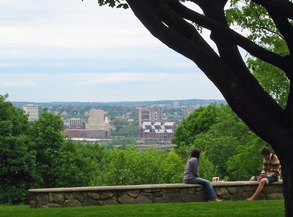
Almost instantly, I could hear the collective sound of Outside subscribers going, “Boston? What the fuck…” But the callout made a solid case. “Urban treks have long been a staple in Boston, one of the country’s most walkable burgs,” the author wrote. While only a few trails were named in the blurb—the Freedom Trail, and the Walking City Trail too!—the award still recognizes a fundamental truth about Boston. We are a City of Trails. Hiking has long been embraced as a vehicle for discovering the city’s cultural, historic, and ecological qualities. The Black Heritage Trail and the Boston Women’s Heritage Trail are portals into activism and building power. The Art Walk Project showcases the city’s talented and resilient creative community. (Resilient because Boston doesn’t make it easy for working artists to live here.) Frederick Law Olmsted’s Emerald Necklace linear park system remains a model for walkable greenways that connect neighborhoods. The Innovation Trail transforms several decades of STEM progress into a city-to-city hike from Boston into Cambridge.
I could go on.
Having started the Walking City Trail—which has become bigger and better thanks to the input and volunteerism of several new friends and fellow trail builders—I’m thrilled to see more people outside of the Boston area grasping the tradition of urban hiking that exists in this city. The sheer number of trails in Boston and the possibility of even more trails coming online in the near future have helped put America’s Walking City on the map for hikers. And one of the foremost intentions of the Walking City Trail was to demonstrate that “building” a new hiking trail in a city or suburb can be accomplished without access to capital or power tools. The growth of digital way-finding tools and apps that are mass audience-friendly means that anyone, anywhere can create a trail.
Which brings me to a looming and exciting question that I’ve been puzzling over for months—a question that I would like to pose to all of you. Where should Boston’s next hiking trail go?
Obviously there are many thematic baselines for a hiking trail, but for the sake of specificity, let’s say we were imagining a new trail in Boston that takes hikers through a range of naturalistic and built environments. Sort of like the Emerald Necklace and the Walking City Trail. Where might this trail take root? What neighborhood(s) should it introduce hikers to? How short or long should it be? And what destinations should the trail feature? Because this is a hiking newsletter with weekly hike ideas, I’m going to offer a couple possibilities that I’ve been considering—and scouting—this year. But consider this week’s newsletter a conversation starter, because I would love to hear from you directly about Boston trail ideas that you’ve been sitting on: especially if you live in the neighborhood(s) where such a trail might run, and are interested in creating and launching such a trail. With that said, here are a few ideas to consider…
Trail #1: Dorchester to South Boston
Dorchester is one of Boston’s biggest neighborhoods and one that’s been historically impacted by environmental racism. (Ex: Fewer trees and green spaces + Rising temperatures = Dangerous summers.) That’s not to say that Dorchester is bereft of parks, but that it’s long been deprived of the green resources that wealthier Boston neighborhoods have enjoyed. An urban trail that visits Dorchester’s natural and built environments could help underscore this at a moment when we have more elected leaders in office who recognize the necessity of expanding the urban tree canopy and improving all residents’ access to green spaces.
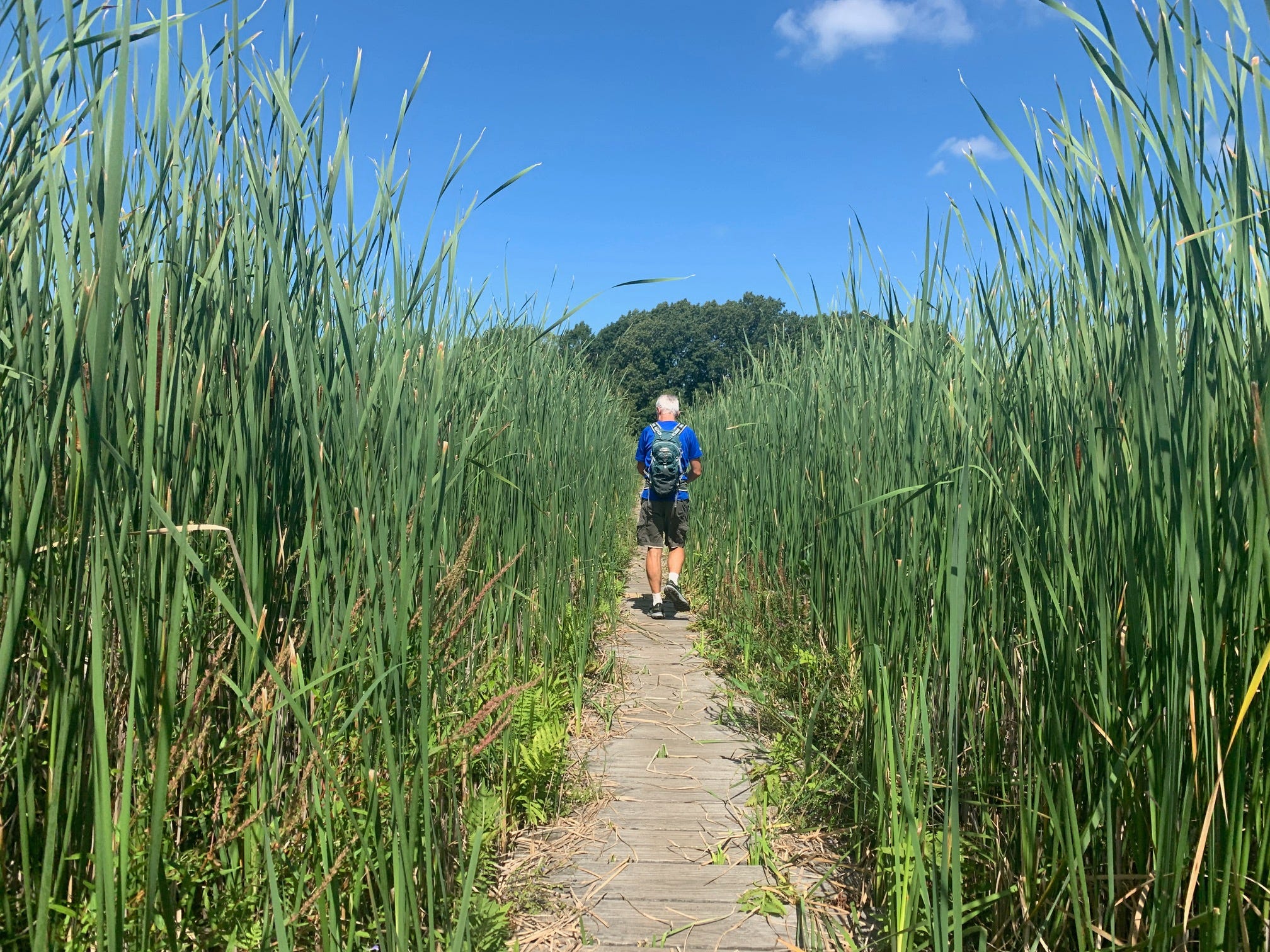
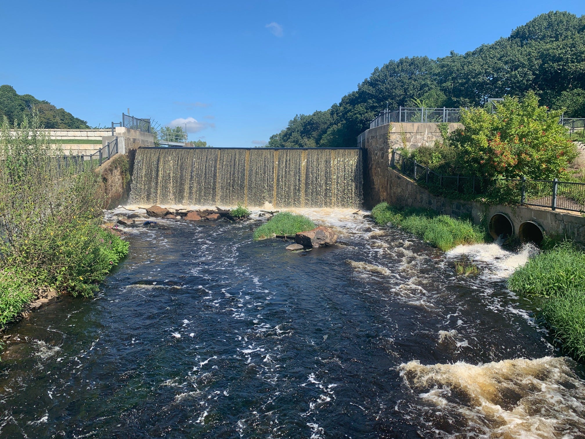
Let’s say you were to kick things off in Franklin Park. From there, you could connect to the wetland trails and boardwalks of the Boston Nature Center, climb Wellington Hill, and continue east to the woods and winding paths of Dorchester Park. From there, the hike could begin a scenic shift from City to Sea, as you enter a marshier stretch of the Neponset River Greenway. You would follow the river to Tenean Beach for a banger view of downtown Boston. In the coming years, an elevated 670-foot boardwalk will connect Tenean Beach to Morrissey Boulevard, which you could use to connect to nearby Malibu Beach and Savin Hill. And after descending the Savin Hill’s puddingstone-rich paths, you’d be at the doorstep of the UMASS Boston peninsula campus near Columbia Point. From here, it's a briny, breezy walk to Carson Beach, the stairs of Telegraph Hill, and finally, the barnacle-encrusted causeway to Castle Island.

And just like that, you’ve gone from the core of Boston’s largest and most diverse neighborhood to the eastern end of the city limits, where you’re surrounded by the roaring ocean and ravenous seagulls, trying their luck for a bite of your hot dog or clam roll from Sullivan’s.
Trail #2: West Roxbury to Brookline
I don’t want to say that creating a greenery-centric trail through Boston’s tony western enclaves would be like shooting fish in a barrel. But if your goal is getting a new trail online as efficiently as possible, the numerous wooded pathways of West Roxbury, Chestnut Hill, and Brookline are like a pile of colorful Lego pieces, just waiting to be clicked together by an industrious 21st Century trail builder.
Millennium Park, on the Charles River, is a wildflowering juggernaut of a park that would be a visually pleasing start or finish line for any urban trail. And its circuitous hilltop paths connect to the bushier trail network of nearby Brook Farm. If you could somehow manage to get from the farm trails into St. Joseph Cemetery (say, through a gate with regular access or a hole in the fence) you would be able to seamlessly segue to Brookline’s Hancock Woods and the much boggier D. Blakely Hoar Sanctuary. An unofficial backdoor pathh connects the latter to a housing complex and from here, it’s a leafy walk to the coniferous woods of Kenard Conversation Area and Lost Pond Sanctuary. And just next door is the sprawling Chestnut Hill Mall.
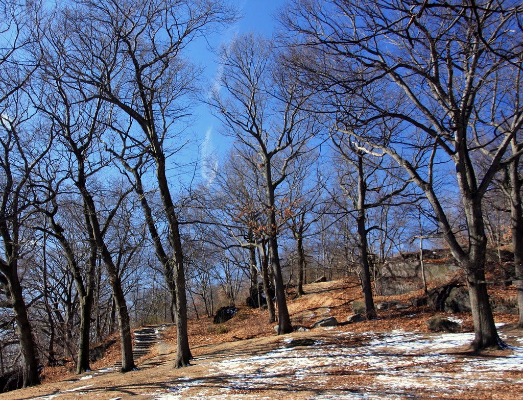
The mall, as some of you might know, is the unlikely gateway to the Hammond Pond Conservation Area trails and by extension (via Boston College’s woodsy campus) the Chestnut Hill Reservoir. This puts you at the foot of Brookline’s impressive hills and their hidden staircase paths: a glute-busting final chapter for the hike. The trail could finish by ascending the Summit Path to the top of Corey Hill, where chaise lounge chairs and views of Cambridge would be waiting.
Trail #3: The Boston Greenbelt
Now here’s an exciting thought. What if an epic park-to-park, town-to-town trail around the Boston area already exists? What if that trail is waiting to be brought to the surface and spotlit with a launch in the year ahead? That pretty much sums up the Boston Greenbelt Trail.
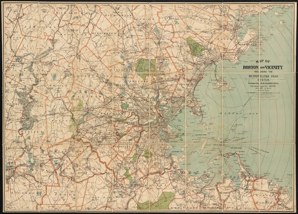
I wrote about this mind-bogglingly cool suburban trail earlier this year. The brainchild of David Loutzenheiser, a transportation planner with the Metropolitan Area Planning Council, this trail encircles Greater Boston in a C-shape, running from seaside parks in Marblehead and Quincy through roughly 90 miles of forests, wetlands, meadows, and neighborhoods in the towns that surround Boston. The Middlesex Fells, Lynn Woods, Cutler Park, the Charles River Watershed, and the Blue Hills are just a taste of the green spaces featured along the regional trail. Plus, the Boston Greenbelt Trail is regularly accessible by bus, subway, and commuter rail. No car required!
But until now, there hasn’t been much digital infrastructure for the trail beyond an interactive map on the MAPC website. And that’s going to change in 2024. Plans to create a dedicated website and more navigational materials for the Greenbelt Trail are underway, and when I say “underway,” I mean that David and I went for a 12-mile hike on a section of the trail this week (Hyde Park to Newton) and we talked at length about joining forces for a full-on launch of the trail next spring.
So if you’ve been thinking about going from Boston Trail Hiker to Boston Trail Builder in the years ahead, consider the Boston Greenbelt Trail an active opportunity to get in on the action. There are several steps involved with launching any new trail—creating a website, doing social media promotion, and generating press coverage—and I’ll be lending a hand on at least one of these fronts as the Greenbelt Trail gets ready for its proper public debut. So if you’d like to learn more about getting involved with the project, please shoot me an email and I’ll send you the deets! There’s going to be a planning meeting sometime this fall and it would be awesome to have you there.
"Connecting" Franklin Park to Castle Island sounds very cool, and I think there's appeal to having an oceanfront stop on any Boston trail. Although, counterpoint, if you're trying to prioritize here, maybe do something else while we wait for the boardwalk to be built!
I live near BC so I do the Reservoir-Hammond Pond-Webster Woods-Houghton Garden or variations sometimes, that's nice too, and definitely not too "vanilla suburban greenspace".