Flume, flume, flume, flume!
A splishy, splashy passage in the heart of Crawford Notch
I don’t know about the rest of you, but I was a log flume kid. Sure, roller coasters and spinning rides were fun, but there was a unique magic to stepping into a hollowed-out “log” boat and riding it through a narrow, winding waterway to a series of conveyor belt lifts and plunges. Part of what I still love about log flumes is the atmospheric touches that are lacking on most amusement park rides: the way the loading station often resembles a sawmill, the Western-style fiddle and banjo music echoing from speakers posted around the ride, and the tunnels through which the flume will often run. But the baseline joy of a good log flume ride is how it feels like a roller coaster slapped together with elements of the natural world. You’ve got your logs, you’ve got water, and you’ve a tight and stony flume through which the water shoots and sloshes.
So what is a flume, exactly? Technically, it’s a narrow channel or ravine through which water passes. Many of the 19th Century flumes that were used for transporting timber were man-made, but naturally-occurring flumes predate mankind by many eons. Take the story of “Aunt” Jess Guernsey. One day in 1808, the 93 year-old New Hampshire resident went poking around the woods near Franconia Notch, searching for a good place to fish. (Talk about nonagenarian goals.) But instead of stumbling across a decent trout pool, Aunt Jess found something way cooler: an 800-foot granite gorge festooned with waterfalls and moss. The gorge had been covered by a glacier during the Ice Age, but once thawed, it became the channel through which a mountain brook made its way into the deciduous woodlands below. Some of you probably know this place as The Flume, one of the most popular New Hampshire state parks, where you can easily pass through the misty, watery chasm on a series of twisting boardwalks.
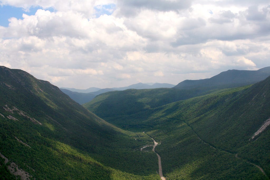
If you’re driving into the White Mountains on I-93, you won’t be able to see The Flume from the road because it’s tucked away in the thick forest beneath Mount Liberty. But Rt. 302 and nearby Crawford Notch are another story. Arguably the most overlooked of New Hampshire’s three big notches (Franconia, Crawford, and Pinkham), Crawford is the divide between the Presidential Range and the Pemigewasset Wilderness. And Rt. 302 East makes a thrilling descent from the Bretton Woods ski area into the heart of Crawford Notch. As the road becomes a curving plummet into a deep and verdant valley, you’ll notice exposed cliff faces in the mountain haunches that tower above you on the right. If you look closely at these exposed cliffs, you might see bands of water cascading down some of them. These are flumes in the most rustic sense.
And guess what? You can make a steep and scenic climb to visit one of them.
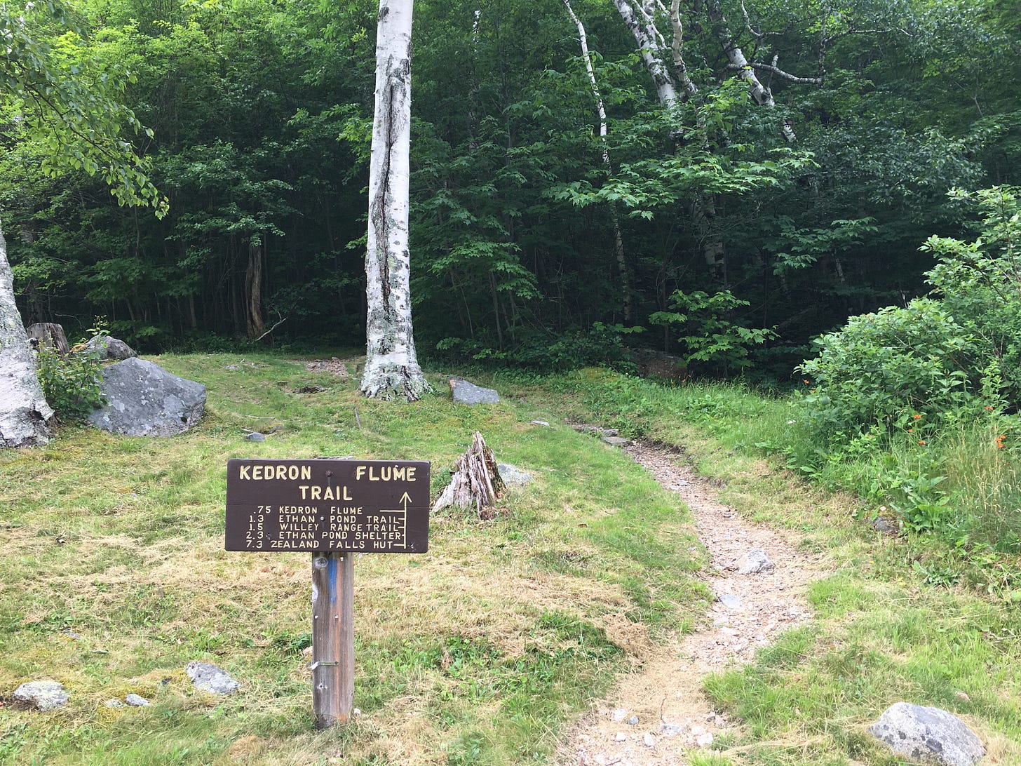
First, set the controls for the Willey House, a relic of the logging era that miraculously survived a landslide and flood in 1826. (Tragically, the Willey family members were outside when the natural disaster occurred, and their bodies were recovered after.) The historic house is located on the floor of Crawford Notch, right next to the Saco River—which flows eastward into Maine and is a popular destination for inner-tube enthusiasts. There’s a large parking lot across the road from the Willey House. You can leave your car here. Once you’re zippered up and optimally bugsprayed, cross the road, follow a dirt path up a hillside to the left of the Willey House, and find the sign for the Kedron Flume Trail, which enters the woods and is marked with blue blazes.
Crawford Notch is home to some popular waterfalls hikes such as Ripley Falls and Arethusa Falls, where the trails are spacious and well-worn. The Kedron Flume Trail is far more rugged and desolate, but in that nice way which will make your dinner taste extra savory come sundown. A set of switchbacks delivers you to a clearing where railroad tracks run alongside the “wall” of Crawford Notch. This is part of the route for the Conway Scenic Railroad, which offers daily trips from North Conway through the notch. Once you’ve crossed over the tracks, you’ll notice that the Kedron Flume Trail becomes raggedy and steeper on the other side. Stones bulge from the earth like swollen organs, with sinewy roots draped over them and occasionally serving as handholds. In other words, the Kedron Flume Trail is a grim New England classic.
As you wheeze and drip and wonder why you didn’t opt for the more conventionally pleasant summit trail up nearby Mount Willard, you’ll catch occasional glimpses of the distant base of Crawford Notch from which you started your hike. The Kedron Flume Trail climbs 646 vertical feet in 0.8 miles just to reach the flume itself, so by the time the leafy deciduous trees begin transitioning to dark green boreal conifers, you’ll likely be ready to plop down and empty an entire water bottles over your head.
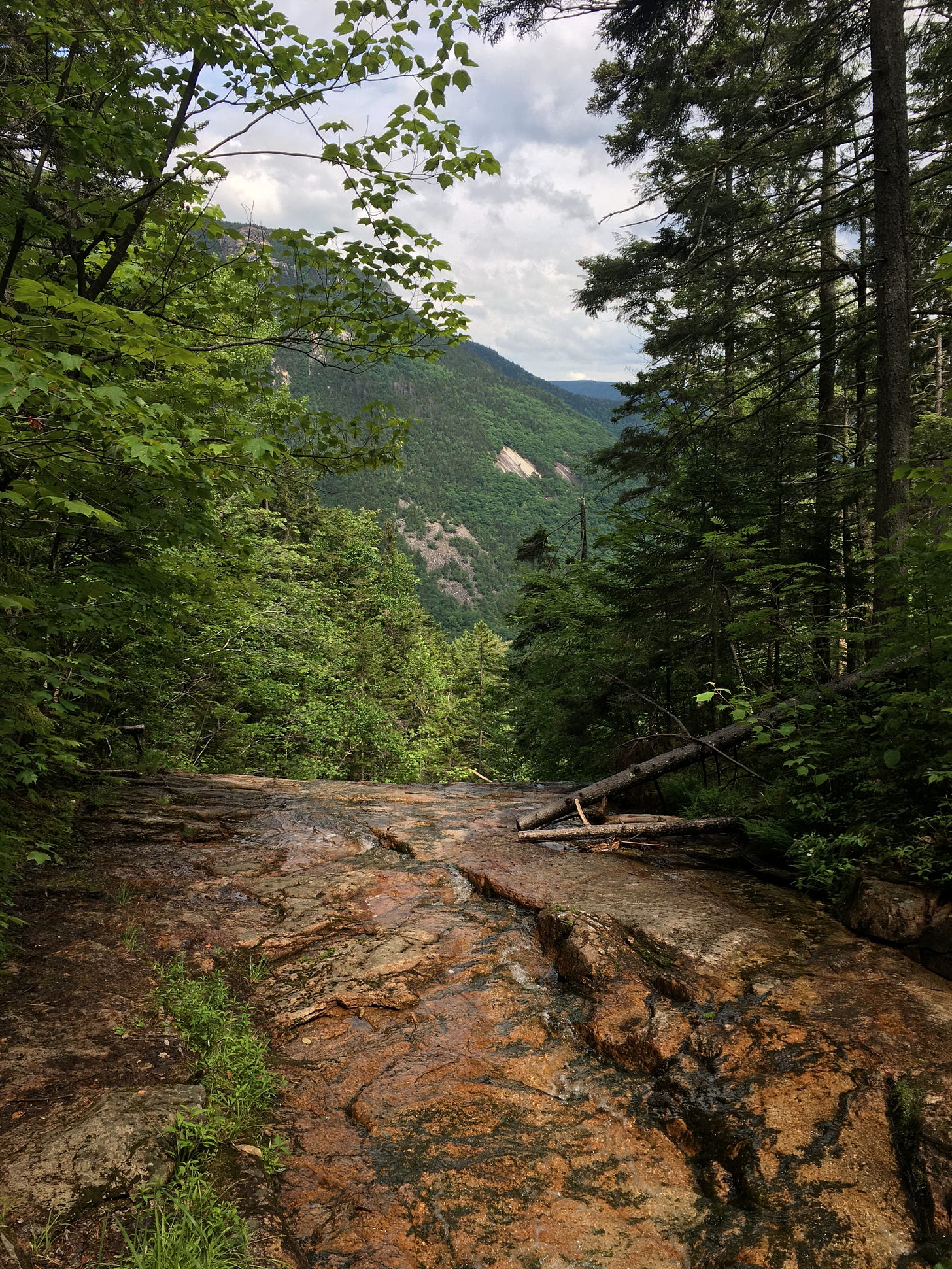
Thankfully, you can save your drinking water. A light “whooshing” sound from the trees foreshadows your arrival to Kedron Flume. Mind your footing on the wet, mossy granite as you walk across the flume, or just take a soggy seat and chill. To your left, you’ll find a lovely view of Crawford Notch. But I was more impressed by the inward view of the flume itself, on the right side. You can see rivulets of water descending through the mountainside forest to reach the flume crossing. I squinted, gazing into the woods and up the flume. It seemed to go on forever. One of the key reasons why Crawford Notch is such a proven destination for cascades is because there’s a great deal of water in the Pemigewasset Wilderness, searching for a place to go. Some of it spills down the wooded walls of Crawford Notch, creating gems like Kedron Flume.
I could have gladly spent an hour hanging out at Kedron Flume if I had the foresight to pack a folding beach chair up the trail with me. (Since the climb is only 0.8 mile long, you could strap the chair to your pack and not get too annoyed as it slaps against the back of your legs.) Once you’ve had your fill of the flume, you could simply backtrack down the steep trail for an efficient 1.6 mile out-and-back hike. But instead, I kept on climbing as the Kedron Flume Trail made an even steeper, scramble-y ascent, gaining another 423 vertical feet before leveling out and concluding at the Ethan Pond Trail.
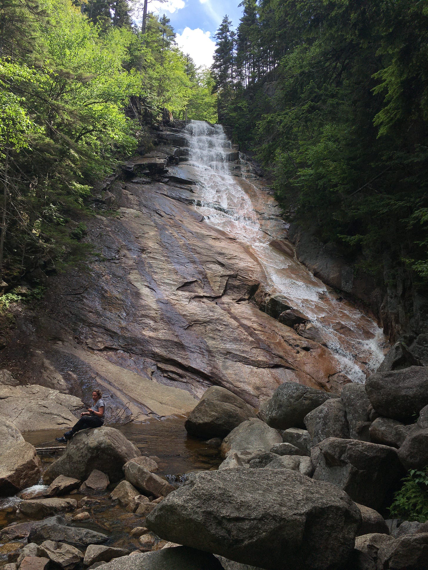
From here, you have two choices. You can turn right and climb for another punishing 1.2 miles to the top of Mount Willey. Or…you can turn your Kedron Flume outing into a less grueling but still formidable loop hike and visit another nearby waterfall. At the junction, I turned left and descended the Ethan Pond Trail—part of the Appalachian Trail!—at a moderate grade. Upon reaching a junction for the Arethusa-Ripley Falls Trail, I took a right turn and climbed through the woods by Avalanche Brook for 10 minutes to re-visit this classic beast of a cascade. At 100 feet tall, spilling over wide rock slabs, Ripley Falls is the polar opposite of Kedron Flume. Enormous. Expansive. Together, these neighboring cascades make for a diesel double-bill of falling waters.
From Ripley Falls, the return journey to the Willey House is mostly level and easier on the quads. After backtracking to the Ethan Pond Trail/Appalachian Trail junction, you’ll take the AT down to Rt.. 302 and into the woodlands alongside the Saco River. Then, instead of climbing to the foreboding Webster Cliffs, you’ll make a left onto the Saco River Trail and walk along the waterway through shadowy woods and the occasional exposed wetland, where the buzzing of insects is immense enough to compete with echoes of cars zooming along Rt. 302. (As always, don’t forget to do a tick check after your hike.) Finally, as you emerge from the woods before a clearing where a gorgeous wooden bridge crosses the Saco River back to the Willey House Parking lot, you’ll be presented with the logical conclusion of falling waters. Whether it’s a svelte flume or an exploding waterfall, the water eventually has to settle someplace and the Saco River is where your hike and many of Crawford Notch’s water tributaries end.
By visiting Kedron Flume and Ripley Falls in one day, you’ve essentially visited the Saco River before it became the Saco River. You mountain hipster. Good for you.
Kedron Flume-Ripley Falls-Saco River loop hike
Distance: 4.6 miles
Elevation gain: 1,375 feet
CLICK HERE for a trail map
From The Guardian, here’s a strange epilogue to a tragic hiking story of late. Back in 2021, two hikers, their baby, and their dog were found dead in the Sierra Nevadas. While the cause of their demise was initially unclear, weeks of investigation found that heat exhaustion was the killer. But apparently, this answer wasn’t good enough for a man from Michigan who recently set off into the region of the Sierras where the family’s bodies were found, looking to dig deeper into the case. But as they often say in lurid true crime podcasts, you won’t believe what happened next. The Michigan man had to be rescued from the woods by the local sheriff’s department! He had dialed 911 several times and he was worried about algae after drinking water from river. The man was treated for bad blisters and dehydration, and Sheriff Jeremy Briese didn’t mince words once the rescue was over. “It is hard not to be angry about this particular rescue mission,” Briese said. “I want people to come here and enjoy all the amazing nature Mariposa County has to offer…To have someone purposely put themselves in danger, using vital resources and potentially putting the safety of our staff in danger all to try and prove us wrong, is maddening and quite frankly sickening.”
I’ve thought about this sometimes—America’s penchant for conspiracy theories and paranoia finding its way into the backwoods. And while I enjoy a found-footage film about Bigfoot as much as any horror buff (pro tip: check out Bobcat Goldthwait’s surprisingly creepy Willow Creek), I sometimes hesitate to point people toward hikes with mysterious backstories, wondering if the “weird” elements of these hikes might speak to readers who will skip past the parts about hiking safely and considerately.
In other words, next time I publish a newsletter about a hike that involves UFOs, ghost towns, or Satanists (all of which are scheduled for later this year), please don’t send it to anyone who watches Infowars. I don’t need Alex Jones and his followers on my ass.


