

It rises from the waters of Moosehead Lake like a stone beast, its sheer rhyolite cliffs looking dark yet glittery from the shoreline, and its haunches speckled with beech and spruce. Mount Kineo might be the most dramatic looking mountain in Maine, and this is saying something for a state where you have summits that are accessible via iron ladder rungs or knife-edge ridge trails. The island sits on a peninsula that’s just barely connected to the land, surrounded by more than 117 square miles of cerulean water. (Moosehead Lake is Maine’s largest lake and the second largest in New England!) A cool 18-ish miles from the lakeside town of Greenville, Mount Kineo is renowned for its unique profile. But simply reaching the base of the mountain is its own adventure.
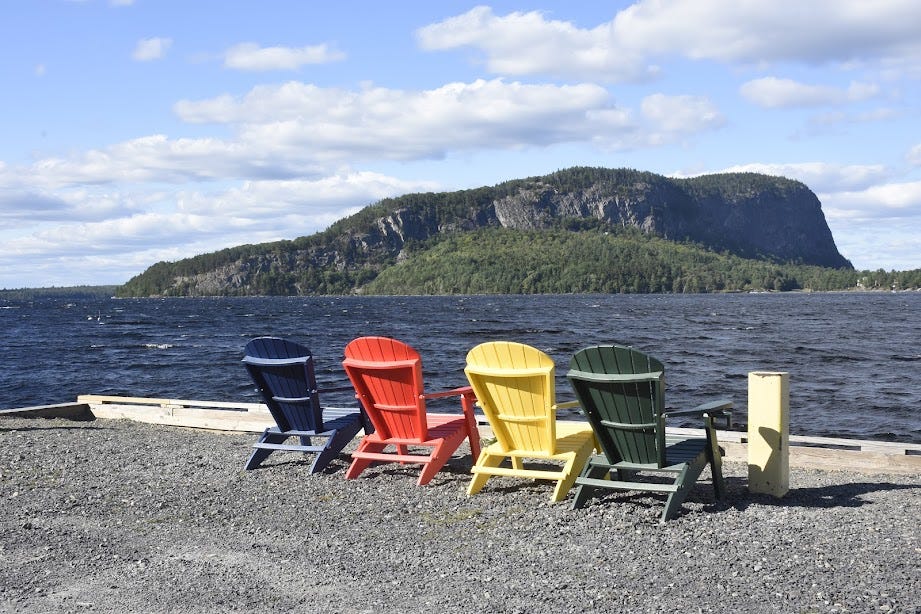
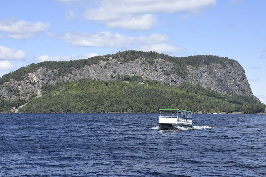
Driving from Greenville to the base of Kineo might seem like the intuitive thing to do here, but the only road that leads to the mountain is a sparsely-maintained logging road that snakes for miles and miles through the timberlands on the eastern shores of Moosehead before emerging from the forest onto the peninsula. Between the distance and the near-certainty of your axles making contact with rocks, you don’t want to rely on Google Maps for this journey. What you want to do is drive 25 or so minutes northwest of Rockland, along the lakeshore, park in the waterfront lot at 62 Village Road in Rockwood, and catch the Mount Kineo ferry for a whitecapped ride to the foot of the mountain. From a lonely dock, you can climb the damned behemoth.
I’ve hiked Mount Kineo with my dad and on my own—both times during the fall. It’s one of the most otherworldly hiking experiences I’ve had in New England, and the window for visiting this waterlocked mountain will close on October 10th when the ferry stops running. So I want to encourage those of you craving a unique autumnal adventure to brave the long drive to Moosehead Lake. You’ll follow in the footsteps of first nations peoples who made their own pilgrimages to Mount Kineo to harvest the “Kineo flint” from its rhyolite rock faces: an ideal material for crafting arrowheads and other tools. Thoreau also made his way up here in 1846 and while Mount Kineo didn’t inspire him to launch into a stream-of-consciousness sermon like Mount Katahdin would, he was fascinated by the geologic form of Moosehead Lake’s flagship peak.
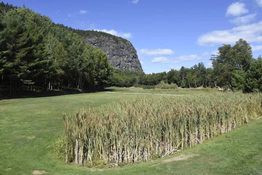
Adding to the weirdness of the Mount Kineo experience is its golf course. During the latter half of the 19th Century, a resort hotel with a golf course was constructed at the southern tip of Mount Kineo’s peninsula and while the place burned down on multiple occasions (?!?) the golf course survived and remains active today. It’s estimated to be the second oldest golf course in New England and when the Mount Kineo ferry drops you at the peninsula dock, you’re greeted with a truly bizarre sight. You’ll find people wielding golf clubs and wearing polo shirts gingerly tapping their balls into holes, as the immense cliffs of Mount Kineo loom above them like Godzilla. The juxtaposition of domesticity and wilderness reminds me of Kristi McCluer’s now iconic photo of a bunch of men teeing off at a country club as a massive forest fire rages behind them.
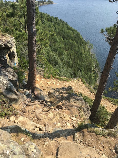
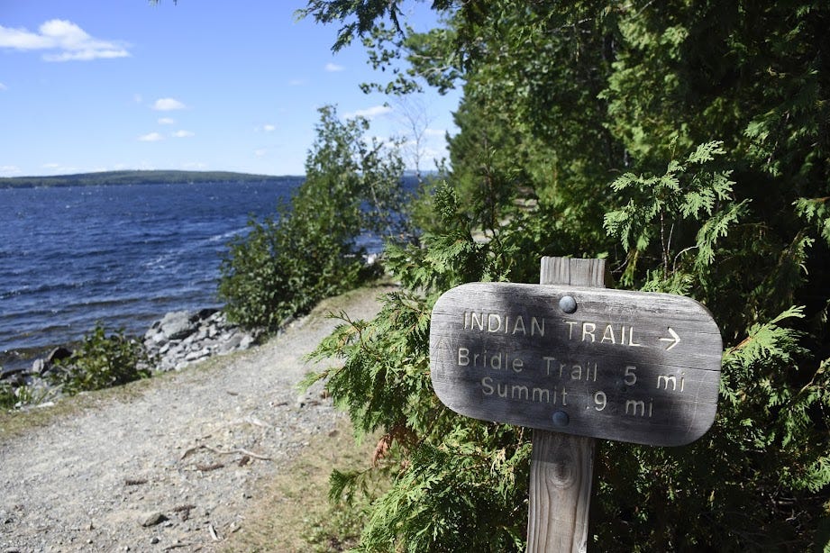
You’ll find a trailhead sign for Mount Kineo around here, to the left of the dock ramp, and this is where you’ll have to make some decisions. The hike starts off on a dreamy carriage road that ungulates along the flank of the mountain, so close to the lake that sometimes the rippling of water is all you can hear. But then, the route forks twice as two rugged trails veer right into the woods. Both of these paths are summit access routes and they can be combined as a loop hike. The first path—the Indian Trail—is steeper and includes some scrambly spots that anyone with a fear of heights should avoid. But the partial views of the lake from this moderately challenging trail are quite magnificent. The second path—the Bridle Trail—ascends the old mountain at a much more meditative grade, with a smattering of bog bridges to break up the monotony of stones and roots. Both trails converge near an overlook where you can gaze out at the lake and golf course. But the summit and the most spectacular vista are yet to come.
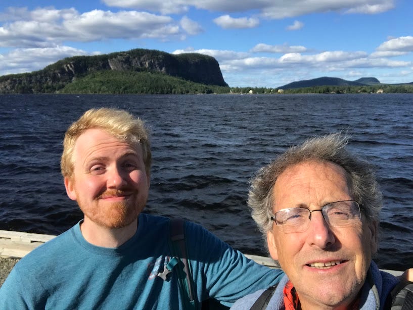
A singular roly-poly trail continues into the forest atop Mount Kineo for about half a mile before reaching the wooded peak of Kineo, where a 60-foot fire tower screams into the sky. The first time I laid eyes on this thing, my stomach gurgled with dread. I have no problem navigating cliffs and precipices if it’s fairly obvious where to place your hands and feet. But for reasons unknown, rickety man-made structures make me tremble. This was not an issue for my dad, who eagerly bounded up the steep, rusted stairs to the crow’s nest at the top of the fire tower. (I made it up 4 flights before my anxiety forced me back to the ground.) When my dad finished descending the stairs 10 minutes later, he said the view of Moosehead Lake and the Maine Highlands at the top of the tower was so immense that capturing it in a single photo proved difficult. And he’s a professional photographer! The promise of that vista haunted me for the next two years. When I returned to Mount Kineo in 2020, solo, I knew I had to see it.
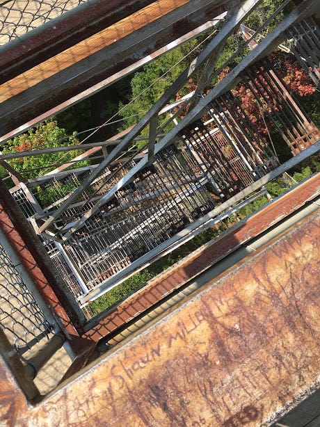
Maybe it was the existential uncertainty of the pandemic, but my second attempt at climbing the fire tower was less torturous than imagined. I played that mental game where you tell yourself that one of your wishes will come true if you proceed with a scary task in front of you (ex: “If I can make it up this next set of stairs, I’ll be dating Hannah Waddingham in two years and I will have just penned a NYT bestseller about a really big alligator.”) After 15 perspiration-soaked minutes, I stepped onto the top of Mount Kineo’s fire tower and was treated to the Maine vista to end all Maine vistas.

And yet, on top of the scenic grandeur of Mount Kineo, my favorite thing about hiking this mountain is actually more terrestrial in nature. Both times, I’ve encountered other hikers so enchanted by the scenic beauty of far northern Maine that we can’t help but briefly revel in it together. The first time, my dad and I ran into a 60-something couple who had bought a summer house near Greenville and made the drive to Moosehead from Lexington, Massachusetts several times each year. (The rich really are different.) The second time, I met a teenage couple along the carriage road who looked like they had stepped out of an H&M catalog. I couldn’t tell if they were hiking the mountain or ambling around for the day, but they were clearly overwhelmed by the atmosphere just like I was, and this sense of wonder gave our conversation a wine-like effervescence. Where did these two come from? Where were they going? Would we ever meet again?
The answers will remain unknown. But for five minutes there, we were at Mount Kineo.
Mount Kineo via the Indian Trail and Bridle Trail
Hike distance: 3.4 miles loop
Elevation gain: 905 feet
CLICK HERE for a trail map
I'm usually pretty bad at reading topo maps, but I think I can tell which trail is the scary one, yikes!