There’s a running theory among Bostonians these days that no matter how gentrified and capital-ized our cityscape becomes—in the face of widening inequality—shards of Boston lore will never die. You might be in a Chase Bank kiosk and when you kneel down and peek into the cash dispenser to see why your $20 bills aren’t popping out, you find a BOSTON STRONG sticker slapped on the underbelly of the ATM. A realtor showing you a fancy-pants condo in the Seaport could suddenly take a call on their cell phone and say, in a totally different voice, “Hey, Ma! We still havin’ Santarpio’s tonight?” Or maybe you’re at a cell phone store looking at the latest Apple models. The sales clerk hands you the iPhone 17 and as you fiddle around with its apps, the Dropkick Murphys’ “I’m Shipping Up To Boston” starts blasting from the speaker.
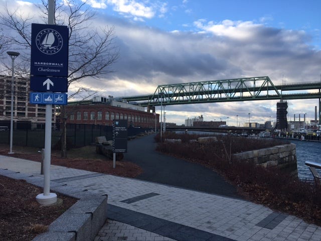
The classic bar-brawler of a song was popularized by Martin Scorsese’s The Departed (which I still argue features one of the more accurate depictions of Boston in a major movie.) At face value, it’s about a sailor who loses his leg while climbing the topsails of some ship that was presumably bound for Boston. It’s a fitting unofficial anthem for the city—because one of Boston’s epic natural features is Boston Harbor itself. At thousands of acres in size, the harbor contains innumerable moored ships, docks, and forested islands with their own beaches and ruins. And if you’ve spent any time gazing into the harbor from Boston, then you’ve probably seen one of these signs posted someplace.
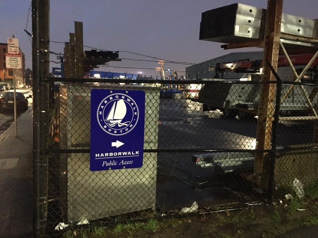
The Boston Harborwalk is a multi-use trail that runs along the jagged shoreline of the Harbor, with its many coves and channels. It was started by the city and a handful of private partners in 1984, as a means of ensuring that large swaths of the waterfront would remain open to pedestrians and cyclists. But what many people don’t realize about the Boston Harborwalk is that it’s 43-miles long. Starting at the Neponset River Reservation in Mattapan, the Harborwalk runs north through the core of Boston before jumping the Mystic River into Eastie and finishing at the west edge of Logan Airport.
I only learned this a couple of months ago. It blew my mind, the sudden realization that Boston has an epic “long trail” with constant ocean views hidden in plain sight. You rarely hear of people completing the entire Harborwalk. I found it baffling that this XL urban trail is so overlooked. And so, for the last few weeks, I’ve undertaken a special project to cap off 2022—thru-hiking the Boston Harborwalk, in segments.

Before embarking on any long urban hike, you need a map. And one of the strangest hurdles that I ran into when planning my Harborwalk thru-hike is the structural quality of the trail. The Boston Harborwalk is not a continuous, unbroken hiking route. Since parts of the waterfront are privatized, the Harborwalk is a handful of waterside trail pieces that add up to 43 miles when clicked together. The first challenge for anyone looking to thru-hike the Harborwalk is figuring out how to connect those pieces. What streets do you choose to walk? Do you stay close to the water at all times? Meander into the city for additional scenic pizzazz? These were the questions that guided my hand as I fiddled around with mapping tools. In the end, I created this thru-hike route for the Harborwalk. The mileage for my unbroken route clocked in slightly below the advertised 43, but there’s always a margin of error with these things. Close enough.

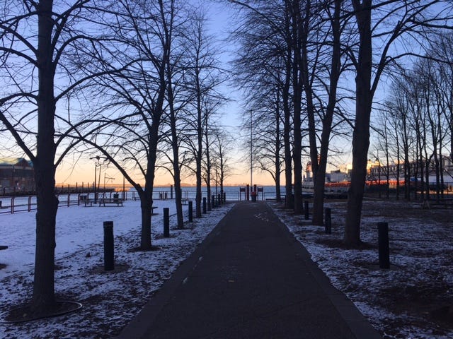
The matter of physically preparing for a Harborwalk thru-hike is also very important. For a start, it’s crucial to know that almost all of the Harborwalk involves walking on hard surfaces like concrete and wood. (At some point, you’ll be longing for the rooty dirt paths of Arnold Arboretum.) Knowing this, plus the mileage, will help you choose the right footwear and break down the long trail into hikeable sections that won’t end with an emergency visit to a podiatrist. Knowing that my feet start to get ornery after 18 miles of walking on pavement, I initially chose to divide the Harborwalk into three robust sections. But plummeting temperatures, freezing wind, and some work snafus compelled me to break the barnacle-encrusted hike into a five chapter affair instead.
Because the Harborwalk is constantly exposed to the harbor weather, you will want to treat a Harborwalk thru-hike like an expedition, in a material sense. A wind-proof parka with insulation, gloves, thick socks, and multiple layers under your outerwear will shield you from punishing elements. Sunglasses will protect your eyes from the wind as well. (If you suffer from dry eye in the winter, I recommend bringing some eye drops too.) Got one of thosevexternal battery chargers for your phone? Get it powered up the night before taking on the Harborwalk. And finally, because large sections of the Harborwalk don’t pass restaurants or shops, load up on your favorite trail snacks.
Rather than guide you through the Harborwalk in full detail—why spoil all the scenic discoveries before you’ve even tried this overlooked trail?—I will offer a hefty teaser of the territory you’ll be covering: starting from the south and heading north to Logan.
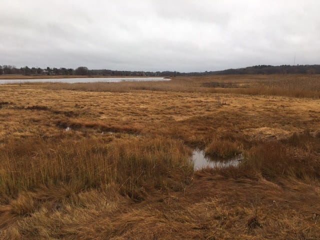
- The Harborwalk begins in the reedy wetlands of the Neponset River Reservation (a short walk from Milton station on the MBTA’s Mattapan trolley line.) As you huff that heavenly salty air, you’ll pass murals of woodland mammals and traverse the breezy fields of Pope John Paul II Park before passing underneath an active bridge for the Red Line subway trains to reach Tenean Beach, one of the jewels of Dorchester Bay.
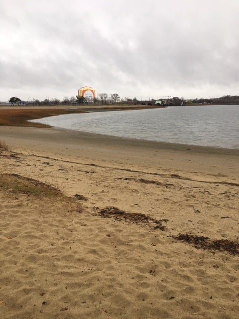
- Tenean is just the start of the sand you’ll be savoring along the Dorchester Bay portion of the Harborwalk. A somewhat scary road crossing at Morrissey Boulevard quickly delivers you to the lovely Malibu Beach, from which you can take an optional detour up and over Savin Hill along rugged wooded pathways to reach that big ass peninsula where UMASS Boston buildings and the JFK Library loom over the harbor.
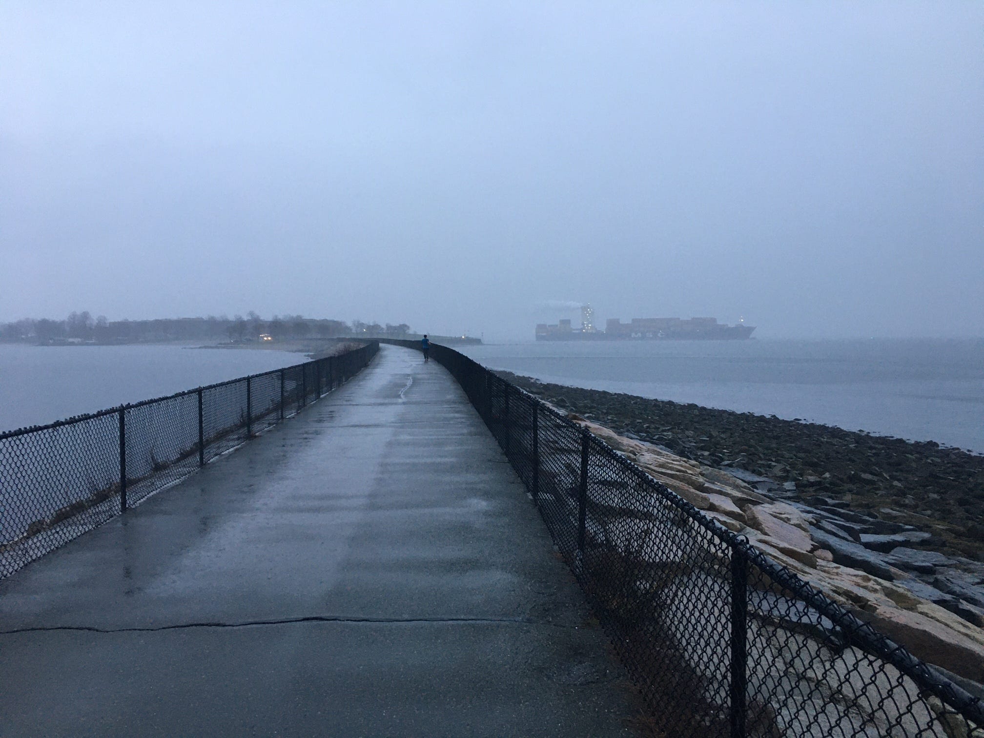
- Hiking the entire UMASS peninsula is a lengthy endeavor but thoughtful landscape design along the water and your first view of Southie sweeten the deal. Once you hit Carson Beach—where the infamous L Street Brownies’ swim goes down each New Year’s Day—you’ll follow the sandy shores of Old Harbor to Castle Island, where you get to cross the water to the preserved fort via a super-exposed stone causeway! I spotted a massive cargo ship from here, its lights twinkling amid a deep blue dusk.
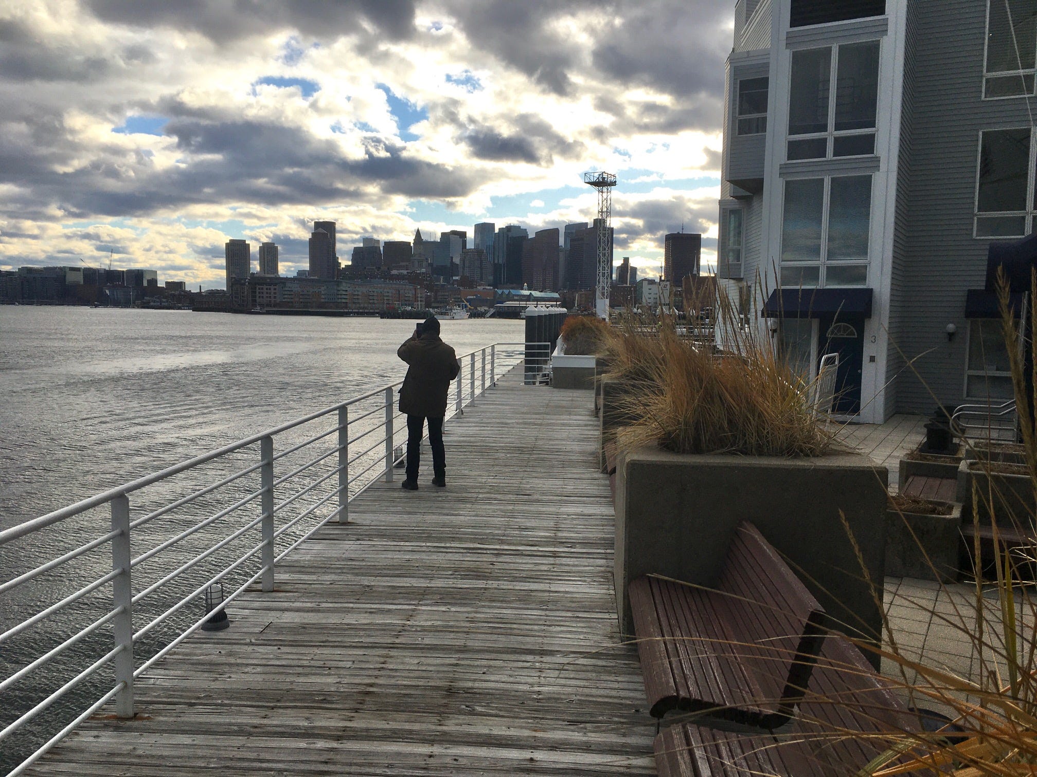
- From Castle Island, the Harborwalk becomes a much more urbanized affair, heading through Southie into the Seaport, where you’ll see lots of industrial machinery and fish shipping centers (there’s even a street here called “Seafood Way!”) before entering the more commercial entertainment district of the neighborhood. This is where the Harborwalk really starts to make use of wooden docks and because it’s a long trail, you will be walking the perimeter of MANY harborside buildings along those docks.
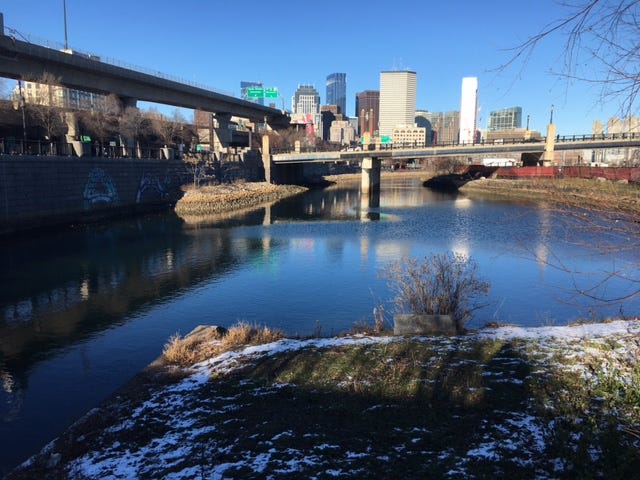
- The Fort Point Channel section of the Harborwalk, which ambles down the waterway separating the Seaport From Boston (and back up the other side!) is laden with some of the coolest oddities along the hike. Lobster traps outfitted with wind chimes. The “Underground” park at Ink Block, which allows you to pass beneath a constellation of highways on boardwalks. And of course, there’s the wonderful Martin’s Park near the Children’s Museum, where you should take a pit stop to clamber around on stone stairs, jungle gyms, and one of the most whimsical footbridges in Greater Boston.
- Possibly the most well-visited section of the Harborwalk is the North End leg, where you’ll pass the New England Aquarium, Columbus Park, and Mirabella Pool before getting a stunning view of Eastie, Charlestown, and the Tobin Bridge from Langone Park. If the city-owned bocce ball courts are open when you arrive here, you might consider warming up inside. Because from here, you’ll be crossing the Charles River into Charlestown on the moving walkways that are built atop the river lock gates!
- Continuing north through the Charlestown Naval Yards, you’ll be gazing back toward the core of Boston like someone standing on the stern of a ship, bidding farewell to the land they’ve come to know and appreciate. This relentlessly gorgeous Harborwalk segment is one long, unbroken view of the city skyline and the territory ahead. It’s also where your most cumbersome “connection” from the Harborwalk’s pieces will begin. Once you start walking inland along the Mystic River and reach Ryan Playground, your only option for hiking onward to the next piece of the Harborwalk, on the Eastie side of the river, is to cross over the Alford Street Bridge and traverse the warehouses and shipping yards of Chelsea. (Your next stop will be the Condor Street Urban Wilds.)
As for the final leg of the Harborwalk—Chelsea to Logan Airport—I confess that I have not done it yet! I plan to put in those final miles next week or the first week of January. But perhaps you’ll beat me to it. It’s the holidays. A lot of us have time off from work. So consider doing something saucy. The days are short, but the trail is long. Get out there, thru-hike the Boston Harborwalk, and please, do let me know what happens.
CLICK HERE for a map of my Harborwalk thru-hike route
CLICK HERE for the official Boston Harborwalk map