

What if I told you that Mount Washington—the tallest mountain in New England—is overshadowed in pretty much every way by a lonelier, gnarlier peak in the woods of northern Maine? What if I described the process of scaling this mountain as finding your way through a labyrinth of house-sized boulders, pulling yourself up iron ladder rungs affixed to perilously steep rock faces, and traversing a long, narrow ridge line that’s only a couple feet wide in places? “Why, that’s Mount Katahdin!” you might say.
But “might” is the key word here. By all means, Mount Katahdin should be considered the one peak to rule all of New England. Hell: the Appalachian Trail concludes here, on it’s tabletop summit! And yet, Katahdin remains a towering enigma for many hikers.
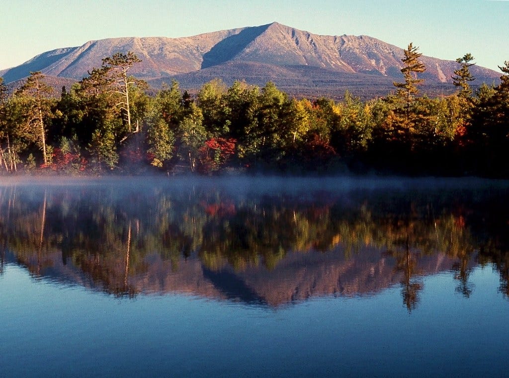
Looming 5,269 feet above sea level, Katahdin—which is the Penobscot word for “great mountain”—is a stony overlord that makes everything around it look pithy. Unlike the White Mountains—a gallery of gargantuan peaks—Katahdin is an anomaly surrounded by comparatively understated topography. The first time I saw it, driving north to the town of Millinocket on I-95, the mountain took my breath away. The vast profile of Katahdin reminded of Ayers Rock in Australia. When Henry David Thoreau attempted to climb Mount Katahdin in 1846 (unsuccessfully) he was so overwhelmed by the sheer *wildness* of the mountain and the Maine forests that he basically went crazy from the ecstasy of being there. This is what he wrote about the experience:
”This was that Earth of which we have heard, made out of Chaos and Old Night. Here was no man's garden, but the unhandled globe. It was not lawn, nor pasture, nor mead, nor woodland, nor lea, nor arable, nor wasteland…Man was not to be associated with it. It was Matter, vast, terrific…rocks, trees, wind on our cheeks! the solid earth! the actual world! the common sense! Contact! Contact!”
If I haven’t yet convinced you that it’s time to visit Mount Katahdin—whether you intend to climb it or gawk at it—then you may as well stop reading now. Because for the next few minutes, we’re going to unpack what it takes to climb Mount Katahdin, the ascent trails you can choose from, and when to go there. Unlike prior New England Deep Cut newsletters, which have covered regions and cities, I’m dedicating this one to a single big-butt mountain. Because honestly, Mount Katahdin deserves that type of coverage.
THE SEASONAL WINDOW
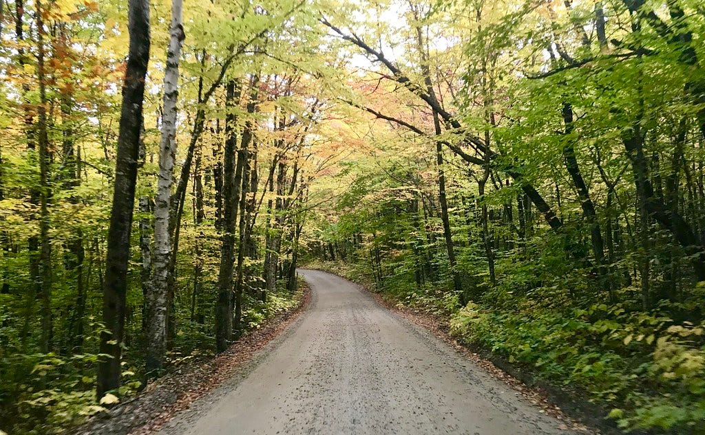
Given Mount Katahdin’s location in Baxter State Park—about 5-and-a-half hours north of Boston—the window for climbing the mountain with minimal odds of running into ice, snow, or subzero winds is a short one. Most years, the “season” for Katahdin runs from early June to early October. This is not a mountain that you can climb on a whim at the end of a grueling week. A Katahdin voyage requires planning in advance. Not just because of the short seasonal window, but because you’ll need a parking permit.
THE RESERVATION SYSTEM
In order to limit the number of climbers scrabbling along the cliffs of Mount Katahdin each day—for safety reasons—Baxter State Park strongly advises hikers to reserve a trailhead parking spot in advance. There are three different trailheads for Katahdin, which we’ll get into in just a minute, and when the park entrance at Togue Pond Gate opens at 6am, the first hikers to be admitted are those with parking reservations for the three trailheads. If there are no-shows by 7am, the park does allow hikers without reservations to access those free spots on a first-come, first-serve basis. (There will be cars lined up, waiting to try their luck.) But you shouldn’t count on this approach.
Each parking reservation costs $5, and if you’re a Maine resident, good news: you can reserve a trailhead parking spot now! But if you’re not from Maine, then you’ll have to wait until two weeks or less before your visit dates to book a parking space. All the more reason to look at the calendar now and start penciling in “Katahdin Expedition.”
THE BAXTER STYLE
One important thing to know about Baxter State Park before you attempt Katahdin is that the park’s namesake, former governor Percival P. Baxter, believed that visiting the northern Maine woods shouldn’t be a cakewalk. Per his decree, Baxter State Park is fairly spartan when it comes to amenities like potable water, electricity, and paved roads. So charge your phones, take it slow while driving, and bring at least two liters of water for your hike, if not three. You might even consider throwing in some water purification supplies like iodine tablets or a mini filter. Katahdin will make you sweat.
THE TRAILS
With the Katahdin logistics squared away, we can proceed with the climb itself. There are several different approaches to Mount Katahdin and as I mentioned earlier, they stem from three trailheads. On the southwest side, Katahdin Stream Campground and Abol Campground offer two ascent routes. And from the eastern side, you can choose from five different summit routes at Roaring Brook Campground. For the sake of keeping this newsletter at a reasonable scale, I’m going to spotlight five trails to the summit of Mount Katahdin (“Baxter Peak”) which offer unique environmental features and a thrilling climbing experience that will haunt you as it haunted Thoreau.
SADDLE TRAIL VIA CHIMNEY POND
Distance: 10.4 miles out-and-back
Elevation gain: 3,832 feet
CLICK HERE for a trail map
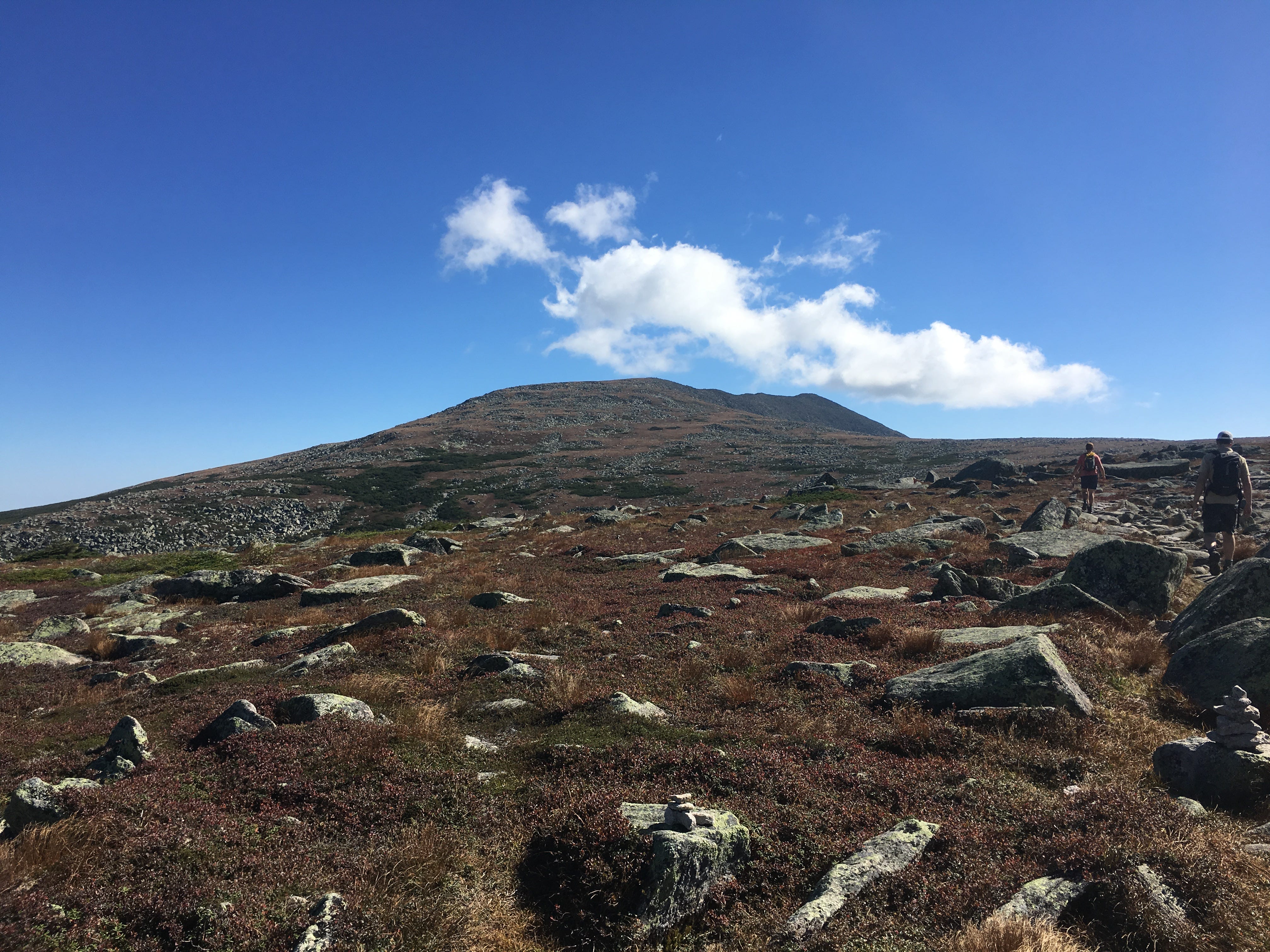
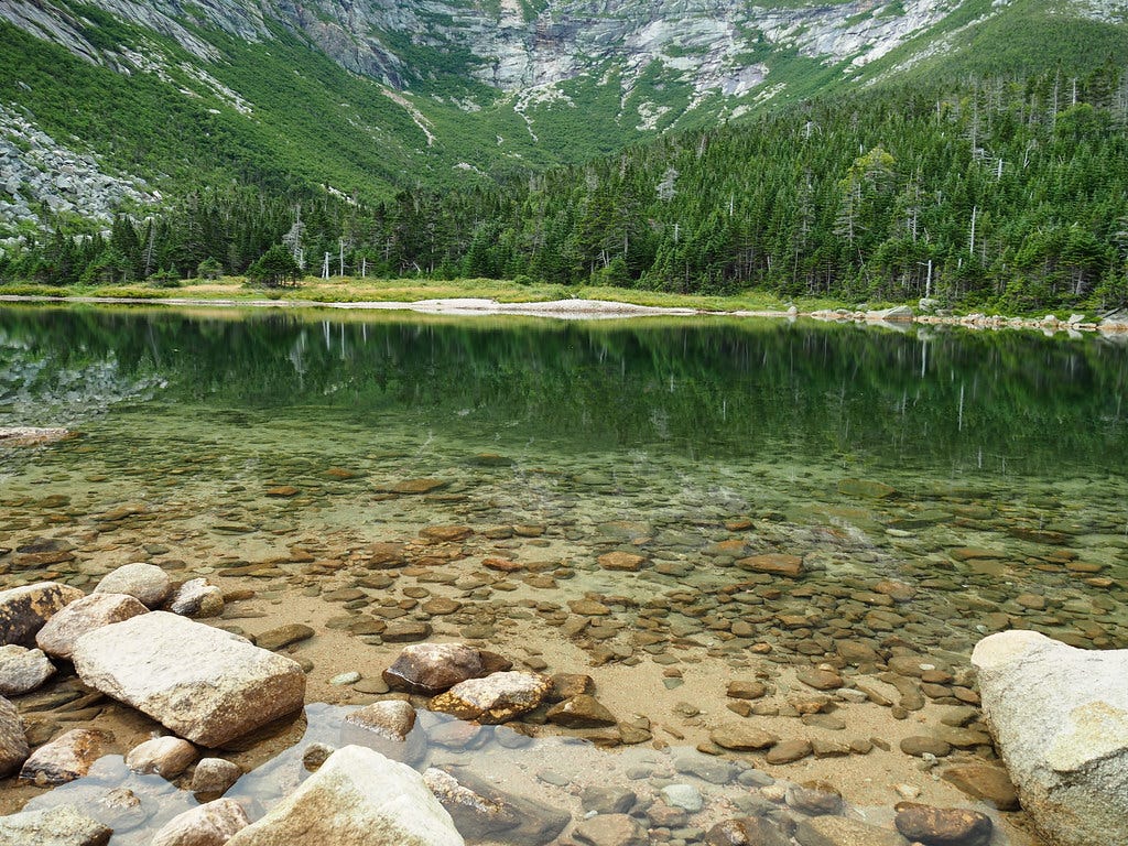
There are no easy routes to the top of Katahdin, but the Saddle Trail may be the least punishing of the lot. From Roaring Brook Campground, you’ll climb at a patient pace through twisting halls of evergreens along the Chimney Pond Trail to reach a heavenly body of water flanked by steep scree slopes. Then, you’ll pick up the Saddle Trail and climb right up one of those slopes! There are no technical climbing segments, unlike some of the other ascent routes up Katahdin, but feeling that scree shift beneath your boots can be quite hair-raising. Once you reach the “Tableland”—the plateau-like upper reaches of Mount Katahdin—you’ll hike to the summit through wildflowering tundra.

HUNT TRAIL
Distance: 10.9 miles out-and-back
Elevation gain: 4,258 feet
CLICK HERE for a trail map
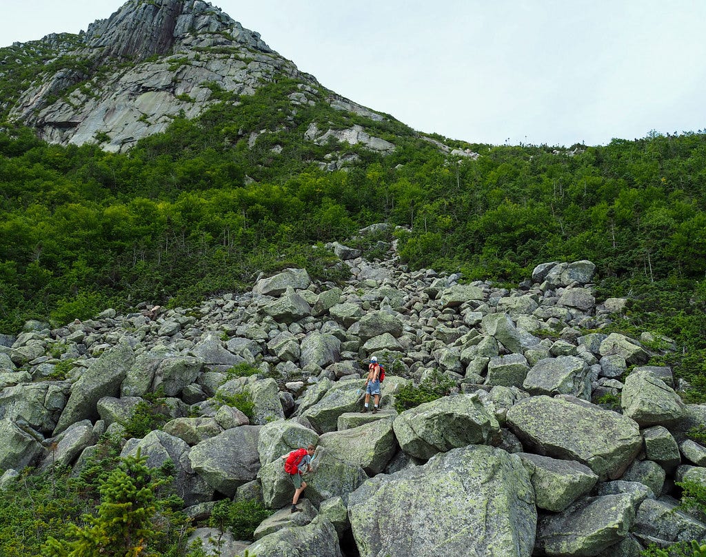
You might assume that the Appalachian Trail route to the summit of Mount Katahdin would be fairly accessible and under-exposed, to accommodate the legions of hikers who’ve traveled from Georgia. And you would be wrong. The Hunt Trail, which departs from Katahdin Stream Campground, starts off like an innocuous pine-scented forest jaunt. But after reaching Katahdin Stream Falls and climbing through the woods just like any other mountain path, the Hunt Trail pitches some curveballs. First, you have to hoist yourself up through a jumble of boulders using iron rungs and pegs which have been affixed to sketchy rock faces. Then it’s time to scale the incredibly steep (and narrow) Hunt Spur. This razorback ridge is your stairway to the tableland and the peak.
Bonus tip: If you’re uncomfortable descending the iron rung portions of the Hunt Trail, you can take the steep but less treacherous Abol Trail back down, and walk along the park road (roughly two miles) to return to the Katahdin Stream Campground trailhead.
ABOL TRAIL
Distance: 8.1 miles out-and-back
Elevation gain: 3,969 feet
CLICK HERE for a trail map
Let’s say you’re not the type to fuck around with flowers, cascades, or interesting trail construction styles. There’s a mountaintop, and you want to get there ASAP. The Abol Trail, departing from Abol Campground, is one of the most direct routes to the top of Katahdin, and maybe the most masochistic. After a solid climb through the forest, you’ll spend at least an hour or two slowly working your way up what appears to be an endless jumble of chewed up rocks. Imagine Frodo, Sam, and Gollum climbing that secret staircase into Mordor. The exposure here is never too treacherous, but it’s the apparent relentlessness of the climb that makes the Abol Trail spiritually challenging.
CATHEDRAL TRAIL VIA CHIMNEY POND (AND SADDLE TRAIL)
Distance: 9.6 miles loop
Elevation gain: 3,805 feet
CLICK HERE for a trail map
Katahdin is such a huge mountain that it doesn’t just have sibling summits like nearby Pamola Peak. It also has stony buttresses known as “Cathedrals,” and if the idea of scrambling your way up these buttresses sounds like fun, you might be ready to try the Cathedral Trail. You’ll start off by hiking to Chimney Pond, but from there, you’ll branch off from the Saddle Trail crowd and begin a wincingly steep climb up and over those rock formations, gaining as much as 1,500 vertical feet in half a mile. You will be using handholds in the rock at times, and for that reason, you will not be taking the Cathedral Trail back down. Instead, you’ll follow the Saddle Trail to Chimney Pond, turning this brutal hike into a loop and allowing your nerves some time to recuperate.
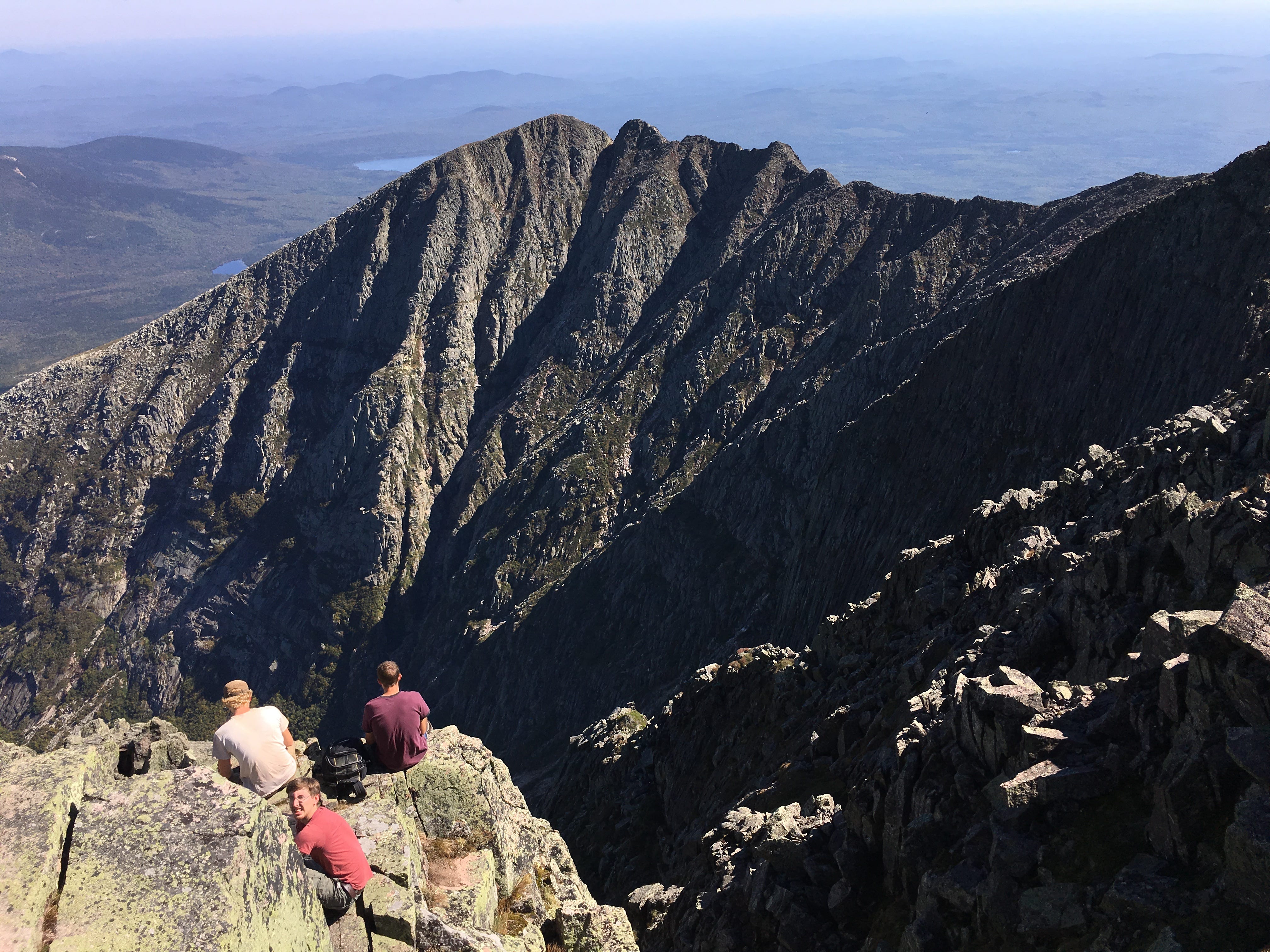
KNIFE EDGE RIDGE VIA HELON TAYLOR TRAIL (AND SADDLE TRAIL)
Distance: 9.8 miles loop
Elevation gain: 3,917 feet
CLICK HERE for a trail map
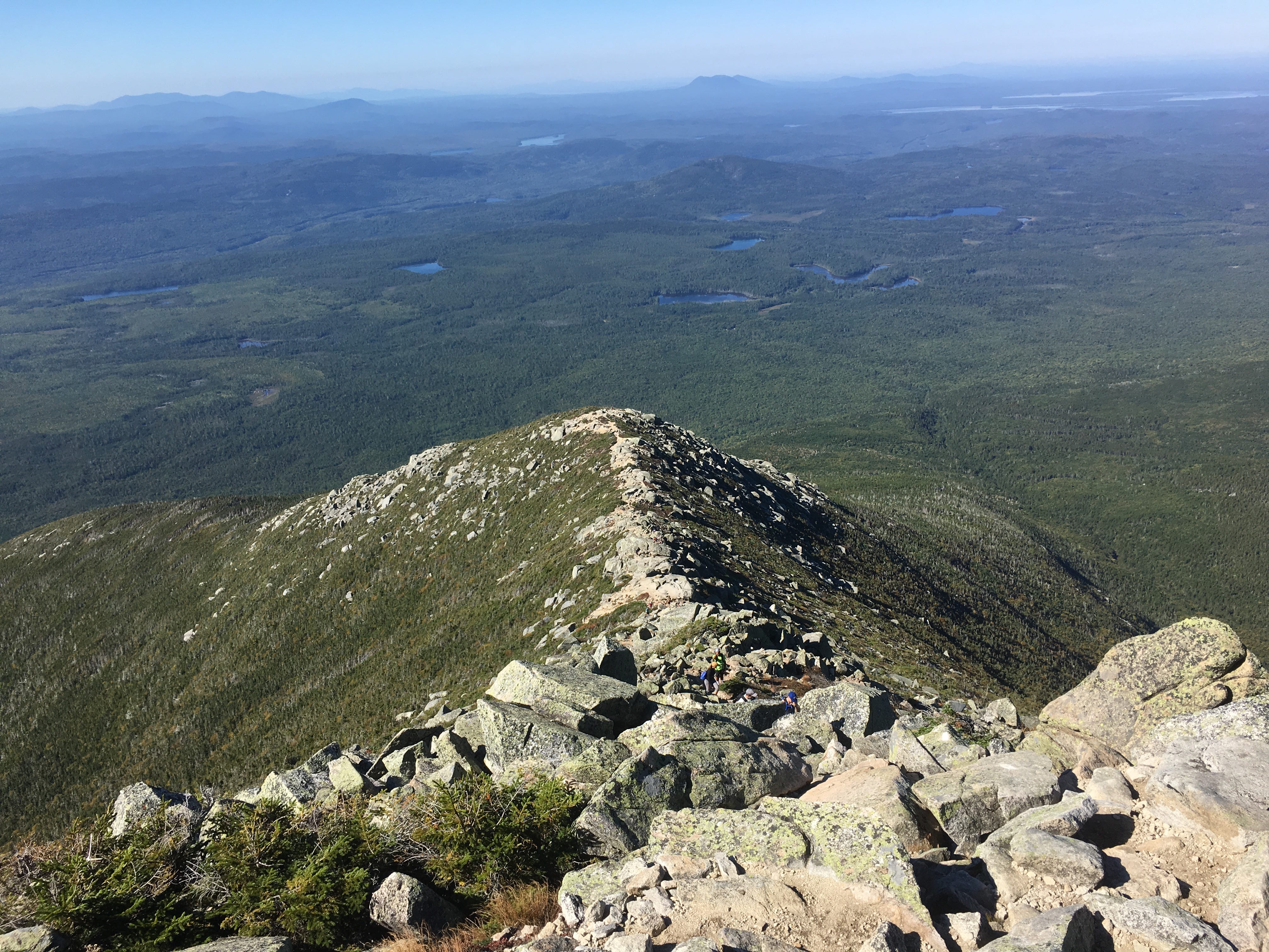
The big one. Katahdin’s “knife edge” ridge line is so bumpy, narrow, and exposed that it can become a white whale of an obsession for hikers looking to tempt fate. And to reach that vertigo-inducing ridge, you’ll climb the already grueling Helon Taylor Trail from Roaring Brook Campground to the top of Pamola Peak, from which knife edge ridge offers passage to Baxter Peak. But the scariest part of the knife edge might just be “the chimney,” a descent into a tight cleft, which you’ll then have to scramble out of. This involves freestyle rock climbing, and a spill here could really mess you up. In fact, some hikers find the long, narrow ridge scramble to be a relief after making it through the chimney. Obviously you won’t want to repeat this traverse, so once you reach Baxter Peak, you return by taking the Saddle Trail down to Chimney Pond and then following the serene Chimney Pond Trail back to Roaring Brook Campground.

CLICK HERE to visit the Baxter State Park website for maps, reservations, and more.
And here’s the audio version of this week’s newsletter:
Katahdin was the most awesome climb I've ever done...a 12 year old in 1967 on a day trip from summer camp in Raymond, ME. I have no idea which trail we took, though. It sounds like the Saddle Trail might be the only one of the 5 above that a group of young campers and their counselors would have been able to manage, but I do remember scrambling up some BIG rocks at one point. Thanks for this terrific guide, Miles!