Switchback Romance (the first newsletter!)
A glorious trail innovation, a dam crossing, and a thundering waterfall in Vermont
When you have a friend visiting New England from the Rockies or the Sierra Nevadas, one of the cruelest things you can do is take them for a hike. The relatively modest elevation of New England’s mountains seems to suggest a gentler climb. But as any New England hiker can tell you, “gentle” is a foreign concept when it comes to trail design in the northeast. Here the trails go straight up: a relentless wall of soil and stone, festooned with slippery tree roots that can often double as hand grips. New England’s trails were not shaped by the idea that someone might want to enjoy hiking.
Many of us adore these evil, punishing trails anyway. In the same way that Australians slather Vegemite on their toast. There’s something cool about Spiderman-ing your way up the granite slabs of Mount Monadnock—one of the most heavily-hiked peaks in the world—and realizing that despite all the people posing for selfies and the daily fleet of tour buses parked at the trailhead, the White Dot Trail is kicking your ass. It speaks to a timelessness about New England trails: the sensation that these trails are still more or less how they were back when Henry David Thoreau went insane on Mount Katahdin.
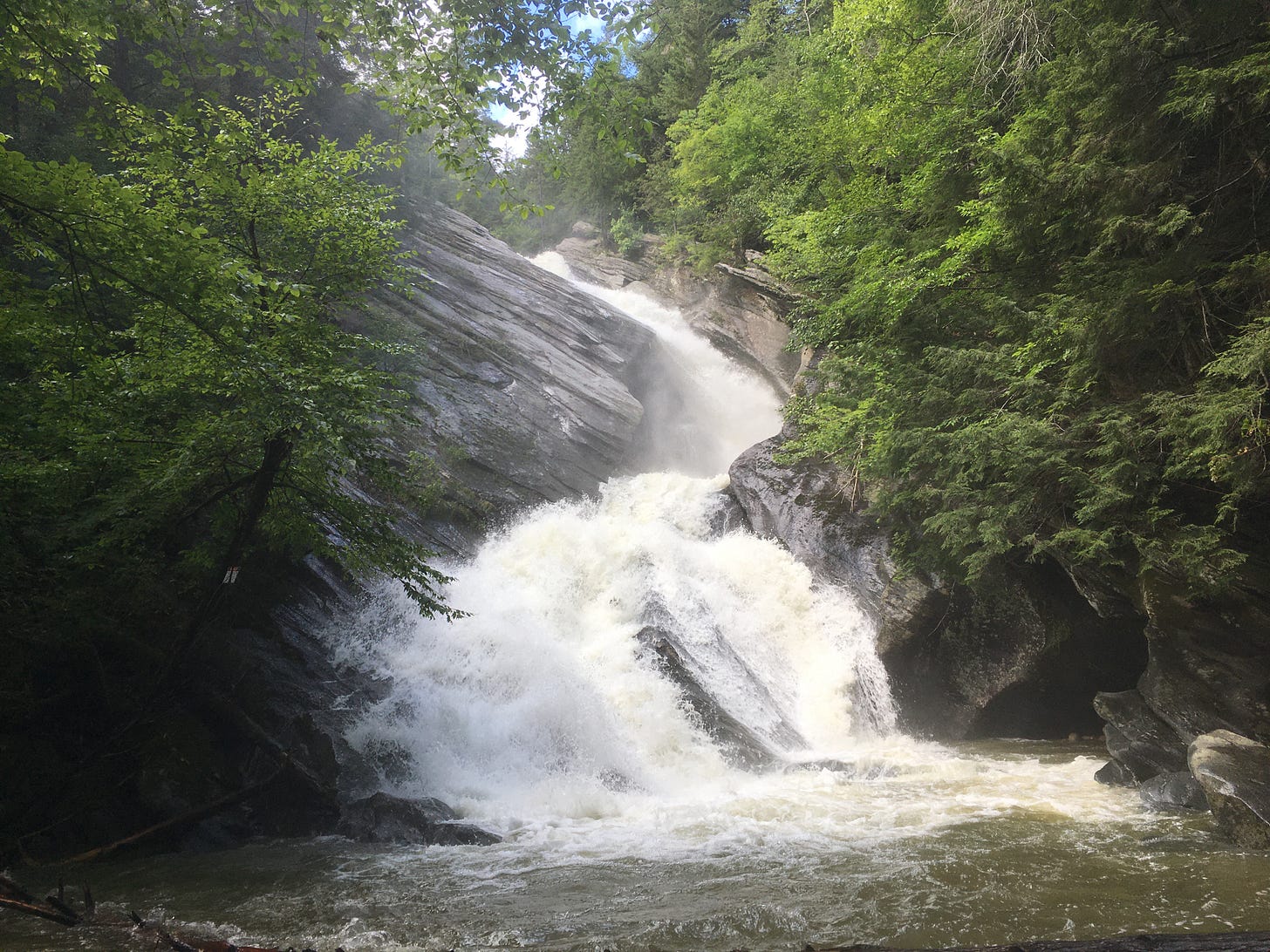
But sometimes you need a breather from the Calvinist masochism of New England hiking. I wanted a reprieve from the vertical slogs a couple of weeks ago, on a day trip in Southern Vermont. (Since receiving the Covid-19 vaccine, I’ve been taking up a lot of friends on invitations to come visit and work remotely from their homes the next day.) It was a broiling Wednesday afternoon and I was craving a big old gusher of a cascade where I could huff some mist. I set my GPS for Hamilton Falls, a 125 foot-tall monster near the town of Jamaica, about 36 minutes northwest of Brattleboro. But the falls are only half of the draw here. To reach them, you walk atop a gigantic dam before making a rapid descent to the West River (a tributary of the Connecticut River.) How? With the help of a trail innovation that’s endemic to the west but seldom seen in New England.
The switchback.
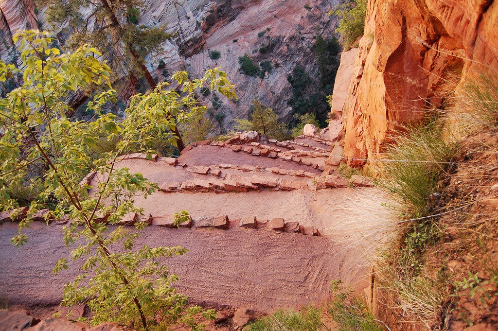
If New England’s preferred “straight up” trail style is like being punched in the face, the Switchback is a more playful series of slaps. Instead of climbing in a straight line, the trail zig-zags upward at a more patient grade, alternating direction, allowing the hiker to gain (or lose) some serious elevation in intervals. The American west is full of switchback trails. If you’ve climbed to Angel’s Landing in Zion National Park or Snow Lake in Washington’s Alpine Lakes Wilderness, you’ll know what a switchback looks and feels like. In New England, you’ll sometimes find a sort-of switchback trail of 2-3 long intervals—for example, the Lonesome Lake Trail to Lonesome Lake Hut. But what’s unusual is the switchback trail in which many short intervals are stitched together so that you can make a sudden climb or descent without scarring a lung.
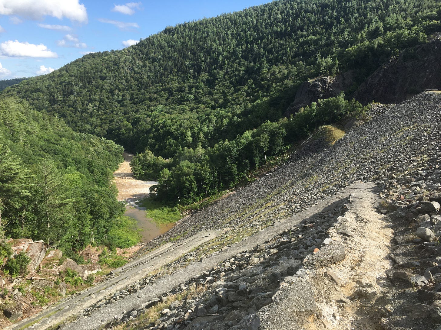
Which brings us to that massive dam that hikers can cross to reach Hamilton Falls. Tucked away in the shadows of Ball Mountain, the Ball Mountain Dam is a hulking earth and gravel gravity dam through which the West River rumbles out of sight, before hooking up with the Connecticut River. You park in a small lot off Ball Mountain Lane and pick up the West River Trail, which follows a cutoff road to the top of the dam. To the left, you’re treated with a vista of Ball Mountain Reservoir, but to the right—the direction you’ll soon be hiking in—you gaze down at the river as it froths through the woods. It’s a long way down. Several hundred feet down. How is this going to work?
That’s when you reach the switchback, after crossing the dam. What ensues here is a roller coaster sawtooth trail formation that efficiently takes you to the bottom of Ball Mountain Dam with minimal impact to your knee cartilage. Initially, gazing down at all those intervals of switchbacking trail, you may feel a twinge of vertigo. (You wouldn’t want to fall off any of the trail intervals by skirting too close to the edge.) Initially, the footing is rather rough: a patchy mix of broken concrete, gravel, and rocks. But after the upper two intervals, the switchback quickly transitions into a more pleasant path and soon, you’re happily losing altitude like a marble rolling down a series of chutes.
Of course, you’ve got to climb back up the switchback, but this is the ultimate tonic for New England’s trails. After descending the dam and continuing through the woods for roughly 1.5 miles to the cascade (a misting beauty which was especially copious after several days of rain) I backtracked and found myself at the foot of the dam near dusk. Through the trees, the symmetry of the switchback trail was strikingly beautiful: like something you’d glimpse at Chichen Itza. An ode to the art of building ingeniously.
I don’t know if I’ve enjoyed an ascent more, this entire summer. Each interval’s modest grade and relatively smooth footing (save for the uppermost intervals) allowed me to savor the surrounding forest as I climbed back out of the valley. In the woods, I could even spot little cascades, trickling and hissing through the trees. Midway up, I took a few minutes to collect my breath, but doing this in an upright position, as opposed to being hunched over and soaked with perspiration, felt decidedly anti-New England. I won’t say it was easy. By the time I reached the top of the dam, both my calves seared and I was relieved to finally see Ball Lake Reservoir again on the other side. As I drove back to Brattleboro, amid golden light and lots of bugs exploding on the windshield, I was tingly with the satisfaction of having seen something you’re not supposed to see, but in a good way: like the time I found a Lord of the Rings themed cafe in Houston, while reporting a story there. I had stumbled across a bonafide switchback in a land where sensible things that make hiking more accessible and less miserable can be seen as decadence. We could use a lot more of these innovations in New England.
You can replicate this post by taking a spin on the West River Trail this summer or fall. (The view from the dam during leaf peeper season will be worth the drive.) Here are some directions for how to reach the trail and find your way to the Ball Mountain Dam switchbacks. Those of you who’ve ever visited AllTrails.com will recognize the link.
For those who are new to AllTrails, here’s the gist: it’s basically Yelp for trails. You can use AllTrails to look up trail maps, find directions for reaching the trail, and if you’re keen on knowing the conditions of the trail, you can read reviews from people who’ve hiked it recently. It’s a pretty cool web platform. Later, I’ll write about how you can use it to scope out underused trail networks or to design your own urban hikes. In Beyond Mountains, I’ll use AllTrails as a source for trail maps and directions. When that’s not an option (there are still a lot of New England hikes not listed on AllTrails) then I’ll link to alternative trail map and directions sources, such as town forest websites.
THE RUNDOWN (a brief recap of featured trail info, included at the end of each post)
Hamilton Falls via the West River Trail and Ball Mountain Dam
Distance: 4.2 miles round-trip (out-and-back trail)
Elevation gain: 974 feet
Parking pass required? No
I’ll conclude each post with a couple of links to recent stories, news, and other articles that offer unusual perspectives on hiking, or spotlight some unusual New England trails.
A few weeks back, I wrote a story for AMC Outdoors about taking a spin on the Cohos Trail: a relatively new 162 mile trail through the largely unknown wilds of far northern New Hampshire. The trail begins in the White Mountains and goes all the way to the Canadian border. The twist? I hiked a section of the trail with Kim Nilsen, the writer and visionary who came up with the idea and recruited volunteers to build the Cohos Trail.
Kim Nilsen is leading me into a buzzing marshland, a couple of klicks northwest of New Hampshire’s White Mountains, when he suddenly nods toward a heaping pile of animal pellets.
“One time,” he says, “I was up near Dixville Notch in my sleeping bag, on the ground, and I woke up around midnight just in time to see this big bull moose coming straight toward me.”
A tall fellow with an enviable flow of salt-and-pepper hair and a well-worn Indiana Jones-worthy hat, Nilsen moves through the thick undergrowth of this grassy path with an intimacy that might seem improbable in such a dense, sparsely visited stretch of New Hampshire forest. Occasionally, he’ll stop to clear some stray branches from the trail, or to adjust one of the yellow trail markers nailed to trees along the trail. Why does he do this? Furthermore, why had Nilsen been sleeping all alone in the backcountry, attracting the attention of a moose?
Reporting for Axios, Alex Contreras presents some exciting stats which show us how America’s hiking communities are becoming more racially and economically diverse. But there’s a lot of work that still has to be done to make the American outdoors a more inclusive space. One especially cool idea, which David Treuer outlined in The Atlantic earlier this year, would be to give the National Parks back to the tribes from which they were stolen (the parks would be run by Indigenous peoples henceforth.)
Finally, on a recent red eye flight from Seattle, I re-watched the classic X-Files episode “Darkness Falls,” in which Mulder and Scully investigate the disappearance of several loggers in the woods of the Pacific Northwest (they have to do some hiking.) I won’t explicitly give away the cause of the missing loggers but let’s just say that I wanted to embalm myself in a protective cocoon for the rest of the long dark flight to Boston. The real strength of the episode is how it imbues the woods with a palpable sense of impending menace, before the “monster” shows. I often feel this way in New England forests. Especially in northern Maine. Even the moss can look kind of menacing there.


