Take the map
Chime in and shape the future of Mind the Moss

Friends: The one year anniversary of Mind the Moss is rapidly approaching and lately I’ve been spending a lot of time in dusty stacks across various northern New England locales, flipping through forgotten books and seeking ideas for new hikes to cover in the year ahead. (The more cobwebs and earwigs you have to shake loose from these books, the more promising the hike offerings, in my experience.) And let me start off by saying that the year ahead is already looking like an escalation of what we started with this newsletter. The New England hiking stories that are on the lineup for Year 2 involve secret staircases, fickle waterfalls, and a forest so haunted that I’m actually scared to go there. (Hit me up if you might be interested in joining me for this hike.)
But Mind the Moss wouldn’t have made it this far without YOUR generous support and enthusiasm. I’m both humbled and thrilled by how much the ”Mosser” audience has grown since I published the first newsletter last August (a switchback-ed voyage to Hamilton Falls in Southern Vermont, for those of you who subscribed more recently) and I thank each of you for going the extra mile and supporting this newsletter with paid subscriptions. But I don’t just want to thank you—I’d love to hear from you about where you’d like to see Mind the Moss venture this coming fall, winter, and beyond!
To that effect, I’ve created an annual Mind the Moss reader survey which you can fill out and share with me by clicking here. Above all, this is your chance to suggest hikes and topics for future newsletter issues. Want the skinny on those distant potato fields up in Aroostook County, Maine? Would you like to see me wade through more bogs or cedar swamps? Are there specific mountains or vast regions of New England that feel foreign to you, begging for more coverage? Any suggestions and ideas you may have will help the next year of Mind the Moss go even further off the map and into the peat.

In addition, I’d really love to hear your thoughts on the newsletter in general. Are there specific elements of the newsletter that make you smile when it lands in your inbox each week? Are there things that you’d like to see changed, such as the length of the newsletter, or the way I put trail distance and difficulty stats toward the end of each newsletter? Whether it’s lavish praise or wincing criticism, I want to hear it all. Your reader survey will be anonymous (unless you feel like dropping your name into any of the text boxes) so please do not hold back. Your unfiltered feedback will help me whittle Mind the Moss into a more formidable walking stick for the year ahead.
Oh, and speaking of walking sticks, don’t think for one second that I’m leaving you without an odd New England hike to poke around this week or next. In the interest of seeing some of you in the near future, I’d like to direct your attention to my Boston neighborhood. Specifically, the forested northwest shore of Jamaica Pond. Some of Boston’s wealthiest residents live in sprawling mansions in the woods up here, along private roads where peons like myself are not allowed to wander. Technically, these mansions are part of Brookline—a silo-ed municipality within the City of Boston—and this is important because back in the 2010s, the Brookline Conservation Land Trust did the unthinkable and built a rustic path through the backyards of these mansions!

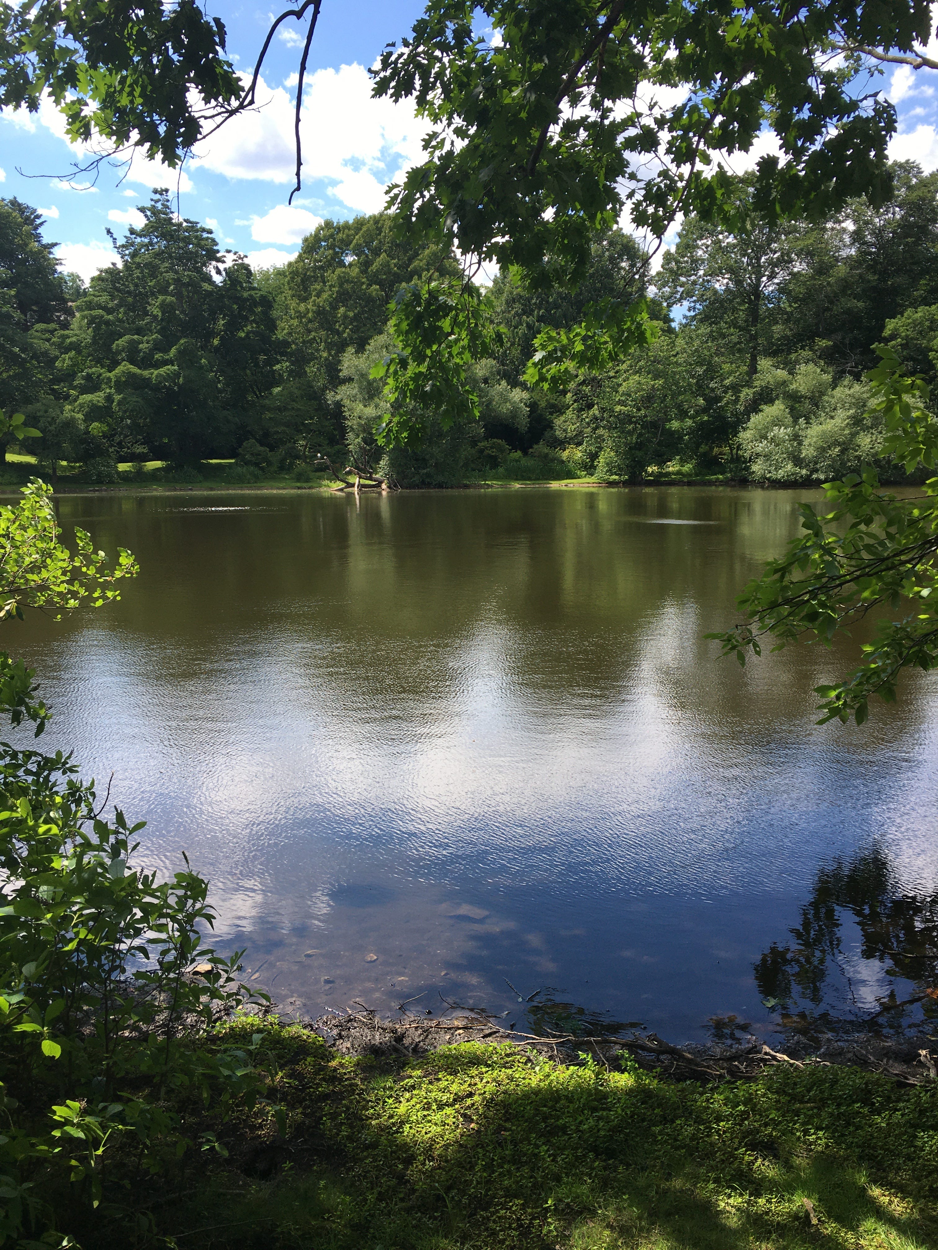
This pathway, known as the Cottage Street Preserve, was made possible thanks to an easement. And the photo above is what it leads to: Sargent’s Pond, a heavenly body of water created and owned by Charles Sprague Sargent, the guy who hired Frederick Law Olmsted to create the wandering trails through Arnold Arboretum. When Sargent’s estate was divided, his pond became inaccessible as opulent homes expanded and surrounded the pond. The creation of the Cottage Street Preserve involved offering property tax cuts to Brookline homeowners who allowed the BCLT to build a public path to the pond through slivers of their properties. But that doesn’t mean the path is easy to find. The trailhead sign is obscured by overgrown tree branches. Stepping onto the trail requires walking down someone’s driveway. And until very recently, there were no legible maps of the Cottage Street Preserve trail anywhere on the Internet.
So a few weeks ago, I went out, walked the path with a GPS device, and made a map.

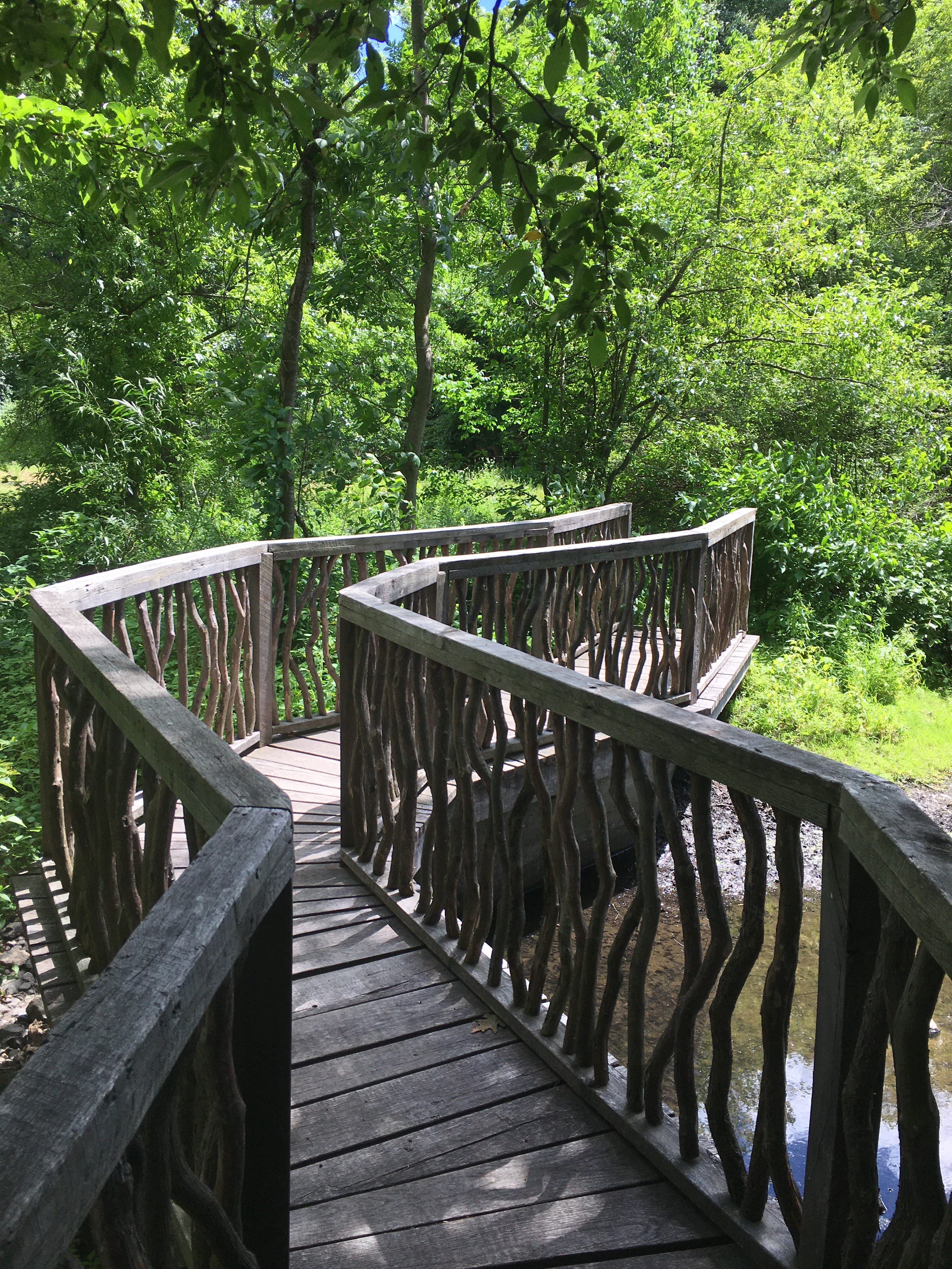
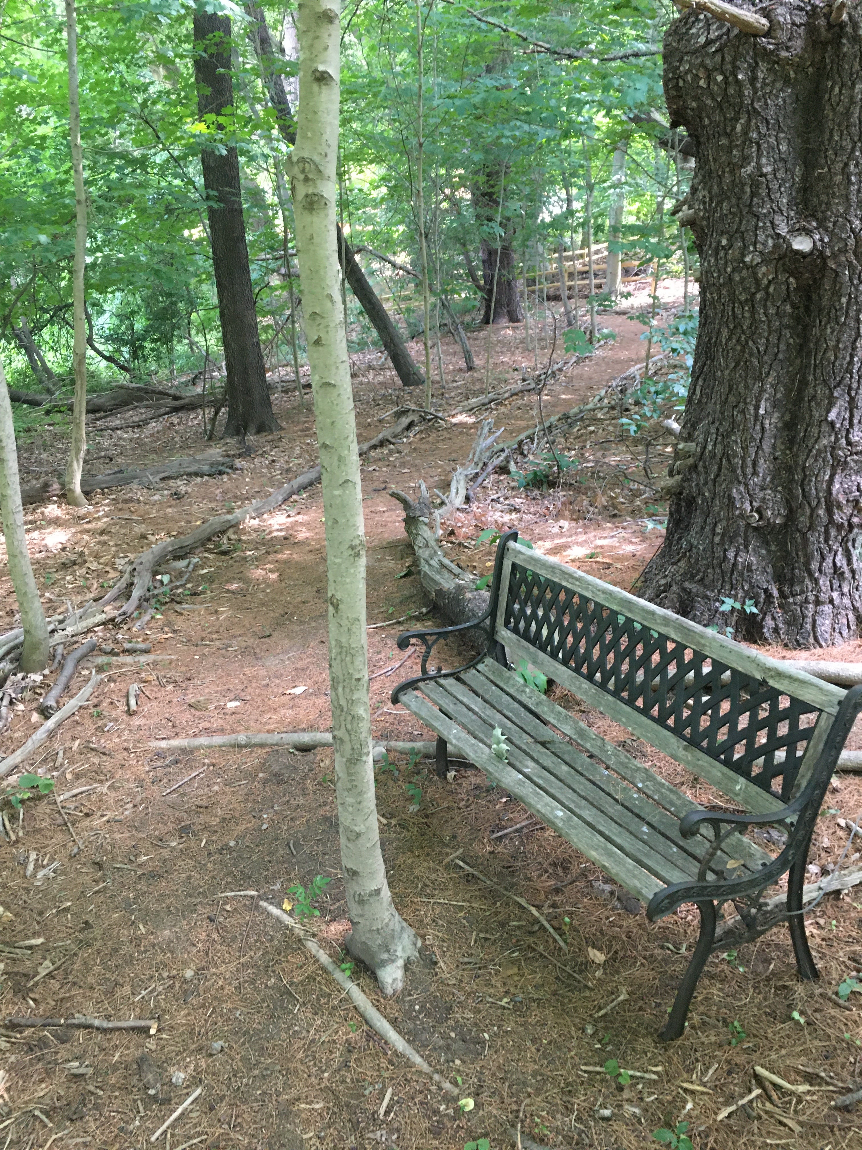
You can download the map by clicking here. I won’t spoil the hike experience with a blow-by-blow trail account, since it’s only a 0.3-mile hike. The trail pictures in this newsletter are a taste. But if you’re thinking of exploring the Cottage Street Preserve anytime soon, let me know if you’d like to meet up! The trailhead is barely 20 minutes away from my apartment by foot, and I’ve gotten in the habit of hiking to Sargent’s Pond with an ice cold ale in a tumbler, savoring the last rays of summer evenings. We could try bringing beach chairs and gazing across the pond, sipping our drinks and looking into the backyard of John and Linda Henry on the other side of the water. It would be a hoot, a fine of example of a hike that makes you feel like you’re trespassing (I wrote about this type of hike back in August last year), but above all, it would be a cracking opportunity to meet and get to know more of you.
After all, you’ve made this long and scenic walk possible.