

A lot of us would like to live in a fancy house on a big hill…until we start to think about having to go up and down that hill every day. If you drive a car, this is an excellent way to turn your brakes into nubbin. If you ride a bike, you’ll need a shower at each end of your commute. And if you’re a pedestrian, then you’d better hope your hill either has gentle slopes OR staircases with railings, which could save your bones during winter.
The hills of Brookline are not like the other hills in Boston. (Yes, technically Brookline is its own municipality, but let’s be real here: it’s part of Boston.) These hills are big and steep enough to turn a day of sledding into a trip to the ER, and during the late 19th Century, when rock star landscape architect and Brookline resident Frederick Law Olmsted was helping to develop Beacon Street into a commerce zone with its own street car line, it occurred to him that people living in the Brookline hills would need a quick, straightforward way to descend to Beacon Street from their homes.
And so, Olmsted started building staircases into those gilded hills….
Today, the staircases of Brookline are treated as something of an open secret. You might have taken one of them to a high point when visiting a friend or participating in a group hill running workout. The latter was my introduction to the long staircase which ascends from Beacon Street through wispy trees and tight spaces in between residential dwellings, eventually reaching the summit of Corey Hill, where you can gaze across the Charles River toward Cambridge and the Middlesex Fells forest.
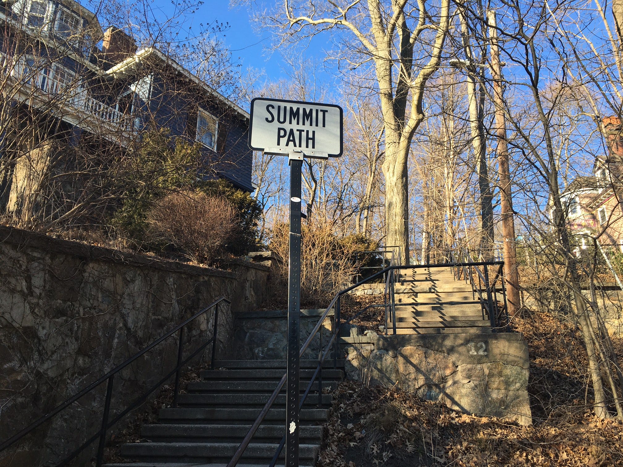
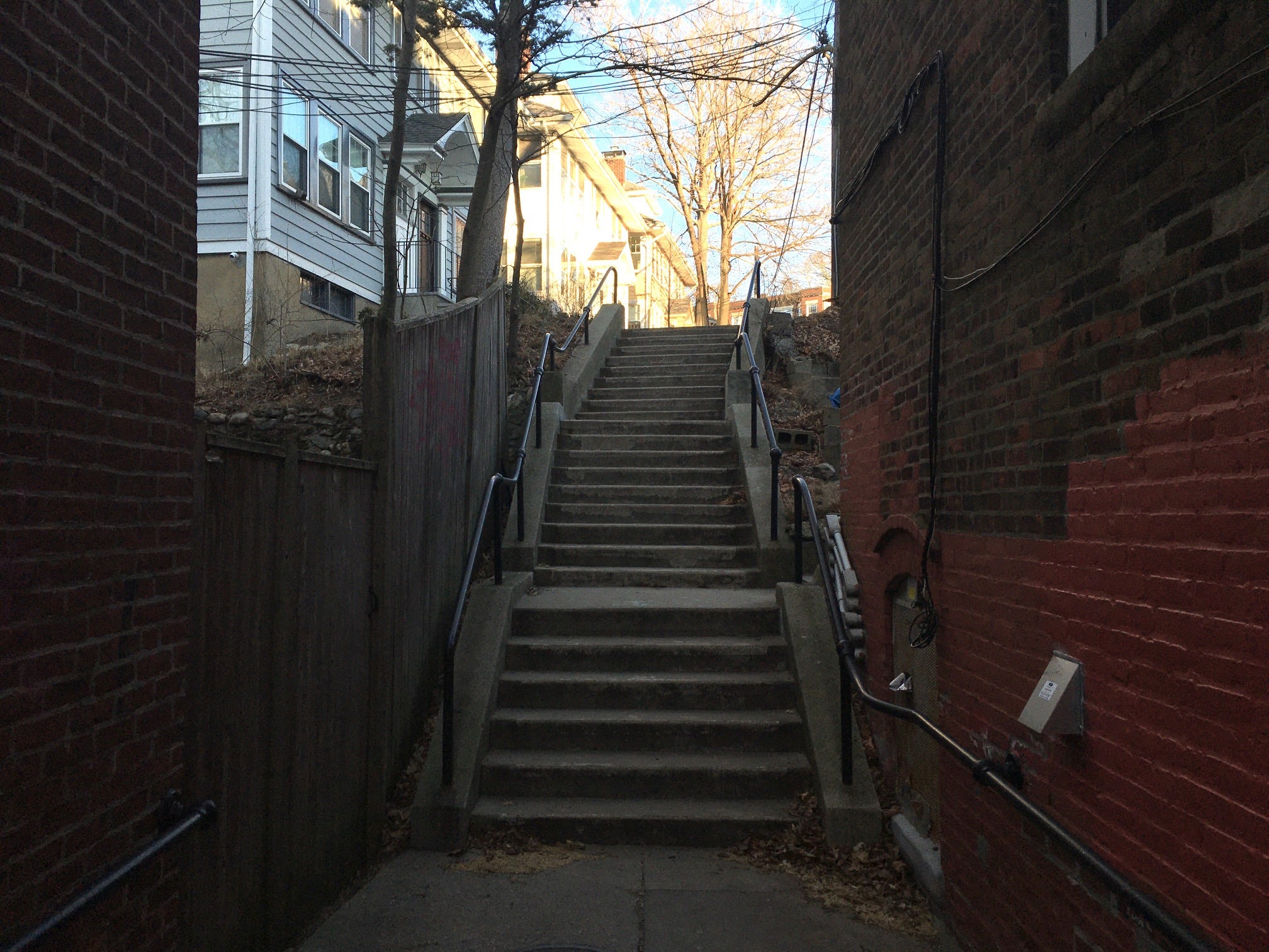
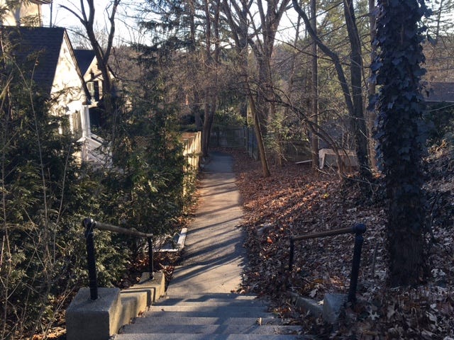
The name of this staircase is the Summit Path. You’ll find this emblazoned on old school metal signs posted along the staircase’s multiple entry points. And one of my favorite things about the Brookline hills staircases is that each one is named as a path. Imagine: a friend calls you up and suggests, “Hey, let’s catch up and go up the Summit Path.” Now imagine the same friend saying, “Let’s go up the Summit Stairs.” One of these sentences is a lot sexier than the other, and it comes down to the last word. “Path” suggests a journey through an environment that might otherwise be impassable,. “Stairs” promises dripping sweat, labored breathing, and tender glutes.
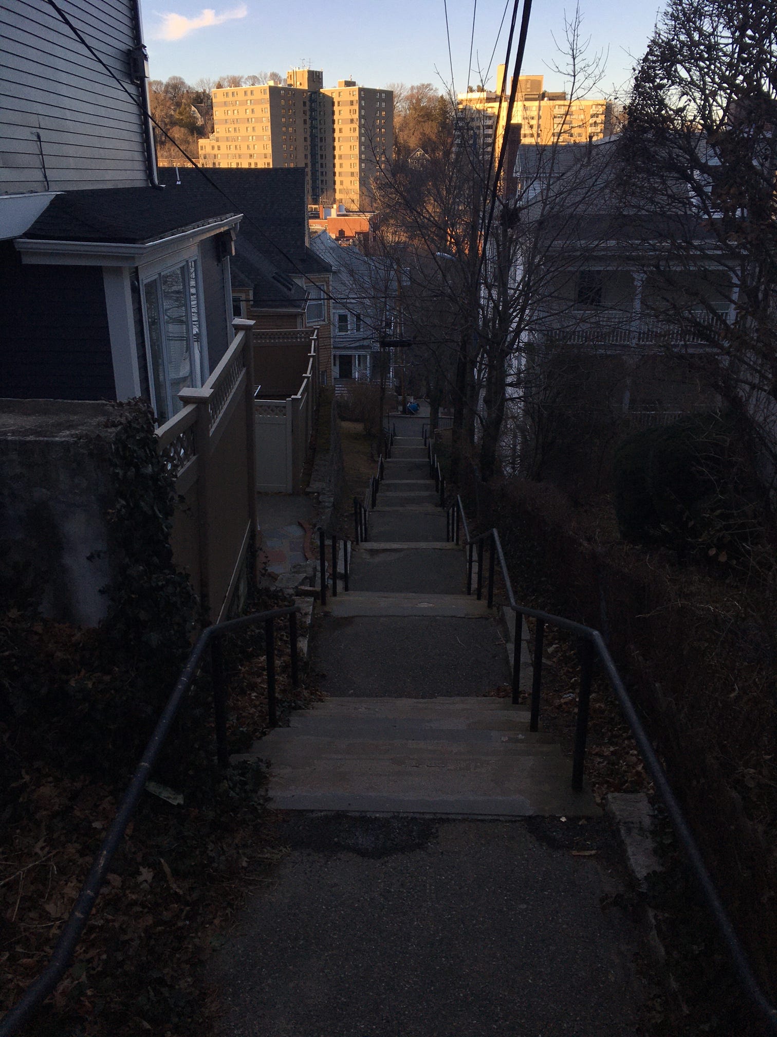
The stair paths cover three hills in Brookline—Corey Hill, Aspinwall Hill, and Fisher Hill. Some of the paths are relentlessly steep. Others break up the stair flights with flatter sections that shoot through greenery-festooned back alleys. In theory, given their uniqueness and their playful names, the staircases could be the skeleton of a banger urban hiking route. But in the absence of trail signs or maps from the Town of Brookline, you have to design your own traverse of the Brookline staircases. And this week, I created a circuit hike that will show you 10 hidden paths while ascending all three hills. In 4.8 miles, you’ll climb 486 feet, which is a lot of climbing for a city hike!

As you set off from the MBTA’s Summit Avenue Green Line stop—located on Beacon Street, where those old streetcars once ran—you’ll begin with the only stair-free path of your hike: the Marion Path. Follow it through the lush expanse of Griggs Park and as you approach the foot of Aspinwall Hill, look for a sign that says “Winthrop Path” and consider performing a set of jumping jacks to get those lower limb muscles warmed up. Because the minute you make a left onto the Winthrop Path, you’ll find yourself huffing up several flights of steps sandwiched between apartment buildings. Just be sure to take a breather and turn around once in awhile. Behind you, you’ll see the gargantuan hump of Corey Hill—a high point that you’ll eventually be returning to.
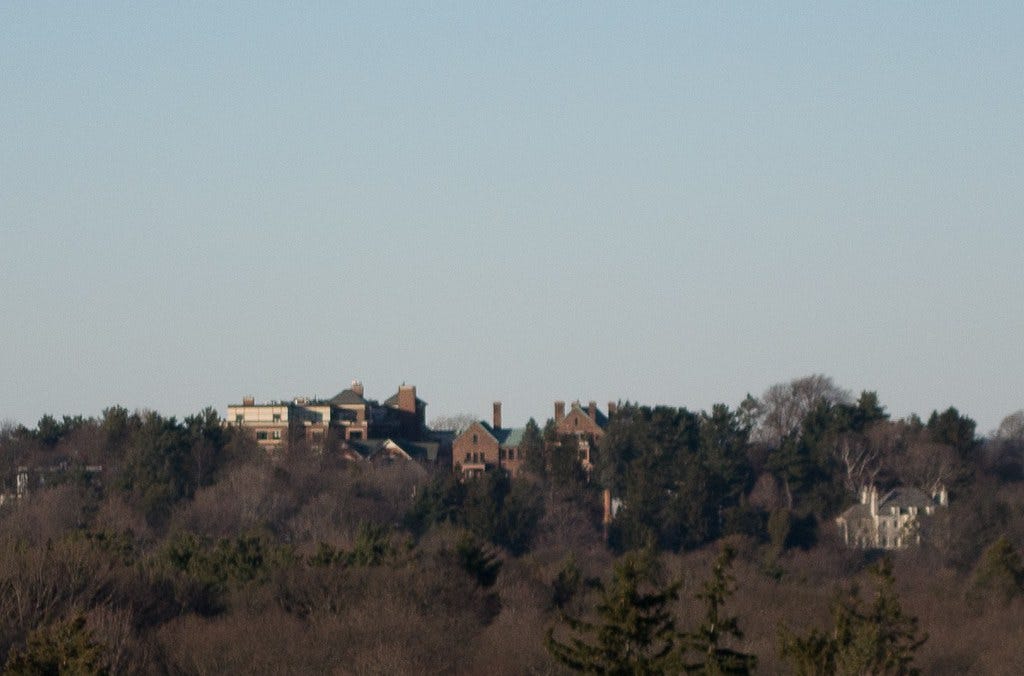
The Brookline staircases crackle with a sense of intrigue any day of the year, but one reason why you might consider taking this circuit hike now is because the bare tree branches make for greater visibility of the surrounding cityscape. The winter views along the hike are less obstructed, and you’ll really start to notice this as you follow the less severe Colbourne Path and Rawson Path into the residential gap between Aspinwall and Fisher Hills. The ascent of Fisher Hill—the tallest of the three hills, at 267 feet above sea level—is more of a gradual, labyrinthine climb up meandering residential roads, where you’ll get to ogle at enviable real estate before reaching Fisher Hill Reservoir Park: a former water supply space transformed into a gusty oasis with a playground, picnic areas, and a charming “wet meadow” boardwalk.
As you complete the descent back toward Corey Hill, you’ll take a brief spin on the only designated path on Fisher Hill—the Beaconsfield Path—through another MBTA station. At one point, a longer stair path existed on Fisher Hill, but it was subsumed by expanding property lines. In fact, property lines were enough of an issue during the construction of the original staircases that Olmsted managed to get himself sacked from the job for not respecting the fiefdoms of adjacent homeowners enough. And when you’re climbing the Brookline stair paths, sneaking glimpses into backyards and kitchen windows, take a minute to think about how remarkable it is that these paths still exist in one of the wealthiest towns in the Commonwealth of Massachusetts.
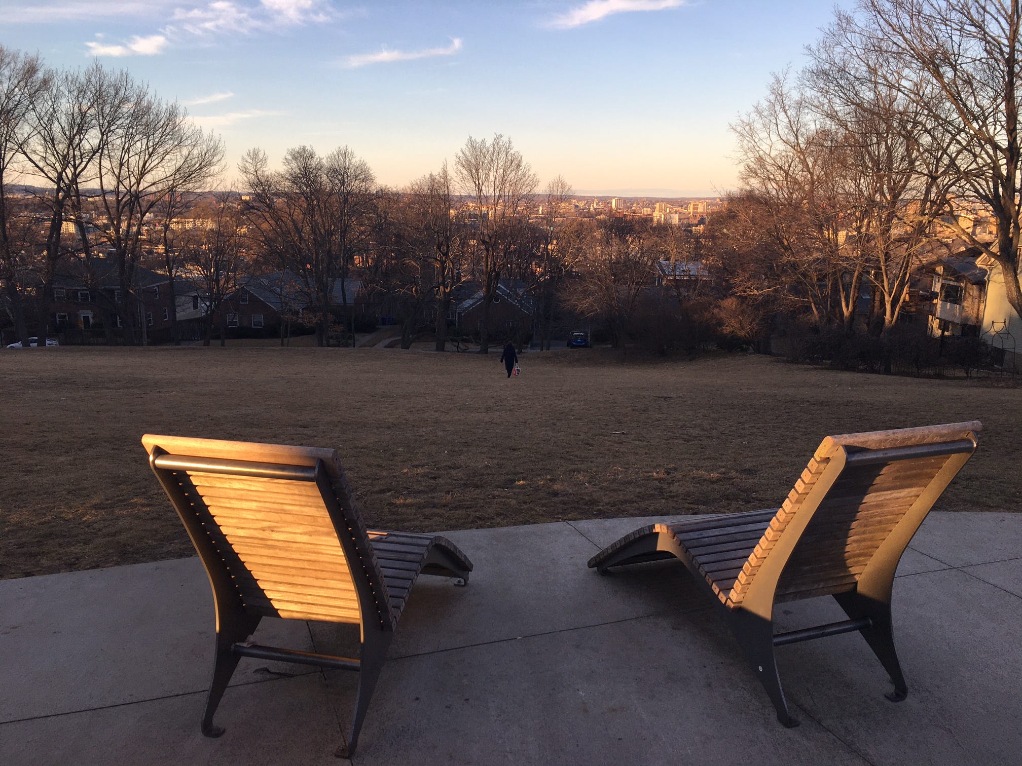
I reckon the survival of Brookline’s secret stairs comes down largely to their charm, but also to their topographic necessity. And as you commence your final ascent up the Summit Path staircases, approaching the summit of Corey Hill, you’ll feel that topography in your legs and lungs. These stair paths remain the most direct way to traverse Brookline’s hills on foot, and there’s something irresistibly humbling about that. But the amenities on top of Corey Hill make your last climb worth the agony. Once you reach the end of the Summit Path, a left turn will deliver you to the hilltop park, where you can take in the view of the Charles and Cambridge from Adirondack chairs and hammocks that some genius saw fit to string between the trees up here.
Maybe I shouldn’t have been surprised by the hammocks. After all, it’s Brookline. An extra heaping of decadence just seems right here. Especially if you take the stairs.
Brookline Secret Stairs Circuit Hike
Hike distance: 4.8 miles loop
Elevation gain: 486 feet
CLICK HERE for a trail map
And here's the audio version of this week's newsletter:
If you’ve enjoyed bumbling around Olmsted’s Emerald Necklace linear park system in Boston and you’d like to pay your respects to the conservancy that maintains those sumptuous parks, I have good news: registration for the 2023 Muddy River Cleanup is now open! The Muddy River is the marshy waterway that ripples from Jamaica Pond to the Charles River. Improving the flow of this once garbage-laden river was the catalyst of the Emerald Necklace project! And the annual cleanup, scheduled for April 22nd at 10am, is a communal effort to keep the Muddy River lush and beautiful. You can register here and you get to choose the section of the Emerald Necklace where you’d like to lend a hand. I’ll be volunteering in the Ward’s Pond area of Olmsted Park. So if you’d like to try and meet up, just send me an email and we’ll plot some plans.
I really feel like this needs to conclude with eating a giant hoagie on top of Corey Hill, but Seven Subs would mean carrying it for 2+ hours and Mamaleh's sandwiches don't seem like they'd travel. Something to meditate on.