

Since hiking San Francisco’s Crosstown Trail and designing the Walking City Trail here in Boston, I’ve become totally obsessed with long urban trails. This idea of stitching park paths and street walks together to create an epic urban hiking route is something that anyone with a grasp of local green spaces and free mapping tools can realize. In June, I had a phone call with Bob Siegel, one of the architects of the Crosstown Trail, and during that conversation, he asked me if I had heard of any other long urban trails worth scoping out. I hadn’t, and not for lack of digging. But the conversation got me fired up and for the last few months, I’ve been chasing down long urban trails like Al Pacino’s Detective Vincent Hanna in HEAT, all-consumed by the hunt for Robert DeNiro and his crew of career thieves. And two weeks ago, I found something in Worcester.
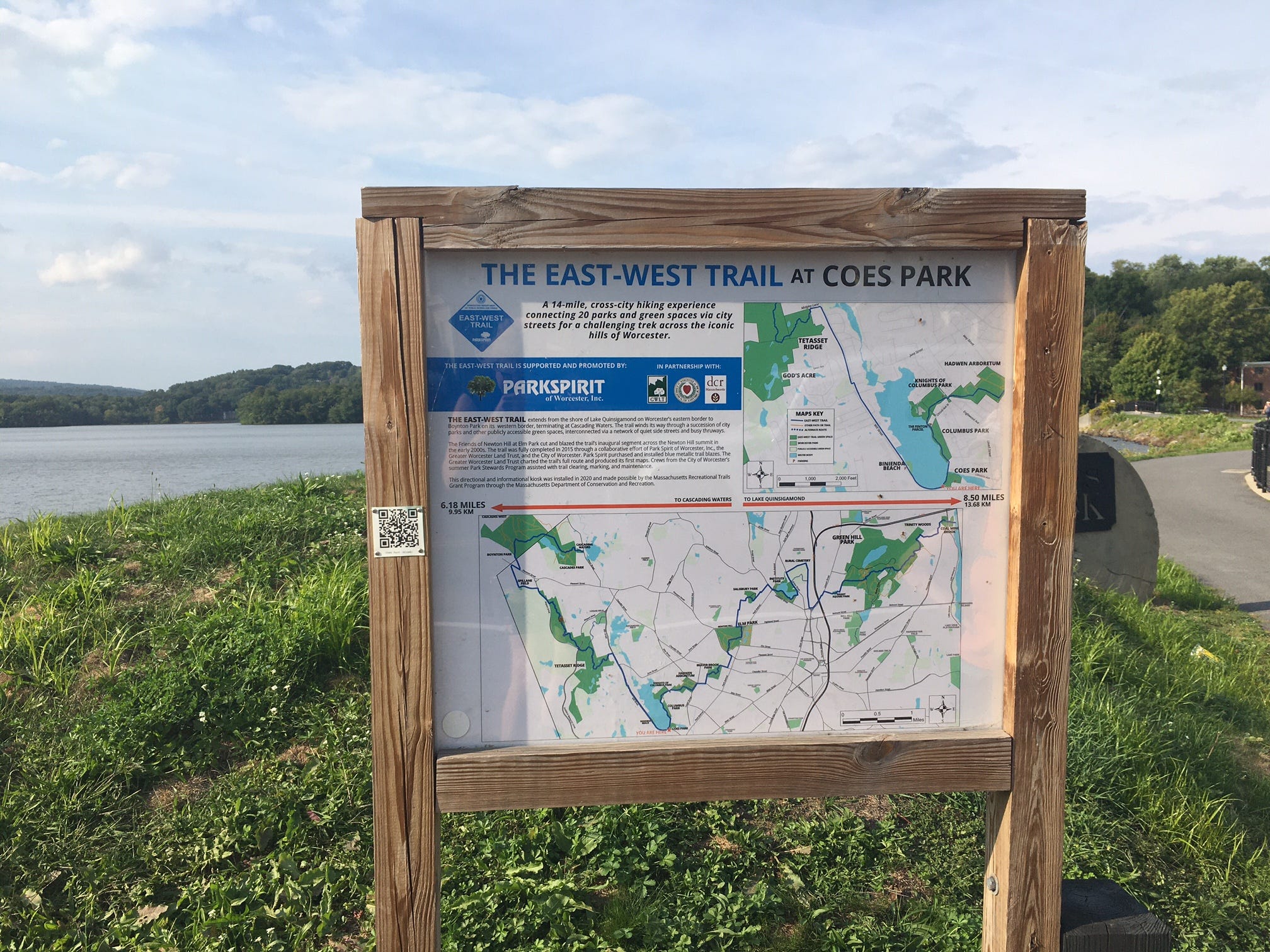
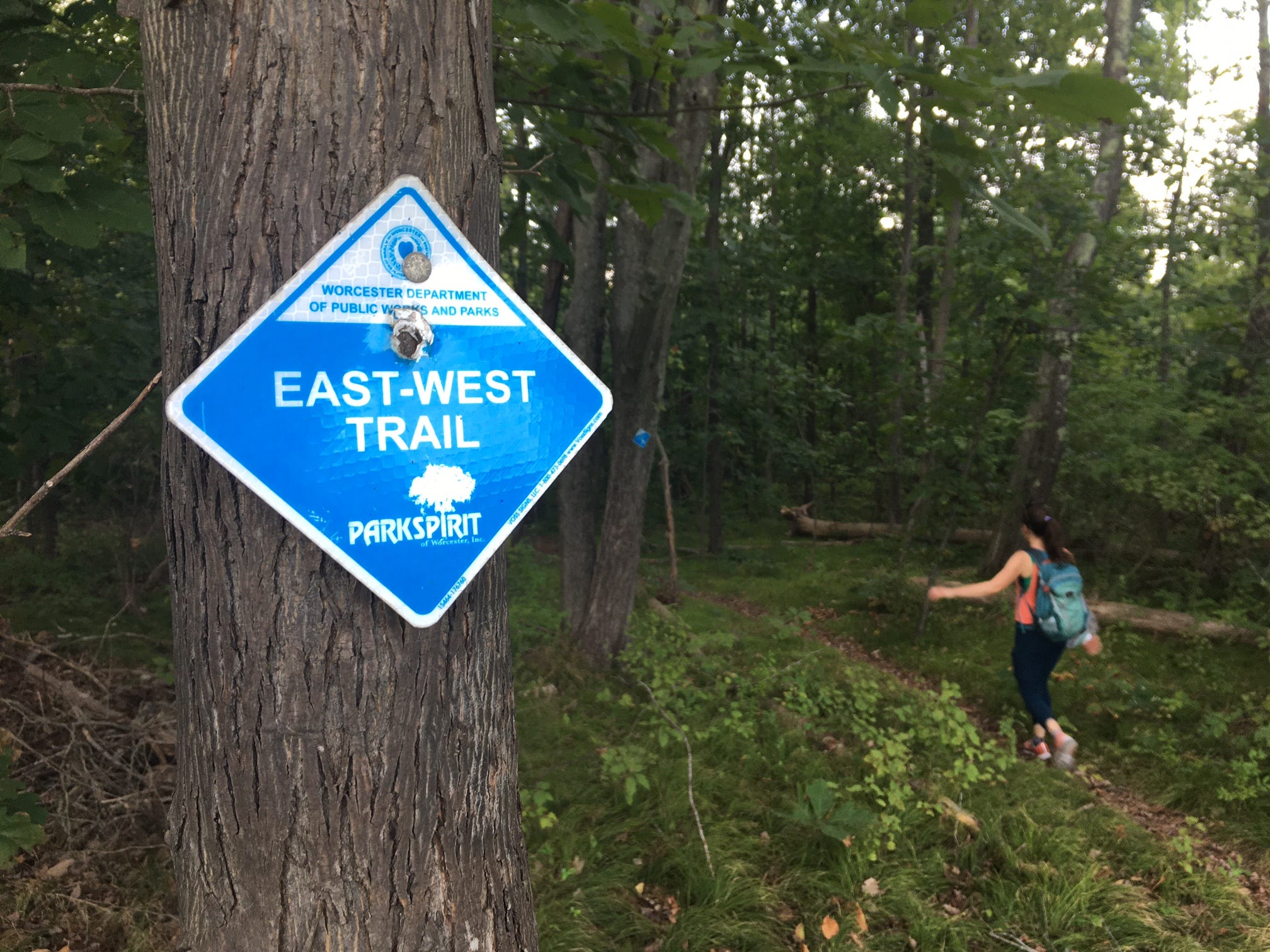
The East-West Trail took root in the early 2000s when Worcester residents Rick Miller and Colin Novick drew up a way to connect roughly 14 miles of Worcester parks and urban woodlands with a singular hiking route. (This already makes the East-West Trail a progenitor for the Crosstown Trail and Walking City Trail.) The two presented their plan to Park Spirit, the nonprofit organization that oversees lots of public greenery in Worcester, and a really cool thing happened. The organization’s board of directors voted to allocate funds to pay for blazing the trail with blue markers! This is the only example of a blazed urban trail that I’m aware of, and in 2015, the City of Worcester tasked one of its summer Park Stewards work crews with installing many of these trail markers along the route. This included attaching markers to utility poles and trees along city streets—a potential nightmare of red rape that the East-West Trail founders managed to skirt. Today, the finished route runs from Lake Quinsigamond on the city’s densely urban east side to The Cascades on its forested western border.
This past Sunday afternoon, my Western Mass-based friend and hiking accomplice Katie and I decided to link up and explore the East-West Trail. We would drive to the city from our respective corners of the state, drop one car in the parking area for The Cascades, drive to the eastern trailhead, and walk the whole thing. However, I should add that it’s possible to hike the East-West Trail using only public transportation! The first step is getting yourself to Worecester’s Union Station via Amtrak or the MBTA’s commuter rail. From there, you can take a Worcester Regional Transit Authority bus to/from both trailheads. (I’ve included public transportation directions at the end of this newsletter, so be sure to scroll all the way to the end if you plan on trying this.)
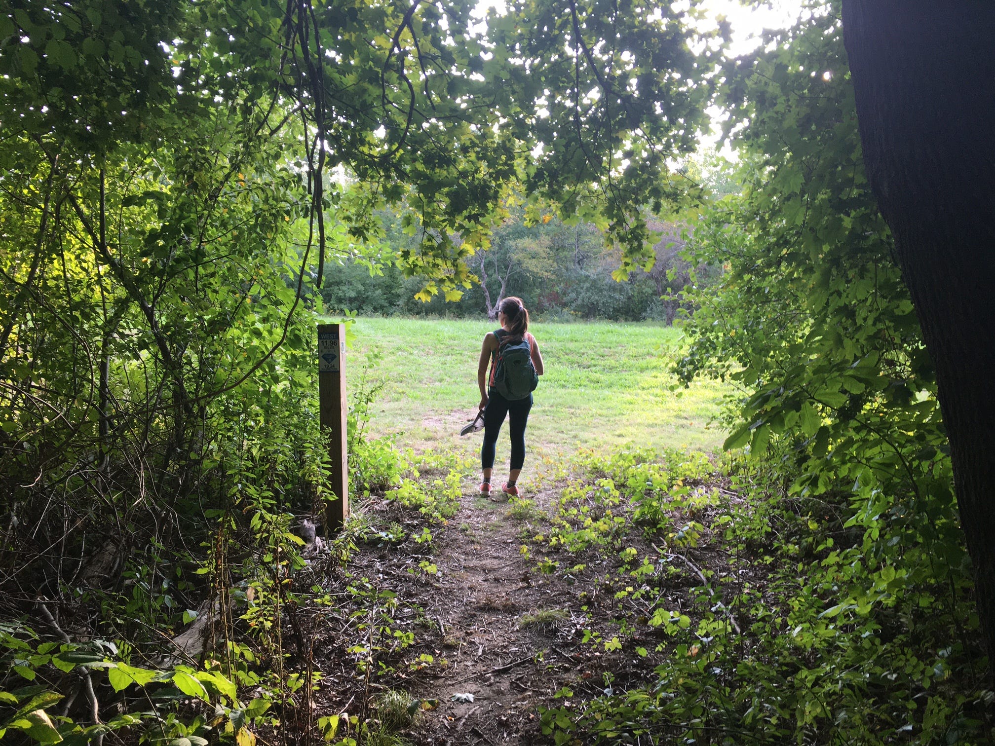
One reason why you might consider public transportation, beyond the usual economic and environmental reasons, is because parking at the East-West Trail’s east trailhead is a bit dodgy. The trailhead is marked by an information kiosk that’s currently turned on its side due to construction in the area—the trail passes through the construction zone—and North Lake Avenue, from which the trail begins, is covered with signs that forbid parking. (The East-West Trail website does include a trail map with parking options.) Unsure but undeterred, Katie and I chose to start our hike at Rural Cemetery, located a few miles from the eastern trailhead. This would mean a “shorter” hike of roughly 10-11 miles…and potentially a return journey to finish the easternmost part.

The layout of the East-West Trail is a reminder that Worcester is literally the nexus between the suburbs and cityscapes of the Boston metro area and the woods and mountains of Western Mass. This is mirrored by the style of the manicured parks on the trail’s eastern segment versus the immersive quality and rustic ambiance of its west side forests. Not long after passing through Rural Cemetery, Katie and I found ourselves strolling beside a reedy pond in Institute Park and sharing the shores with thousands of revelers who had turned out for the Brazilian Festival of Worcester. (In Greater Boston’s metro west cities, there’s a thriving Brazilian-American community.) The aromas of cheese bread and chicken croquettes were tantalizing. There were dancers in sequins, assembled to celebrate 200 years of Brazilian independence.

Ten minutes after leaving the park, the music had faded. Katie and I found ourselves standing before Bancroft Tower, a century-old castle on a hill that was in erected in 1900 in memory of George Bancroft, a former Secretary of the Navy who hailed from Worcester. The next minute, we were ambling down a residential street with a view of nearby Mount Wachusett to reach the edge of Elm Park, a more sculpted green space with ornamental bridges that was designed by Frederick Law Olmsted’s sons. Here, a food truck festival was popping off and once again, we found ourselves traversing the trail and a ketchup-stained crowd at once. In my opinion, these first few miles of the East-West Trail really exemplified the beauty and scenic range of urban hiking. There’s truly no telling what or whom you could bump into when you’re hiking across the city.

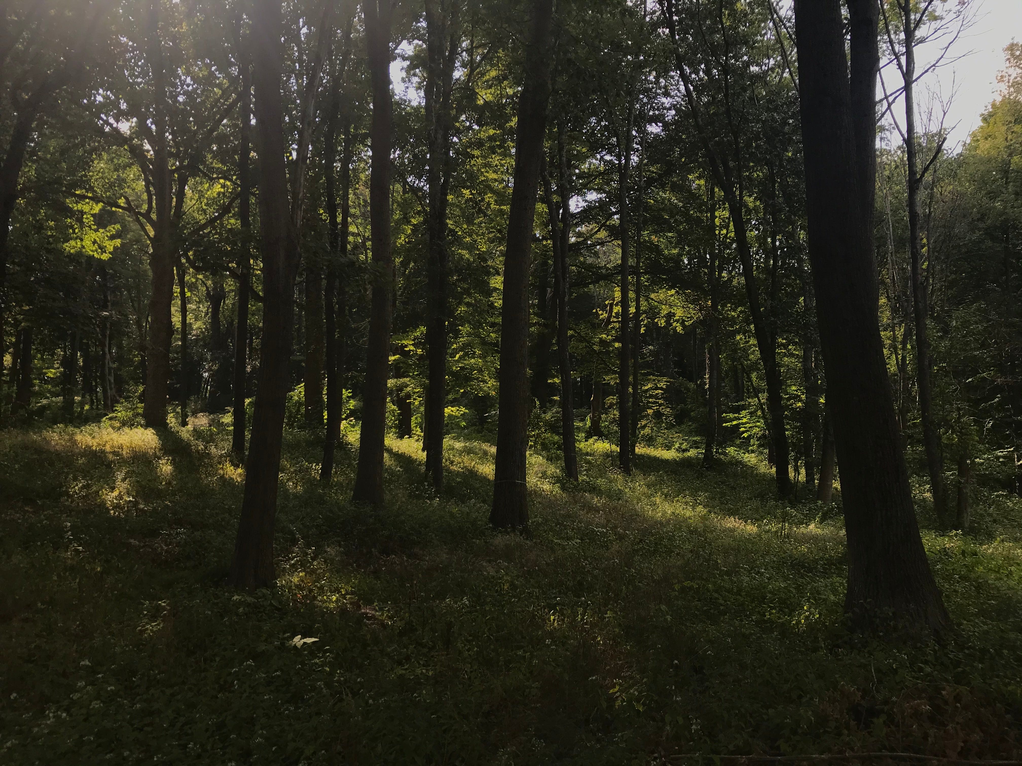
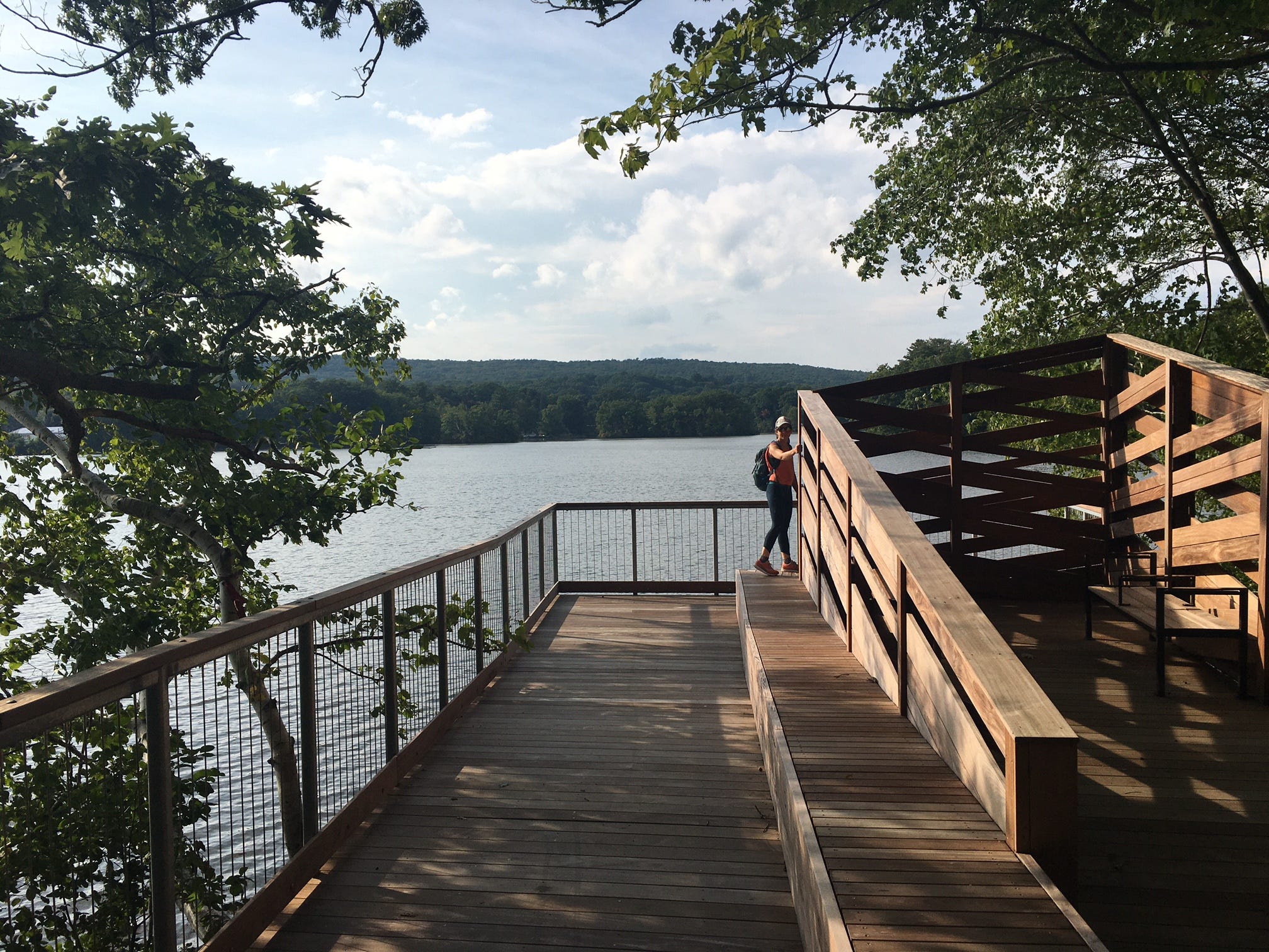
From Elm Park, the trail crosses a series of athletic fields to reach the forlorn-looking entrance of Clark University’s Hadwen Arboretum, a 6.4-acre plot of naturalistic forest that was alive with flowers and vivid understory when we passed through. This verdant nook marks the point at which the “city” elements of the East-West Trail are overtaken by the more rugged landscape Western Mass. A foray through some more residential streets near the arboretum delivers you to the Coes Reservoir Boardwalk, a relatively new feature that allows you to gaze across the calm waters of the reservoir without watching the ground for errant roots. (It’s also a welcome change-up from the usual dirt and pavement.) The magic of the reservoir boardwalk is somewhat disrupted by the longer, louder walk along Mill Street that follows. But this street walk has a fine purpose—to deliver you to the East-West Trail’s incredibly immersive forest finale.
I’m hesitant to get too deep into scenic detail about the trail’s last and almost totally wooded western section, given that some of you might be hiking the trail soon. But I will offer a few observations. First, the trail does some significant climbing through the forest of Tetasset Ridge, gaining several hundred feet in a short distance. (This section really feels like a hike in the classic sense.) As you cross into undeveloped woodlands near the Tatnuck Country Club, you might hear the hum of aircraft from nearby Worcester Regional Airport. But the dense shade trees do an incredible job of soundproofing the forest here. This final stretch of the trail is deeply quiet and from the looks of the greenery engulfing the trail, under-traveled. (Watch out for poison ivy along this section.) Even the road walk sections around here feel more peaceful and spirited away from the city. At one point, I stopped beside a hillside bursting with springy-looking plants to take pictures, only to be informed by Katie—an expert on flora—that I was photographing the super-invasive Japanese knotweed. Oh well.
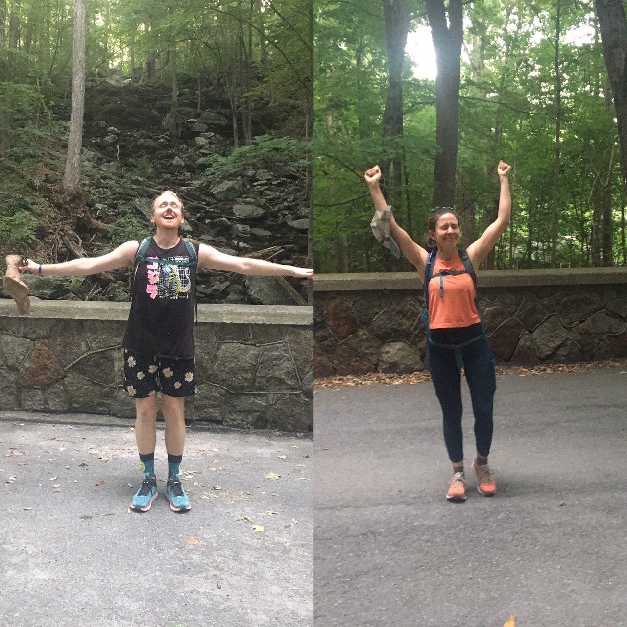
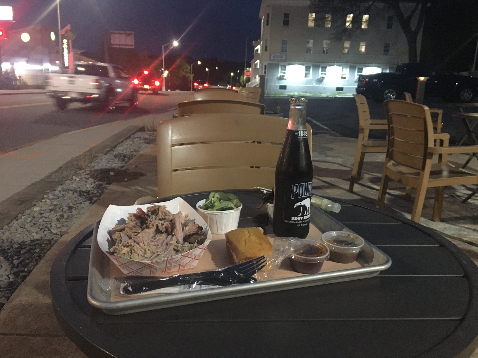
Cascades Park marks the western home stretch of the trail and while the trail does end at the foot of the titular Cascade—which I’ve seen in proper spattering form on prior occasions—Katie and I were shocked to find the whole thing completely dry: a predictable consequence of the drought conditions Massachusetts has endured this summer. Even so, the enormous jumble of parched boulders looked formidable in its own way and the lack of cascading waters didn’t stop us from taking victory pics to commemorate our long hike. That’s the other thing about urban hiking. You have to be creative to recognize the agonies and ecstasies of hiking in a city. The steep climb up Tetasset Ridge was our Mount Katahdin. The parched cascade was our final glimpse of epic wilderness. And the pulled pork platter I refueled with at B.T.’s Fried Chicken and BBQ near dusk was a country-flavored reward for a solid day of urban rambling.
But don’t take my word for it. As Kim Nilsen, the guy who started New Hampshire’s Cohos Trail once told me, “Trail is long, life is short.” Go and hike the East-West Trail.
The East-West Trail
Hike distance: 14 miles
Elevation gain: 1,200-1,300 feet (est)
CLICK HERE for a trail map
PUBLIC TRANSIT CONNECTIONS
- Union Station to/from East-West Trail eastern trailhead: 16 bus
- Union Station to/from East-West Trail western trailhead: 2 bus, 6 bus
- Union Station to/from Rural Cemetary (where Katie and I began our hike): 30 bus
I am so glad you enjoyed the East-West trail! I would love to get a little group here going to do it on a regular basis. All our GWLT properties are stunning, it's so cool to have them integrated into this trail.
I will mention that the Eastern trailhead is definitely a weird spot, but parking there is fine (especially on the weekends). It's possible they have parking restrictions there currently since they are creating a new park - I just haven't looked closely when I've driven by.
The other weird thing is shortly after you begin on the East side, you'll have to cross a very wide Plantation St. with lots of traffic and no crosswalk. I would love for them to add some safe way for hikers to cross. But the walk through Coal Mine Brook is really pretty (saw a giant Blue Heron once!), as is Green Hill Park. Hope you can do it the next time you're here!