


Three decades ago, when I was a wee lad trying to ride my tricycle down the stairs (true story), my family and I spent a year living in Marblehead: a little town nestled into the North Shore of Massachusetts, where the trees meet the sea in a rather dreamy way. One of our favorite local destinations was a wooded trail from the local high school to the water that we referred to as “The Bunny Path.” I’m not quite sure why. Maybe we saw a memorable bunny scampering through the woods on our first hike. Perhaps my scampering along the path brought to mind a bunny. Whatever the case, we logged countless hours on The Bunny Path. Following its contours through the forest to an ocean overlook became as natural for us as going to the post office.
Ideally, any city and town should have at least one trail that holds this kind of potential for residents and visitors alike—a trail that connects a busy area to scenic gems that are nestled throughout town. These are the trails that you revisit way too many times to count: like the episode of The Office in which Dwight almost burns down the office after starting a real fire to raise the stakes of a fire drill he’s conducting. And this year, purely by accident, I happened upon another coastal trail which speaks to a genre of trail that scratches this itch for any municipality. A trail that takes you through mossy wetlands, old growth forests, athletic fields, vast salt marshes, sandy beaches, and and at one point, by the ordering window of an ice cream and fried seafood shack.

The setting is Cape Elizabeth, Maine—a suburban enclave the hugs the edge of South Portland—and the trail is called the Cross Town Trail. (Not to be confused with the San Francisco Crosstown Trail that I’ve written about in this newsletter before.) It’s managed by the Cape Elizabeth Land Trust and it runs 7.8 miles across town, as the name suggets. The northern trailhead is located in Fort Williams Park, steps away from the iconic Portland Head Light, which you might recognize from road tripping guidebooks or prior issues of Yankee Magazine. The southern terminus is the briney expanse of Kettle Cove State Park. As soon as I learned this last part, the trip started coming together in my mind, like the arrangements of a Brian Wilson track. Park near the lighthouse. Pick up the trail. Head south. Jump in the ocean. And then, call an Uber.
While I’ve logged some miles in Portland, my only prior visit to Cape Elizabeth (that I can remember) was a Father’s Day celebration that involved a cold plunge at Kettle Cove, followed by some clam rolls. In other words, I still hadn’t gotten a mouthful of this town. I hadn’t even seen Portland Head Light in person. The idea of a moderate distance trail that offered a tour of Cape Elizabeth’s natural and built environments was just too enticing to turn down. So on a late May weekend, when I had to make a brief visit to Portland for work, I decided to extend my stay by a day and find out what it’s like to traverse Cape Elizabeth on the trail that was designed for just that purpose.

Now, as I mentioned earlier, getting to the Cross Town Trail requires a car. Portland’s public transit network stops short of offering bus service to either of the trailheads. And this leaves two options. You can stage your vehicle at either end of the trail and order a ride from Lyft or Uber to close the gap. Or, if you don’t have your own set of wheels, you can order a ride to the trailhead from which you’ll start, and another once you’ve finished. (Again, Cape Elizabeth is literally next door to Portland, so there are plenty of available drivers.) Not wanting to hog beach parking and being somewhat cheap in these situations, I parked my Honda Fit on the restriction-free Cottage Lane and walked five minutes down Shore Road to the entrance of Fort Williams Park. A breezy clifftop path took me to the base of Portland Head Light, around which visitors were gathered like a bunch of drone bees looking to shoot their shot with the queen.
I wondered if there would be a sign or kiosk by the lighthouse to mark the beginning of the Cross Town Trail. If there was/is, I couldn’t find it. But what I did have was a clear map of the trail route, courtesy of Maine Trail Finder. Just like the Crosstown Trail of San Francisco, the Cape Elizabeth Trail is a constellation of pre-existing trail segments and a few short roadside walks. And it didn’t take me long to find my first visual confirmation that I was, in fact, following a trail. From Portland Head Light, I walked south through a tunnel of flowering shrubs, passing some tennis courts and ending up back at Shore Road. And that’s where I saw it: the first of many blue trail markers nailed to trees, bearing the words “Cross Town Trail” and a little pine stencil.
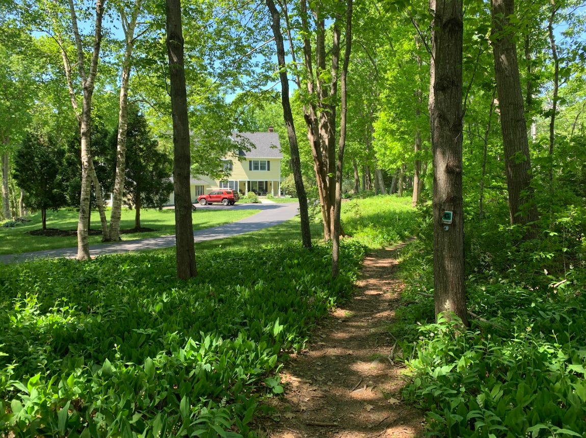
But it wasn’t the marker that excited me as much as where this inaugural segment of the trail went. Or rather, where it didn’t go. The rooty, stony trail disappeared into one of the skinniest segments of forest that I’ve ever seen. On both sides of this slivery woodland were expensive-looking houses and palatial lawns. And yet, here was this pencil-thin forest containing a ragged trail that would take me into the heart of town and beyond, to one of the finest beaches in Southern Maine. So I clomped forward, excited to see what would happen when the forest expanded and these tony houses faded from view. In 10 minutes, I was in a peaty, buzzing green space: a nameless town forest that felt like it could have been located three hours north of Portland.
And then there were the bridges. Just like some of us will go weak in the knees when presented with a mini-golf course with lots of water features, a trail that’s replete with wooden bridges over soggy areas gets me seriously hot and bothered. You’re more likely to find bridge crossings in Maine’s mossier coastal forests, as spongy ground can necessitate building low-profile bridges to mitigate hikers’ impact on the fragile terrain. The woodlands and wetlands visited by the Cross Town Trail contain *many* bridges: most of them belong to the minimalist bog bridge variety. But as I crossed into the Robinson Woods Preserve, I also encountered more elaborate segments of board walk that snaked through ferns and other leafy plants. Some of it was in need of repairs, but for the most part, the walkways were in good shape. And I took this as a reflection of how many people utilize the Cape Elizabeth Cross Town Trail each day. Every five minutes, I would trade nods with a dog walker or a pair of trail runners. It was a Friday morning, midway through the workday and yet, there were people here.

After crossing a metal walkway over the westernmost cove of a long and reedy pond, a dead ringer for one of the water bodies you’d find in Baxter State Park, I realized that I had spent the last 45 minutes walking with the same cup of Aroma Joe’s coffee that I had picked up on my drive to the trailhead. That’s another neat thing about the Cross Town Trail that feels like a Best Practices tip for cross-town trails in general. As wild and sumptuous as the scenery here feels, the terrain along the Cross Town Trail never becomes too unruly. The trail runs across primarily level ground, with short-lived dips and rises, and a manageable amount of trip hazards. And this makes it much easier to hike the trail in a manner that doesn’t feel like hiking with a capital H. Picture it. You have your trekking pole in one hand (for added stability) and a corn dog in the other, for the sheer pleasure of it. For a lot of people, this could be the gateway to hiking.
Roughly midway through the Cross Town Trail trek, you pop out from the green inferno into the center of Cape Elizabeth, passing the town hall and a small strip mall. Here, I bought a bag of thick-cut Irish potato chips at a grocery store, before pressing on and reaching the athletic fields of the local junior high school. Suburban trails often pass through schoolyards, and while that can make it a little awkward to trek across them, as a lone adult hiker, the likely rationale for having a trail run past schools is a good one: it’s the idea that trails are community resources that should be connected to the places where people are mostly to assemble…and discover the trail(s). And schools, with their playgrounds, tracks, and football greens, are reliable human activity hubs. While the kids were mostly in class during the hour of my arrival, there were still a handful of people jogging and doing pushups on the athletic greens. I ambled by a wooden dugout, the backside of which was plastered with big posters of the local varsity baseball team: the Cape Elizabeth High School Capers. How perfect is that?

And yet, this communion with the business end of Cape Elizabeth is short-lived. No sooner had I crossed the fields when I found myself in the most romantically rustic portion of the trail yet: an expansive range of conserved marshlands, with blooming bushes and the longest boardwalk stretch yet. From here, it was Kettle Cove or bust! The swoonable sights kept on coming. The wetlands got greener as I entered a parcel of woods near Great Pond, which more than lived up to its moniker when I finally got to gaze across its waters from a modest clifftop. Not far from here, I encountered another long and super-skinny segment of preserved forest in an area that contained houses and roads. And this sliver of woods led me to the parking lot for Kettle Cove Creamery & Cafe, where I watched legions of sunburnt people licking their ice cream cones, in the same way that you’d observe a beaver contentedly chewing on a stick.
Tempting as it was to throw in the towel here and buy an electric-green mint chocolate chip cone, I had one last trail section left: a winding stroll down Kettle Cove Road, to the beach and its shockingly refreshing waves. After that last elemental immersion, I would find a place that offered greasy paper bags of fried shrimp and celebrate my journey. But as I ambled by some rosa rugosa plants toward the water, the elation I felt wasn’t just the thrill of finishing a big hike: it was the sense of possibility that the Cross Town Trail presented, in full color detail. Before setting off on this hike, I liked the idea of every town or city having some kind of trail that inspires repeat visits. Now, the idea was sharpened. What if every town or city had its own Cross Town Trail?

The Cape Elizabeth Cross Town Trail offers a stunning showcase of what this concept can look like in a suburban environment, just like the San Francisco edition offers the same for the cityscape. And from the looks of it, a handful of other municipalities in New England have answered the call. There’s the Cross Town Trail of Wellesley, MA, the Crosstown Trails network in Dover, VT, and—half an hour west of Portland—the town of Gorham, Maine appears to have its own Cross Town Trail as well. Have you stumbled upon any others in the region? Have you harbored dreams of building one?
If so, I’d like to hear from you. And ideally, one day, I’d like to hike across your town.
The Cape Elizabeth Cross Town Trail
Trail distance: 7.8 miles point-to-point
Elevation gain: 302 feet
CLICK HERE for the Maine Trail Finder map and information page
CLICK HERE for an AllTrails map that I designed

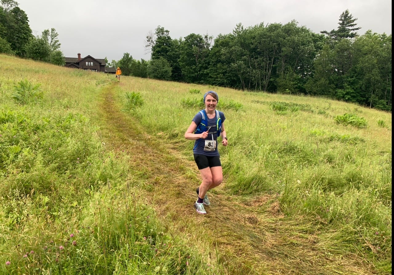
Speaking of traversing forests, congratulations to all who finished the Catamount 50K and 25K trail-running races in Stowe, Vermont last weekend! I was up there watching my sister and cousins (Julia Howard, Jenny James, and Al James) run the lush yet prodigiously hilly course. And it left me seriously interested in giving an entry-level trail race a try. I’ve been feeling the need for something that I can physically train for: something that’s not as dangerous or expensive as a mountaineering expedition, but still formidable enough to royally kick your ass if you don’t do your strength training homework. Ideally, I’d love to find a trail race with trails that aren’t super rocky and rooty, like so many of New Engand’s hiking trails are. (The Catamount course was heavy on grass.) I would appreciate any suggestions! Hell, maybe I’ll see you there.
Also, get this: I’ve written about unorthodox hiking snacks and how one of my favorite overlooked options is canned or boxed soup. But as it turns out, I neglected to include an important caveat. Don’t dump your leftover broth on the trail. The Korea Times just ran a fascinating story about the impact that high-sodium soup broth can have on the vegetation you’ll find on a mountain. Why? Because a lot of the hikers who visit Jeju Island’s Mount Hallasan have brought instant ramen noodle cups for and disposed of their unwanted broth on the mountain terrain. Not only can salty liquids kill plants, but it can also seep into waterways and pose problems for aquatic wildlife! So if you’re planning to feast on instant noodles during your hike, guzzle down every last drop of that broth. Hikers need extra sodium anyway, which is one of the reasons why I hike.
Do appreciate a good bridge and that latter part of the hike does sound dreamy. Thanks for the ultra shoutout!