

Most waterfalls in New England tend to have names that bring to mind enigmatic figures or events. LIke “Mother Walker Falls” in Maine’s Grafton Notch State Park. Who was she? Or “Little Hellgate Falls” at the tip-top of New Hampshire? What happened there? But in the woods just outside of North Conway, there’s a timeless and widely-beloved set of cascades whose moniker evokes the scenes of a John Waterhouse painting and the guitar chords of an early 1990s dreampop record.
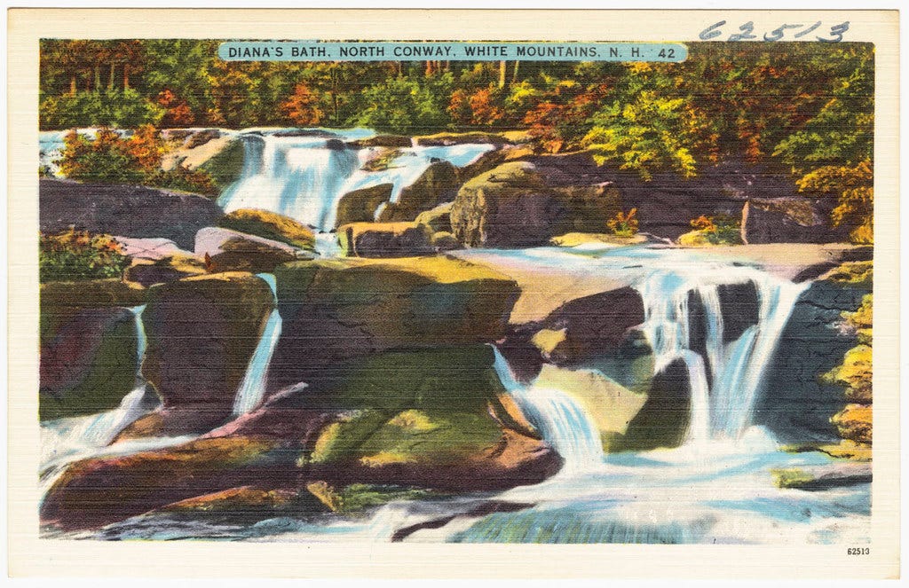
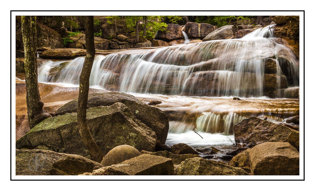
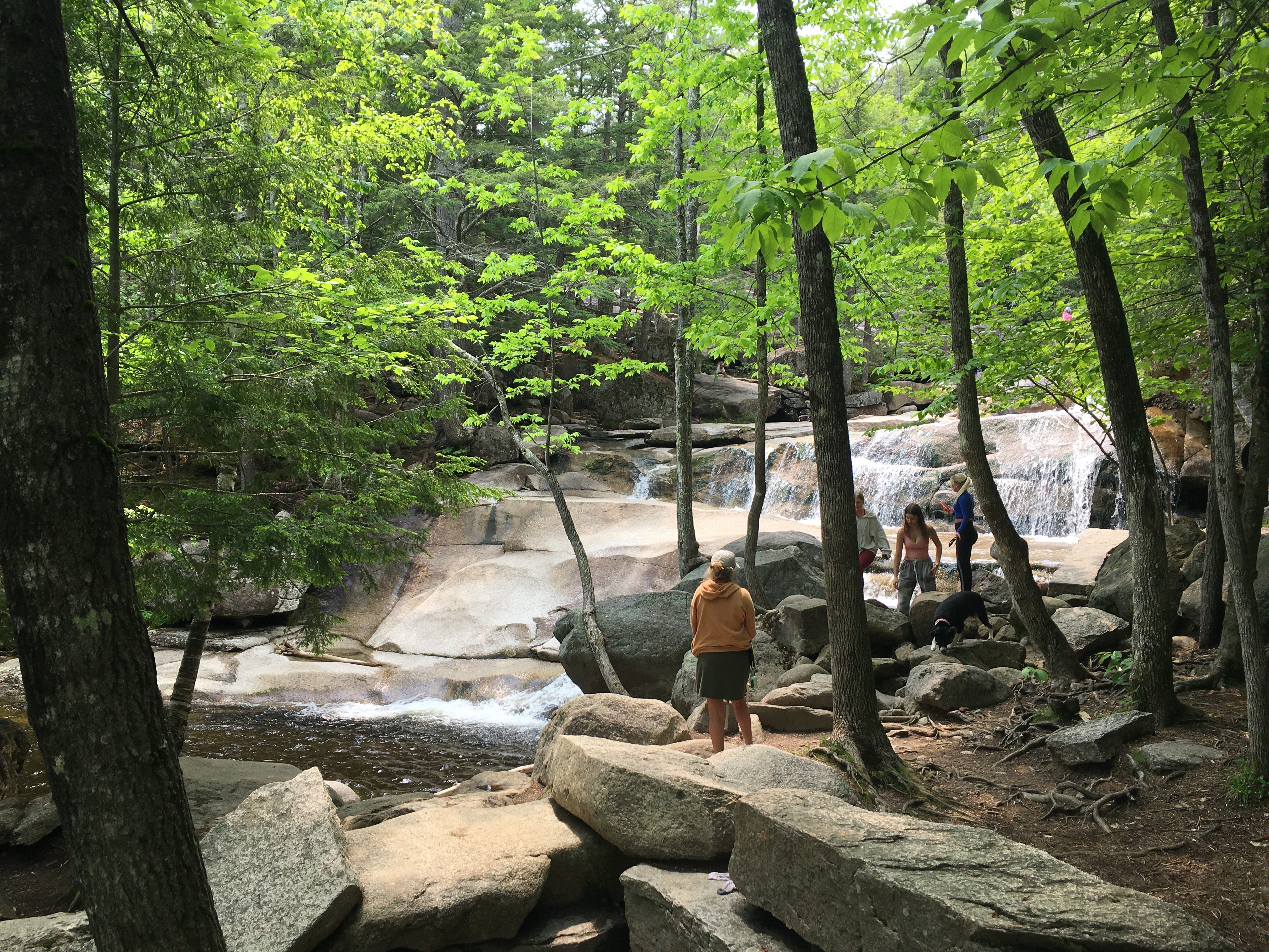
I’m talking about Diana’s Baths. Imagine a collection of naturally-formed whirlpools, fed by waterfalls that would look right at home in a billionaire’s private grotto, and you’ll have the gist of what draws so many visitors to this ethereal place. (The name was coined by the former land owner, as an allusion to Diana the Roman goddess of nature.) But there’s a dark side to the baths. Over the last decade, visitor demand for access to Diana’s Baths has outgrown the size of the parking lot for the short access trail. And parking is not allowed on the shoulders of West Side Road, where the lot is located. This means that almost every day, each summer, there’s a long line of idling cars on the road, waiting to get into the parking lot—a contender for one of the most depressing sights in the White Mountains. Inhaling exhaust while waiting for a swim.
Normally, this is where I would encourage you to check out some of the other lovely swimming holes in the White Mountains, such as Jackson Falls or Sawyer Pond. But everyone with a soft spot for northern New England should be able to step into the bone-chilling waters of Diana’s Baths at least once, and lucky for you, I’ve decided to dedicate this week’s newsletter to an alternative “back door” method of accessing these magical cascades! It requires a robust hike, but on top of gaining access to Diana’s Baths, you’ll also be rewarded with a stellar vista of North Conway, and a peaceful walk on a country road, along which you’ll see big cows and distant peaks.

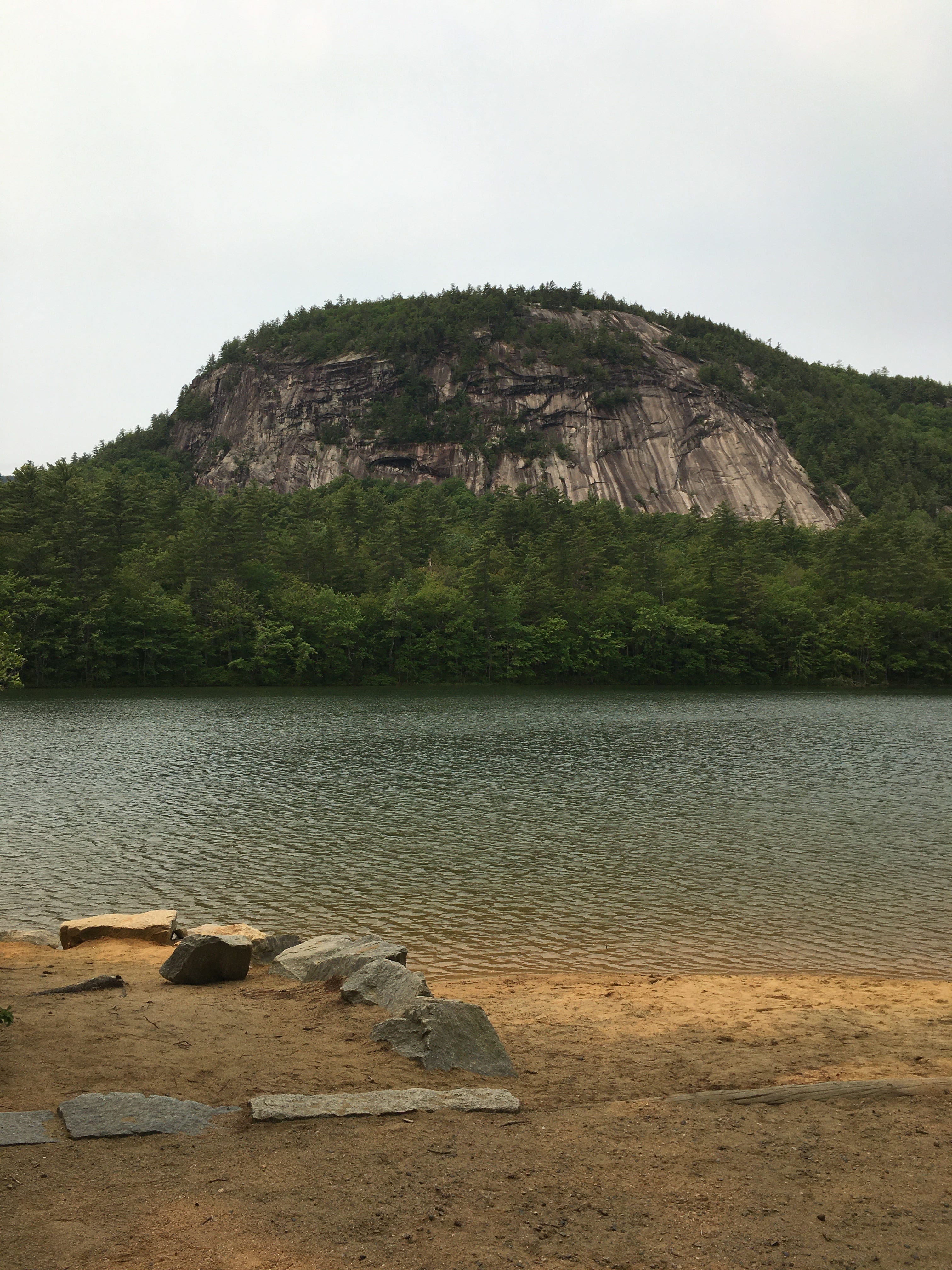
As you can see on this map, Diana’s Baths are located next to two high points on the west side of North Conway—Cathedral Ledge and Whitehorse Ledge. The massive, exposed cliff faces of these ledges are routinely speckled with rock climbers in the summer. But you can also hike to the top of each one, thanks to the trails located at Echo Lake State Park. Located at the foot of the cliffs, Echo Lake is another blue ribbon swimming hole that attracts droves of visitors during the most infernal months of the year. But here’s the neat thing. For a very reasonable $4.00 day use fee, you can show up and park in the large Echo Lake lot for the entire day (plan to get there before 9am to avoid a line) or you can make a parking reservation via the NH State Parks website. This allows you to get a foothold in the vicinity of Diana’s Baths. And once you’ve made it into Echo Lake State Park, you can begin your odyssey to the baths…
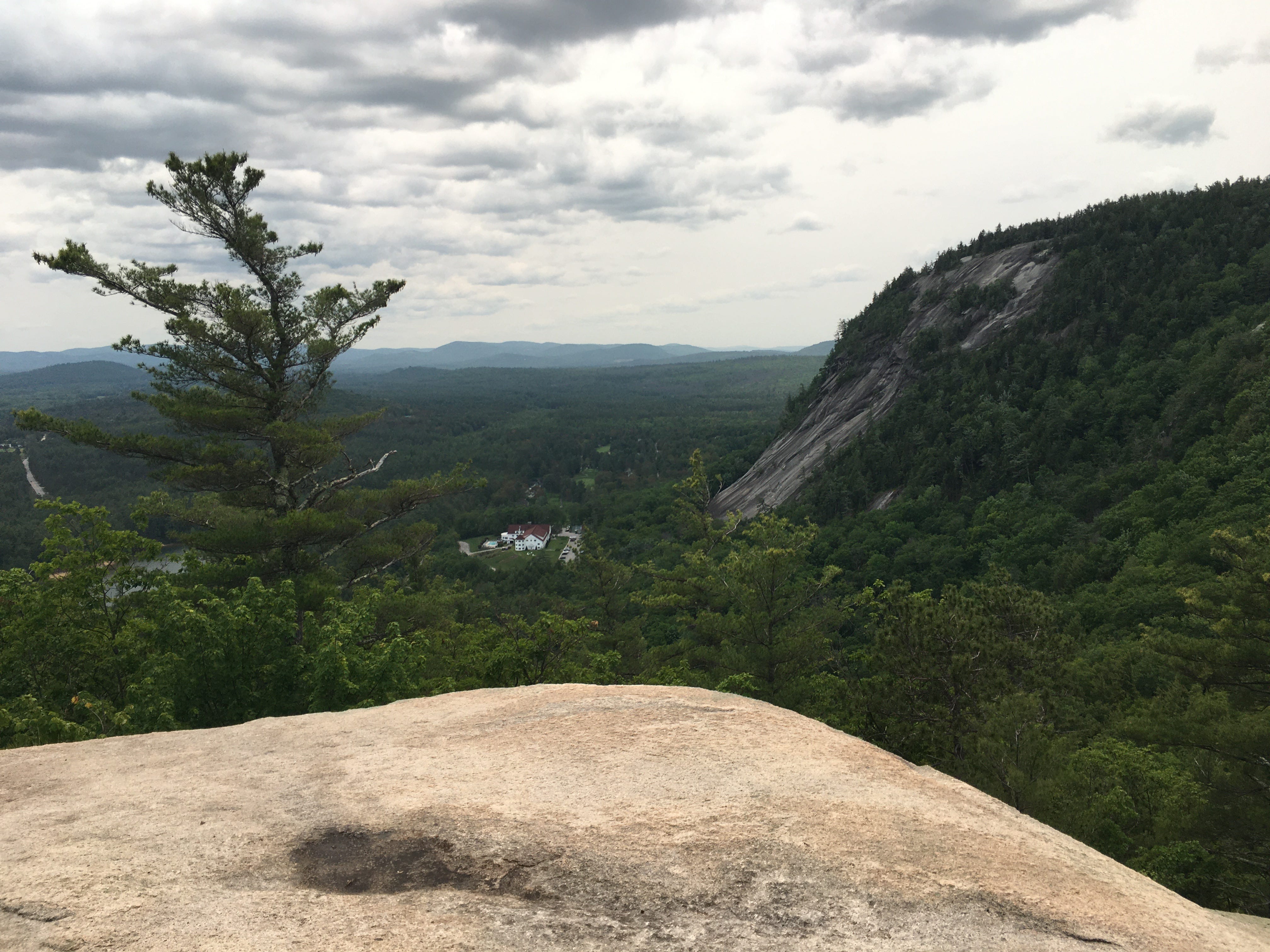
The trick to sneaking through the “bathroom window” is climbing over the ridge that separates Echo Lake and Diana’s Baths. You’ll follow the gentle lakeside trail to the junction for the Bryce Path. (Don’t worry: I’ve sketched all of this out on the trail map at the end of the newsletter.) After passing the rusted ruins of a jalopy in the woods—which feels like a metaphor for what happens when you wait in the line of cars for Diana’s Baths—the Bryce Path climbs right up the steep slope between Cathedral and Whitehorse Ledges, at the sort of angle that blindsides visitors from Colorado and other states where graded switchbacks are a thing. Thankfully it’s a short-lived climb, as the birch trees open up to reveal partial views of the valley. The trail levels out into mossier woods and makes one last push to the top of Cathedral Ledge—one of the only destinations in New Hampshire where, on any given day, you’re equally likely to find couples getting their engagement photos taken and kids terrorizing their parents.
From here, your approach to Diana’s Baths becomes less cardio-forward and more exploratory in nature, as you follow the Cathedral Ledge summit access road down into the woods. Look for a green sign on a tree on your left, and an access gate. This is the point where you’ll dart back into the woods, following a partially overgrown dirt road. It gets somewhat muddy in spots, but remember: you’re heading for a place where you can wash away all the literal and spiritual mud that’s clinging to your boots, calves, you name it. As the old road takes you deeper into the deciduous forest, it’s hard to shake the feeling that you’re wandering through a long-forgotten environment.
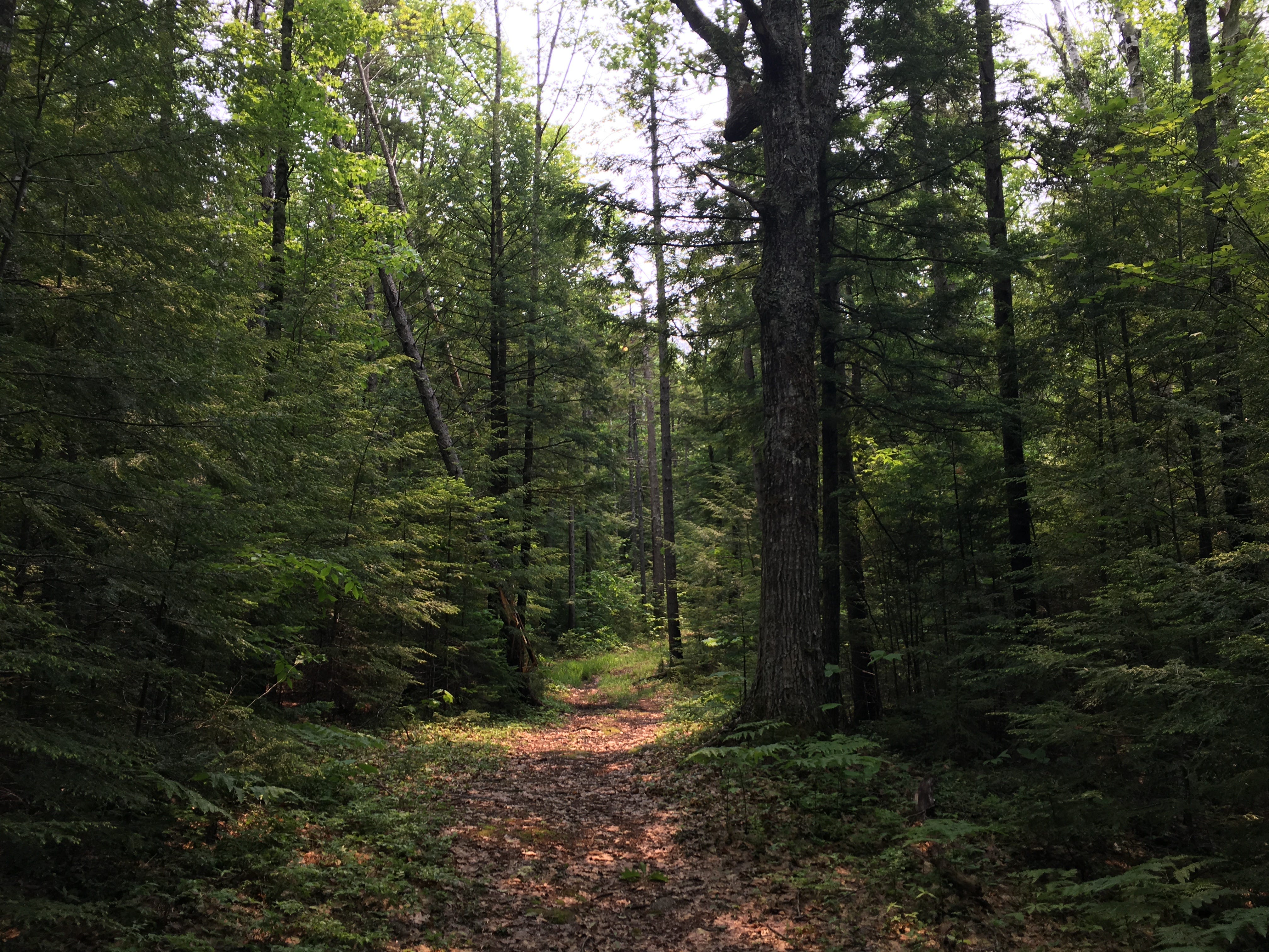
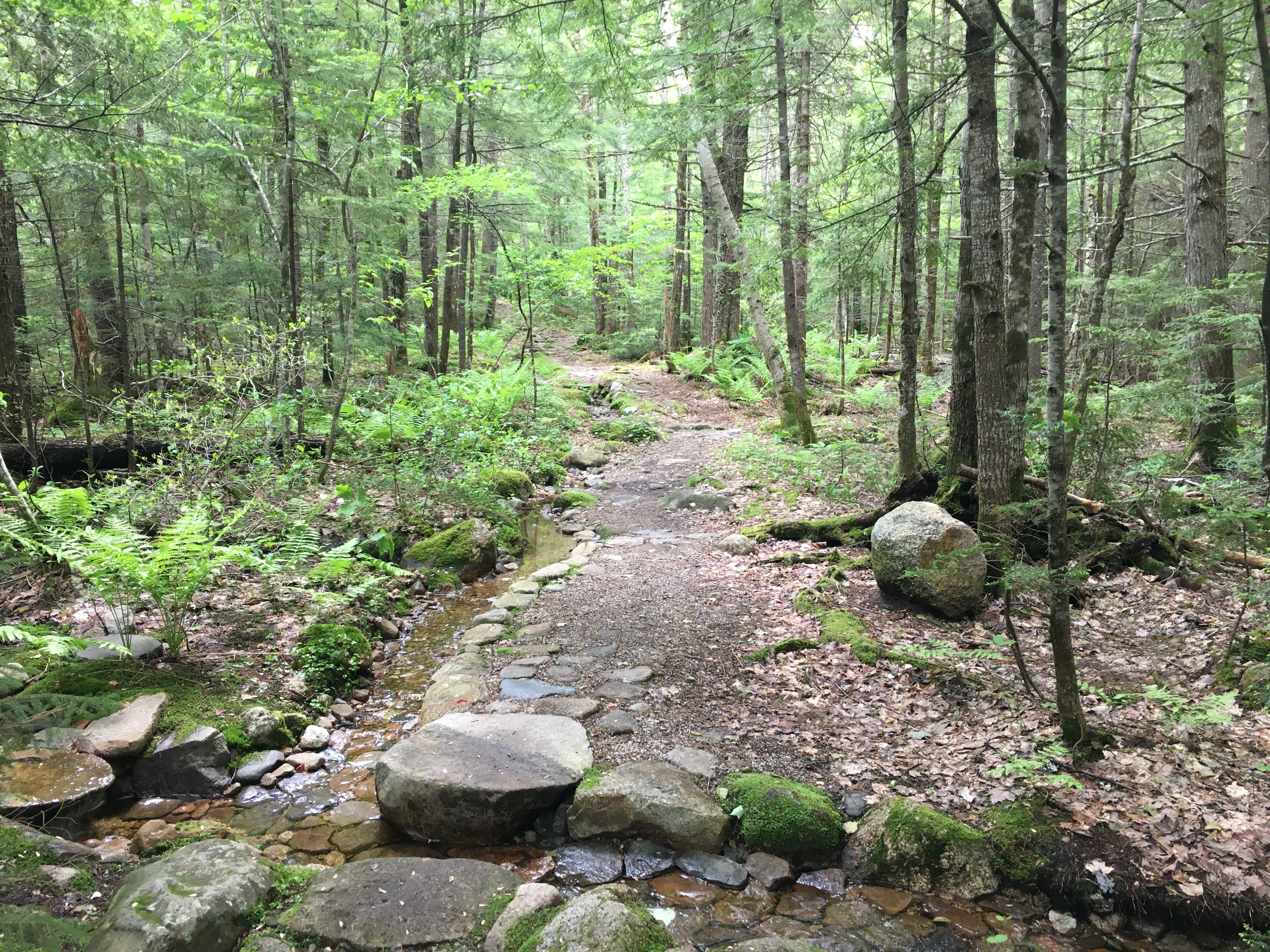
But then, as you reach two stone cairns on your right, something funny happens. The cairns are the gateway to an unsigned path that branches off from the road, and as you follow this pathway downhill toward Lucy Brook—the source of Diana’s Baths—the standard potpourri of roots and rocks smoothens into a terrace-like surface, where trailbuilders laid stones to create an elegant walkway that feels like something from The White Lotus. You have to wonder if the people who created this trail (apparently it’s called the “Red Ridge Trail”) anticipated that hikers would use it to reach Diana’s Baths. Between the aesthetic of the path, the nearby shoosh of Lucy Brook and the ravenous black flies that I found myself slapping at, I was ready for a long, icy soak.
After rock-hopping across Lucy Brook, you’ll turn right on the Moat Mountain Trail and follow the waterway as it ripples through the forest toward the sounds of voices, laughter, and splashing. If you’ve never experienced the self-satisfaction of arriving at a superlative outdoor destination by an unconventional route, I highly recommend this final approach to Diana’s Baths. You’ll pop out of the woods right next to the falls with a sweat-stained shirt, dirt on your socks, a day pack slung over your shoulder, trekking pole in-hand, and as much of a right to bask in the baths as those who locked horns for parking spots at the main access trail. But you’ll feel like you’ve robbed a bank.
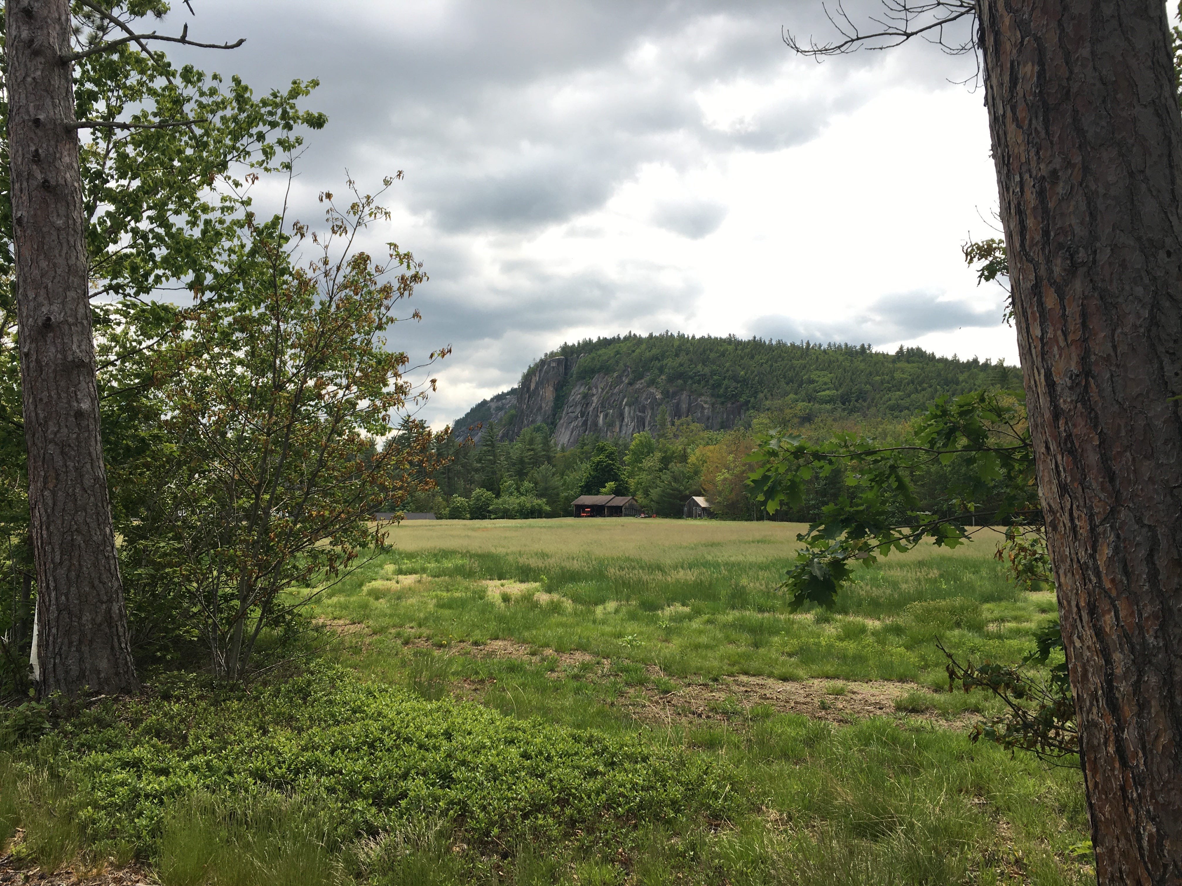
Rather than backtracking up and over Cathedral Ledge again (and then descending the steep Bryce Trail), the more pleasant way to return from Diana’s Baths to Echo Lake involves taking the access trail to the parking lot for Diana’s Baths, walking past all the cars lined up for spots, and then following West Side Road back to the state park. There’s a bathroom at the parking lot, if you’d like to change out of your wet bathing suit for the bulk of the return journey, and the shoulder of West Side Road is nice and spacious. What begins as a walk through a hall of hemlocks opens up into a sunnier road walk through the Saco River Valley. At one point, you’ll pass a farm with some enviable bovines and two dogs who might go into Woof Mode when they see you coming. (They’re penned in with one of those invisible electric dog fences—the farm owner was outside when I passed and she told me this.) And in the distance, you’ll see North Conway-adjacent peaks like Black Cap and Kearsarge looming proudly.
When you make it back to the sandy shores of Echo Like, you might as well indulge yourself with a second swim—in the same way that having a second breakfast is the way Hobbits live. I’m a firm believer that hiking should be fun and decadent whenever possible, and swimming hole hikes are the epitome of summer succulence. Hell, you might even show up at Echo Lake State Park and decide that you’re perfectly content with bathing beneath the granite expanse of Cathedral and Whitehorse Ledges. More power to you for being content with what’s right in front of you! But take it from a long time White Mountain rambler—once you’ve seen and waded into Diana’s Baths, those falls will be whooshing through your memories for years to come. Just like the guitar layers of this old Slowdive song, which is essentially what my first bath there felt like.
Diana’s Baths via Cathedral Ledge
Hike distance: 6.4 miles loop
Elevation gain: 801 feet
CLICK HERE for a trail map
Those of you who’ve followed the growth of the Walking City Trail here in Boston will probably be excited to learn that on June 24th, a long-brewing trail project is going to kick off. We will be installing the first round of homemade trail signs along Section 1 of the trail, from Mattapan to Roslindale Village! The remaining three sections of the trail will be marked with signs in the weeks ahead. It’s taken a lot of research to reach this juncture, and I couldn’t be more stoked about the upcoming installation.
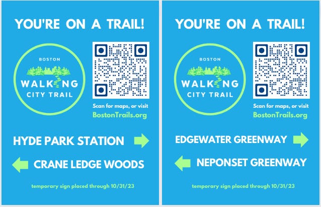
We’ll see how long the City of Boston allows these signs to stay up (getting official permission to do this would have taken months, if not years) but I’m confident that the signposting locations we’ve chosen will strike the right balance of high pedestrian activity and modest odds of detection by municipal workers. You can stay in the loop about this trail project and others by going to BostonTrails.org and signing up for the WCT newsletter (at the bottom of the home page.) And while I’m plugging the WCT website, I’ll throw this out there too. I’m currently running a micro fundraiser to recoup the Walking City Trail’s Year 2 project expenses: website hosting, DIY sign-making materials, etc. If you’d like to help me cover these out-of-pocket costs, I’d be very grateful for your support. You can make a donation to the trail by CLICKING HERE.