

This past weekend, my dad and I went for a spring hike on Mount Tom (the weirdest mountain in Massachusetts) and the forest canopy looked like one big rolling moss colony. Every shade of green was represented. The sight of the surrounding woods looking so lush and verdant made you want to leap off the nearest cliff, Crouching Tiger Hidden Dragon Style, and allow the pillowy canopy to catch you. Or I suppose you could just walk through the greenery, appreciating its fullness and vast scale.
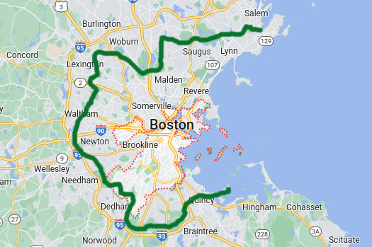
Massachusetts is a well-endowed state when it comes to greenery, and the Greater Boston Area is no exception, with over 20,000 acres of park lands in 37 communities. Several of you have no doubt wandered through some of these beloved green spaces, such as the Middlesex Fells or the Neponset River Reservation. But what if you could embark on a 90-mile thru-hike or section hike across these green spaces, starting on the north shore in Marblehead, tracing a C-shaped ring around Boston across woods, wetlands, and suburban streets, and finishing your journey on the sea again in Quincy?
That’s the alluring hook of the Boston Greenbelt Trail—a trail concept that could one day become a signed and transit-accessible circuit hike for the Greater Boston Area.
The idea for the Boston Greenbelt Trail is the brainchild of David Loutzenheiser, a Cambridge-based transportation planner for the Metropolitan Area Planning Council, whose work has included comprehensively mapping trails throughout the region. I first met Loutzenheiser last November out at the MassTrails conference in Fitchburg, where I was giving a talk about the Walking City Trail and the concept of “instant urban trails.” Right now he’s working on a really cool initiative to establish community-approved biking and walking routes from Mattapan to the Blue Hills Reservation. And during a call about this, David told me about the genesis of the Boston Greenbelt Trail.
”A little over 10 years ago, I learned about this group called FreeWalkers, and they do long distance hikes through urban areas,” Loutzenheiser said. “I joined them on a 50 mile walk through New Jersey—along the East Coast Greenway—and we ended up in Hoboken.” After returning to Greater Boston, Loutzenheiser started thinking about the public green spaces and conservation lands around Boston that he had mapped and run, but in a more contiguous way. What if you could connect them into one gigantic metro area hike? The question yielded a trail route map and soon after, a couple of “trial balloon” community hikes along a lengthy section of the trail. “We got people together, with the option to do as much or as little of the Greenbelt Trail route as they wanted, and we went from Malden to Newton, which is about 31 miles,” Loutzenheiser said. “And the following year, we hiked the same route from the opposite direction.”

Whether or not the Boston Greenbelt Trail becomes a more official trail in the future is contingent on people embracing and promoting the concept. Speaking from personal experience, the sense of possibility for a trail becomes much more tangible and vivid when you actually hike a section of that proposed trail. So I was pleasantly surprised to find an AllTrails map of the 31-mile section hike that Loutzenheiser and his peers took. The hike runs from the Oak Grove MBTA station in Malden to the Waban MBTA station in Newton, passing through forests and bogs. When I realized that the trail literally goes past my parents’ house in Winchester, a plan materialized. I would take the train from Boston out to Winchester early in the morning, have breakfast with my folks, and I’d hike the Greenbelt Trail from their street to Lexington. Around 10 miles.
(It’s possible to design a shorter section hike along this hefty portion of the Greenbelt Trail, thanks to the availability of MBTA buses and trains along the way. And at the end of the newsletter, you’ll see a few suggestions for alternative Greenbelt section hikes.)
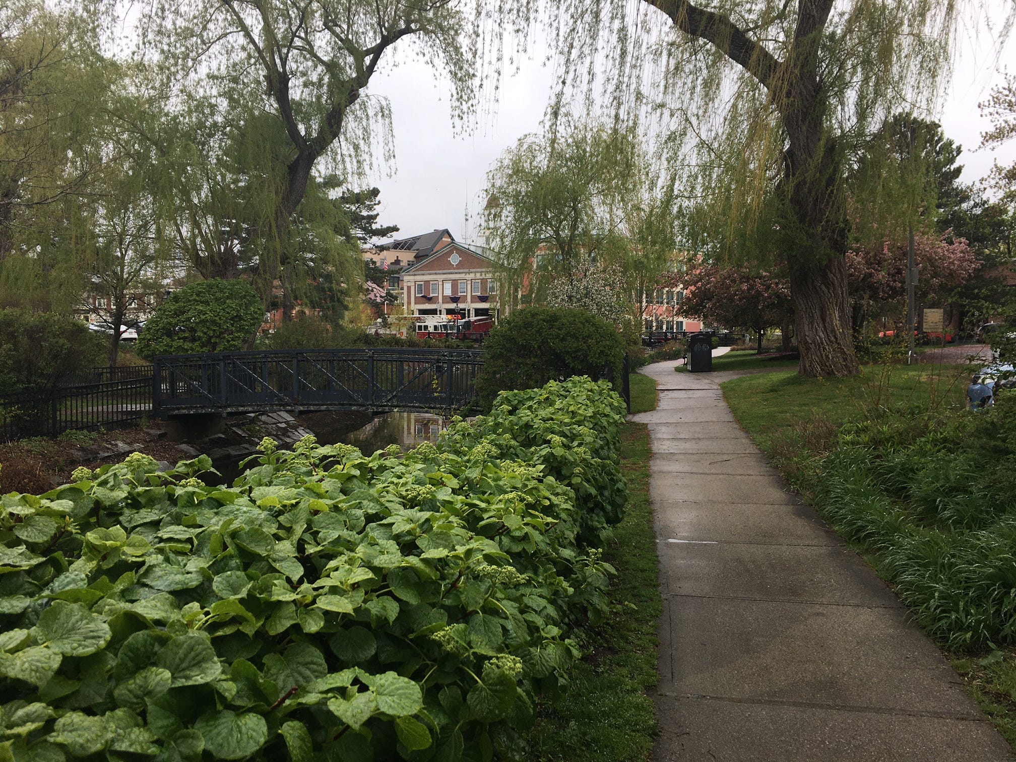
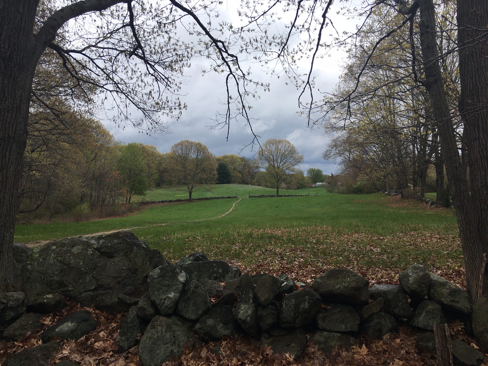
The weather forecast called for intermittent showers, which I didn’t mind because a spring drizzle can sometimes amplify the aromas of spring. After housing several syrupy waffles at my parents’ place, I started my Boston Greenbelt foray by strolling into downtown Winchester, past my high school and the Stop & Shop where I once got in trouble for bagging a few vulnerable cartons of blueberries beneath several heavy cans. The Winchester segment of the Greenbelt is a sidewalk-heavy link between the Middlesex Fells and the next array of green spaces: the Horn Pond Brook greenway, Horn Pond Mountain, and Horn Pond itself. Allegedly the mountain can become a haunt for teenage vice after dark, which seems fine. Every municipality should have a mountain where you can smoke some weed, make out, or tag some old infrastructure.
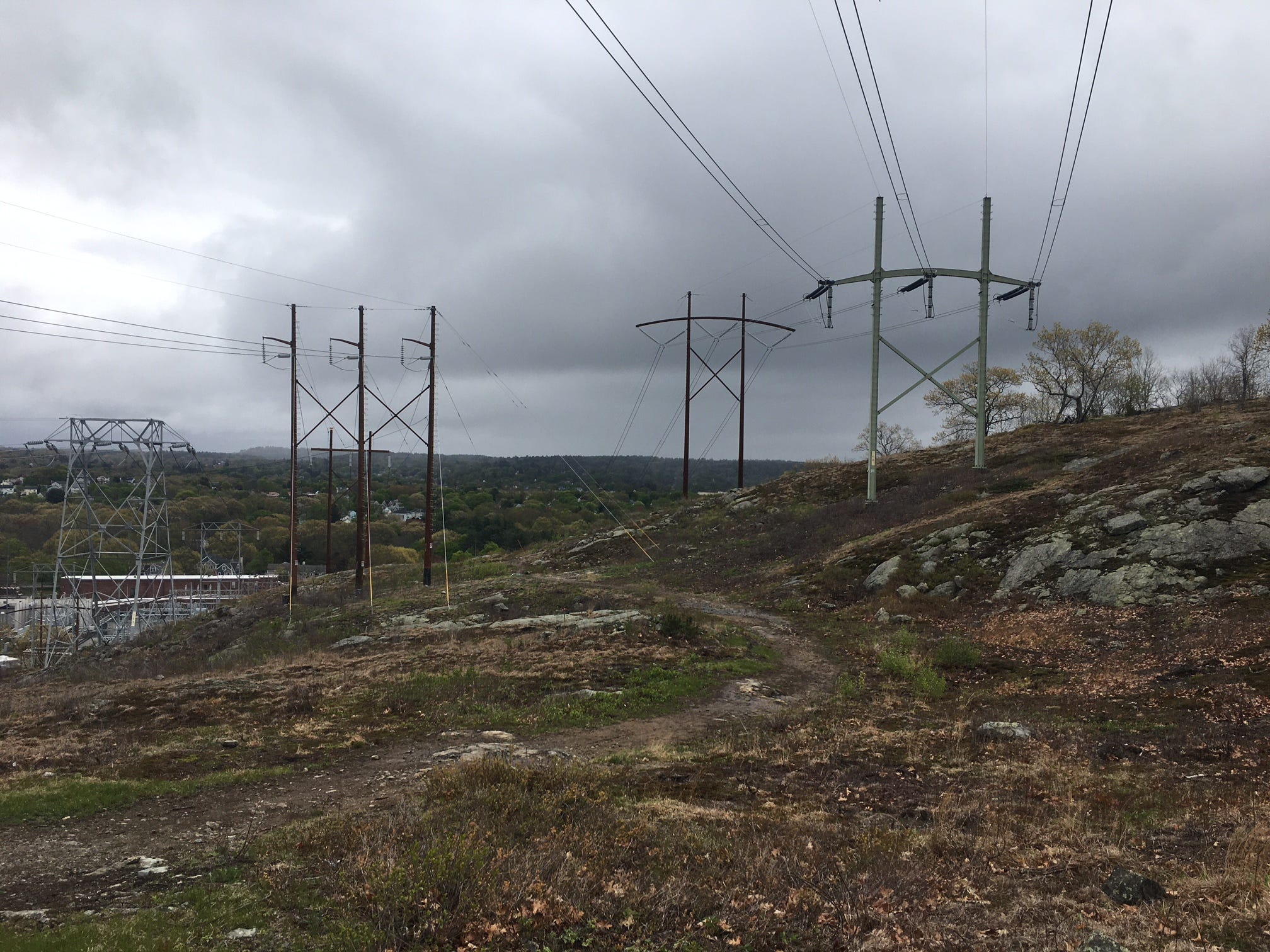
A surprisingly steep scramble down the mountain’s slick rock slabs and a meditative bumble along Horn Pond took me to the parking lot of the Woburn YMCA. From here, I followed a crumbling service road past power lines and into the viney woodlands of Whispering Hill Park. One of the pleasures of hiking the Greenbelt is constantly being surprised by the way a path or forgotten road will connect you to the next surplus of greenery.
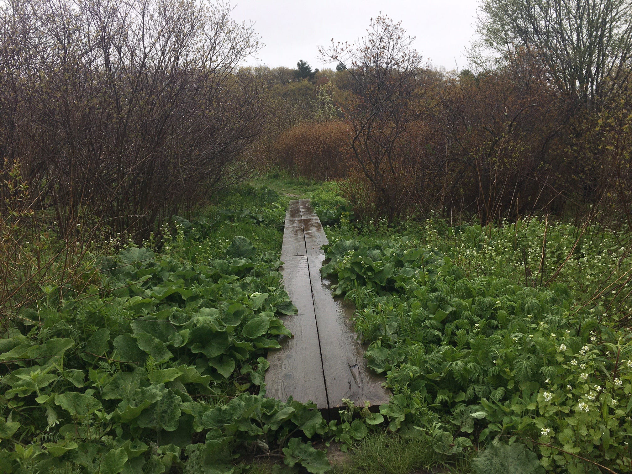
I was especially smitten with Mary Cummings Park, a pastoral wonderland hidden between Burlington office buildings and Interstate 95, where some rotten bog bridges suggested years of dormancy. And eventually, the trail led me directly to one of Burlington’s man-made gems—the back of an H-Mart supermarket, where I made a beeline for the food court, ordered the Japchae glass noodles with beef and veggies, and attempted to wring some of the rainwater out of my tights as I digested lunch.

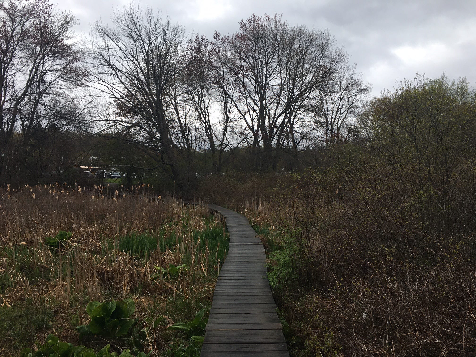
Leaving the mountains of yakgwa and shiitake mushroom chips behind, I crossed into Lexington’s sumptuous forest and followed winding fragments of the signed ACROSS Lexington Trail—a labor of love for the late Rick Abrams—through halls of evergreens, rippling wetlands with narrow wooden bridges, and at one point, along a paved path past Parker Meadow’s seasonal pond, which was dubbed a Barrier Free Trail (instead of, say, a “wheelchair-accessible trail.”) I had been hiking nearly 10 miles at this point, and while that’s nothing to sneeze at, I was impressed by how the Boston Greenbelt Trail felt like a curation of paths and roads that minimized common hiking barriers. I almost never had to walk on the shoulders of roads. The path entrances were clear and tough to overlook. And I never found myself walking through anyone’s backyard, which is something that Americans need to be warier of than we should have to be.
From Lexington’s town square, I had been planning to catch the MBTA’s 62/76 bus to the closest subway station but my dad kindly drove over and gave me a ride, eager to hear how the trail was. We’re now planning to hike the legs that connect Marblehead (where we once lived) to Winchester (where we eventually settled). It’s impossible to hike any of the Boston Greenbelt Trail and not be ensnared by the sense of possibility—of where you could end up, or what sort of leafy, rooty space you might wander into.
But don’t take my word for it. Give it a shot this spring or summer. And tell everyone.
CLICK HERE to visit the AllTrails map of the (partial) Boston Greenbelt Trail
And, as I promised earlier…
Boston Greenbelt Trail section hike ideas, with MBTA public transit connections:
My hike: Winchester to Lexington
Distance: 10 miles
Winchester transit options:
- 134 bus (Main Street at Vine Street)
- 350 bus (Cambridge Street at Oneida Road)
- Lowell Line commuter rail (Wedgemere station)
Lexington transit options:
- 62/76 bus (Massachusetts Avenue at Depot Square)
Malden to Winchester
Distance: 5.6 miles
Malden transit options:
- Orange Line subway (Oak Grove station)
- 131 bus (Oak Grove station)
- 137 bus (Oak Grove station)
Winchester transit options:
- 134 bus (Main Street at Vine Street)
- 350 bus (Cambridge Street at Oneida Road)
- Lowell Line commuter rail (Wedgemere station)
Waltham to Newton
Distance: 6.5 miles
Waltham transit options:
- 61 bus (691 Main Street)
- 70 bus (Elm Street at Main Street)
- Fitchburg Line commuter rail (Waltham station)
Newton transit options:
- Green Line D subway (Waban station)
Finally, if you’d like to see a complete map of the Boston Greenbelt Trail route, CLICK HERE, zoom in on Chadwick Lead Mills Park in Marblehead, and look for a trail line of red dashes heading inland. You’ll see “Boston Greenbelt” written alongside this route.
I know David well, and I'm pretty sure he k nows me. So, surprises me that he didn't mention
the Bay Circuit Trail Project during your walk (or bike). I've been trying to reach you via email.
Still would like to chat about what to me is substantial mutual; interest. Alan French 978-475-4910.