As I write this on November 4th, it’s pushing 70 degrees in Boston. And as much as I’m savoring the pithy joy of wearing sandals and being able to dry laundry outdoors for a few more days, I know this is not normal and it has to end soon. That sense of frosty inevitability has its share of melancholia—the mountains are about to become much harder to climb and the streams far less ideal for bathing—but the limitations that New England winter presents for hikers are an opportunity to cultivate hikes in other places. Or to re-imagine what kind of foot journey can even qualify as a “hike.”
If the summer and fall are ideal times for exploring the alpine zones of the northeast, then I’d argue winter is a banner window for discovering the agonies and ecstasies of urban hiking. Think about it. Winterized cities are festooned with twinkling lights and other seasonal decor that conjures visions of elves and celestial beings. (I might be speaking for myself here.) The parks and urban woodlands are much quieter, you’re never too far from a warm coffee shop or pharmacy that you can duck into whenever the windchill becomes too punishing, and when you’re finished—or in need of some simmered courage—you can take a rest at the closest ramen or udon shop.
We’re going to be visiting several New England cities and towns over these next few dark months, discovering their unsung green spaces and the adjacent amenities. But since a lot of us will be traveling for holidays over the next month or so, I want to take this week to touch on one of the coolest perks of urban hiking. With a little research and creativity, you can create your own urban hiking route in pretty much any city.
Last week I was in Seattle to visit two dear friends and meet their baby. Both of them returned to work recently, so I had the better part of a Friday to kill before we met for dinner and tummy time. I wasn’t renting a car and the city’s acclaimed transit-to-trails bus program had ended its season. So I knew that if I wanted to go for a hike, it was going to be city-bound. Thankfully Seattle offers more than 480 parks where one can huff some cedar and pine aromas. Taking a hike across several of these parks as a means of going from one neighborhood to another seemed like a fine way to spend the morning and afternoon in less familiar city. So that’s what I did—I hiked roughly 9 miles across the city center from the University of Washington campus to the Elliot Bay waterside trails near the Space Needle. By the time I hopped on the bus to meet my friends, I was tired—in that toasty “bring me the Malbec” kind of way—my shoes were caked with mud, and I had a fresh smudge of wasabi on my shirt. A great hike.
Here’s how I did it and how you can craft your own urban hike, wherever you end up.
STEP 1. PICK A DESTINATION AND BUILD BACKWARD
I appreciate a scenic journey as much as the next person, BUT…when you’re doing the physical and mental exercise of walking across a city and calling it hiking, you need a destination that will dazzle you and any companions you’ve roped into the enterprise. Your finish line could be a superlative landmark like the Philadelphia Art Museum or the Hollywood sign. It might be the biggest, baddest park on the city roster: a place that’s bucolic as fuck and bursting with enough native and invasive flora to decorate a dictator’s bedchamber. Or it could just be a place which has something that you know you’ll be craving after hiking several miles across a ratio of dirt, gravel, and pavement.
Bearing in mind the quality of local seafood in Seattle, I chose FOB Poke Bar (FOB being an acronym for “Fresh Off the Boat.”) This little Belltown counter serve joint offers some of the tastiest, squeakiest raw fish you’ll ever cram into a bowl with veggies, rice, and sesame dressing. To quote the proprietors of Susan’s Fish and Chips—a Portland, Maine institution—the fish at FOB is so fresh that you’ll want to slap it. Dreaming about that fish would be my sole motivation throughout the Seattle hike.
#2: BECOME A MAP FREAK AND FIND YOUR “TRAIL”
Believe it or not, there are people who can spend a whole night toggling around online maps, admiring the ways in which parks and green spaces are intersectional. But you don’t have to become a full-time map freak to create your own urban hike. Thanks to the relative ease of scrolling around with free mapping tools like Google Maps, Gaia GPS, and AllTrails, the process of unfurling a giant map of a city and planning a long walk has never been more streamlined. While each of these mapping tolls will reveal different patches of walkable green space in a city (AllTrails is the best for showing active, accessible trails) most online maps will reveal the locations in cities where you have green space clusters. That is to say, neighboring green spaces that can be stitched together as part of a hiking route. You’ll want to find at least one of these clusters after you’ve chosen your destination, because doing so will determine the basic trajectory of your hike. Backcountry trailbuilders look at forested landscapes and use the topography to figure out where a trail should intuitively go. That’s what you’re doing by locating and appraising various green space clusters on a city map.
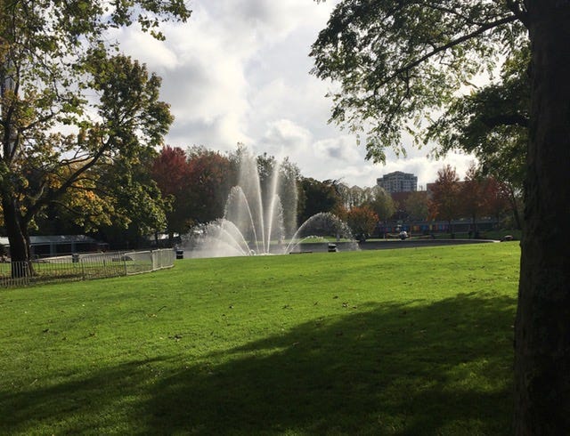
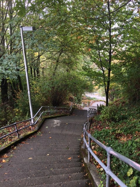
When planning my Seattle hike, I settled on a bounteous green space cluster along Union Bay. Here you can hike across a series of tiny islands that are connected with floating bridges before passing beneath Interstate 520 and entering the Washington Park Arboretum. After meandering through oaks and azaleas to the west edge of the arboretum, you climb into the residential hills of Montlake and enter Interlaken Park, an absurdly ferny pocket of rustic woods with winding stairs that take you to a high point near Volunteer Park, home of the Seattle Asian Art Museum (and one of the liveliest duck ponds I’ve seen in a city.) From here, a ragged descent down some mountain bike trails underneath the massive I-5 freeway is all it takes to reach the south shores of Lake Union. This was an irresistible green space cluster. I knew my Seattle hike would have to include it. So I decided that my startling point would be the nearby University of Washington campus—specifically, the Union Bay Natural Area.
#3: GRAB YOUR GEAR AND GET OUT
When you’re hiking an improvised trail, bringing along reliable maps becomes really important. If you decide to print a map of the area(s) you’ll be hiking through, zoom in and print several pages of the region so that you’ll have a more detailed map in front of you. If you’re planning to use the aforementioned mapping apps mid-hike, consider packing a portable batter and phone charger in case the cold knocks out your battery reserve early. At the very least, bring a charger so you can strategically plunk down in a coffee shop with power outlets, if need be. As much as I’d love to point you in the direction of a series of guidebooks showing you how to hike from Point A to Point B in a series of major cities, this is a travel literature sub-genre that doesn’t exist yet. I’m working on changing that (more news on that soon, hopefully) but for now, digital or printed maps will be your best friends and your keys to a memorable cross-city hike.
Finally, despite the fact that you’re hiking across a city, treat the rest of your packing as though you were in the backcountry. Warm layers, outer layers for wind and rain, a cozy hat and possibly gloves, and water-repelling footwear will make your hike more comfortable. While it’s possible to take shelter from the elements in a city far more frequently than you can in the backcountry, you’re still going to be dealing with those elements for several hours. Plus, when you treat packing for an urban hike like rural hiking preparation, your city journey will start to seem more like a proper expedition. Since urban hiking is kind of goofy by nature, that kind of vibe can make it feel real.
But then again, I’d argue that throwing a bunch of loose clothes and some peanuts in a backpack and taking off across the countryside is pretty goofy wherever you do it.
RETRACE MY CROSS-SEATTLE HIKE
Hike distance: 9.0 miles (Point A to Point B)
Elevation gain: 669 feet
CLICK HERE for an AllTrails map


Great post- one of my favourites! I enjoy seasonally-inspired hikes, too - countryside England is great in most of three seasons, but winter means city hikes - and there’s nothing like the Christmas season to bring out the best colours, festivities and, well, tat!
Good tips! For some reason it reminded me of all the times I've accidentally urban hiked without a plan. In my family we call them "death marches" but they're usually more good than bad. But we don't talk about Busan.
Just wanted to piggyback on your "wrapping up for the year" vibe and say that I had rich and memorable trips to Providence (new spots in an old fave, 24k steps...) and Vinalhaven (lifelong intention to visit, pushed over the finish line with your logistic info) this year because of your newsletter and I really value it.