


You know That One Day in spring, when you wake up and find yourself feeling more turned on than you’ve been since October? When I say “turned on,” I’m talking about the totality of mind and body energy. You’re able to appreciate the delicate flavors of your morning coffee or tea. You can feel the warmth of those sunbeams refracting through your bedroom window, bouncing off the walls. And when you eventually step outdoors and get an immediate noseful of allergens, you couldn’t care less about the sneezing fit that follows. To paraphrase the early 2000s Christian metal band P.O.D., you feel so alive. It might as well be the very first time. And there’s no denying spring.
The rebirth of the landscape each spring actually precedes another epic flourishing of new life. Summer and early fall are the peak seasons for baby deliveries. Odds are you know somebody who’s getting close to their due date. That’s just how the conception calendar has historically worked out. (I mean, let’s be real: Would you rather conceive during the fetid humidity of midsummer, or during sweater season?) But some of us get started earlier, and this week, I would like to introduce you and the whole Mind The Moss community to my new baby. A very big baby, born just a couple of days ago. . .
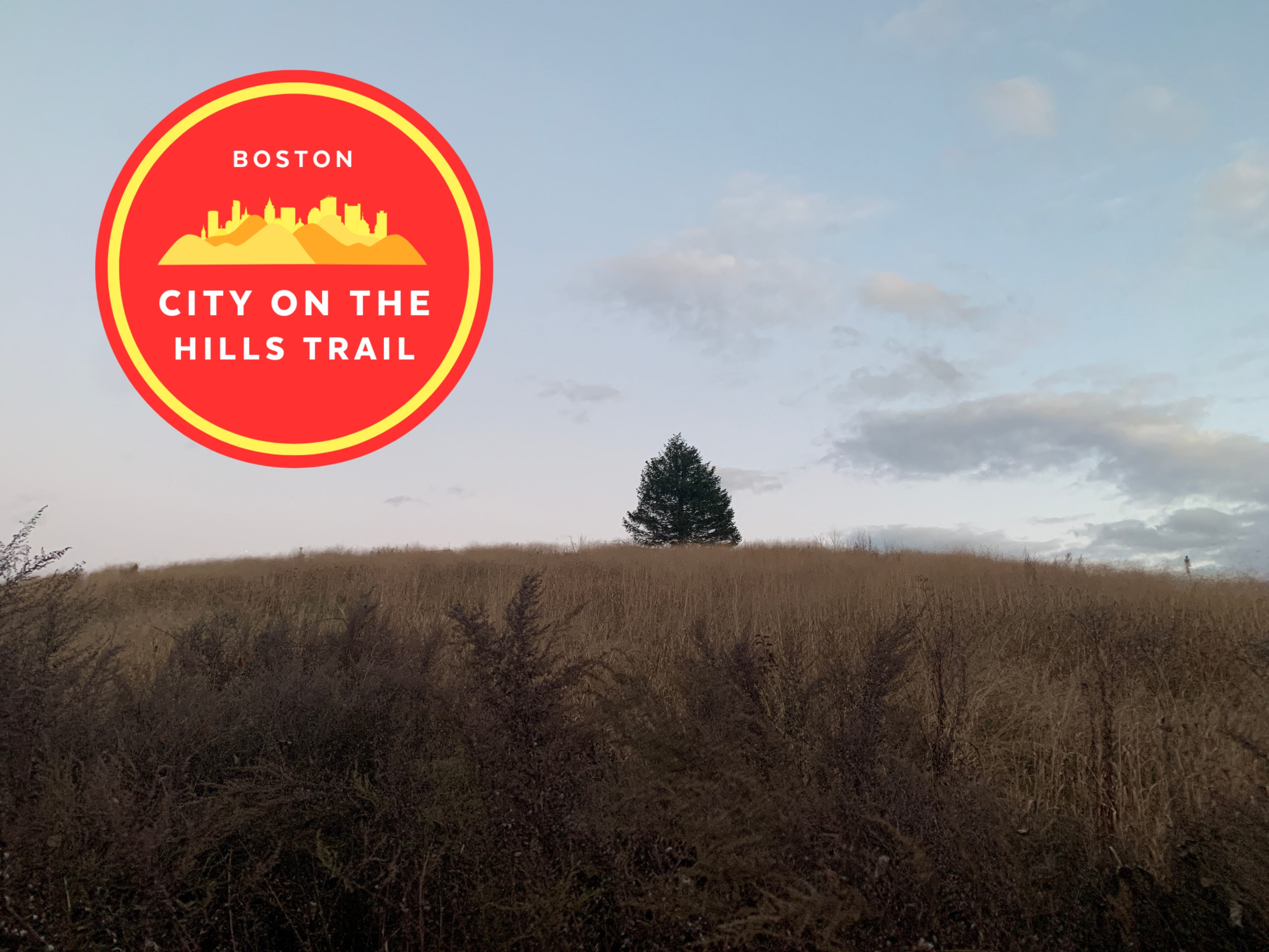
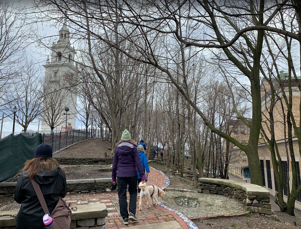
Originally conceived during the summer of 2024—which gives us a gestation time of about nine months!—the City On The Hills Trail is the newest addition to Boston’s trail labyrinth. It’s a juggernaut of an urban hike; starting on the banks of the Charles River at Millennium Park, on the edge of the city in West Roxbury, and running 31.1 miles to Castle Island, where you can gaze at Boston Harbor and watch some seagulls fight over spilled french fries from Sullivan’s seafood shack. The City On The Hills Trail is an east-to-west sibling to Boston’s Walking City Trail, which meanders just over 27 miles from the Neponset River in Mattapan to Bunker Hill Monument. The two trails briefly intersect atop Mission Hill, forming an octopus-like shape across the City of Boston.
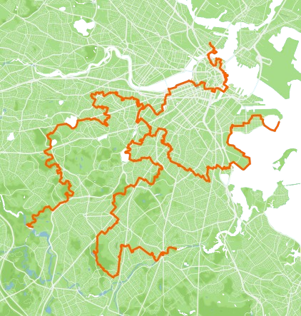
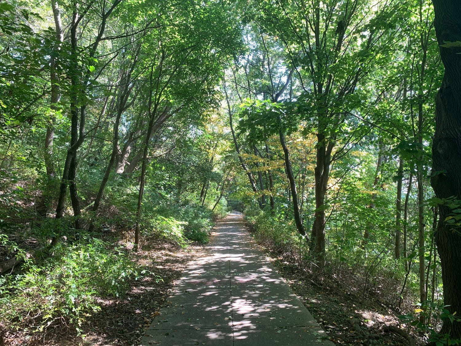
Continuing the Walking City Trail’s narrative—celebrating Boston’s green spaces and the many shapes and sizes in which you find them—the City On The Hills Trail is split into five segments of 6-7 miles each. You can hop aboard an MBTA bus or train at the start, midpoint, and ending of each trail section. Local outlets for grub, libations, and mid-hike shopping become more frequent as you walk eastward from the river to the harbor. And the range of green spaces that you encounter along this journey is really something. From vast, chirping forests and wetlands in Chestnut Hill and Brookline, to little-known hilltops and community gardens nestled in Roxbury and Dorchester, you’re hiking through over 40 verdant oases spread across nine city neighborhoods. If that’s not an invitation to take the train, ferry, or freeway into Boston right now, as the trees return to full color and the once-dormant flowers bloom like hell, I don’t know what is.
Those of you who read Mind The Moss regularly most likely know that I’m the guy who started the Walking City Trail, despite lacking any background in land management or construction. Both the Walking City Trail and the City On The Hills Trail are examples of a new, grassroots approach to trail building—a model known as the Instant Urban Trail. It’s basically an act of walking space curation. You find a cool path through an urban green space that offers some sweet scenic features. Then you find a similarly interesting street (or a series of streets) that connect to another green space. Rinse, repeat. Then, you come up with a catchy name. You make some maps and directions for your route. You throw them on a website, and BOOM! You’ve got a new urban trail.
Instant Urban Trails have been mushrooming up from the sticks and streets in a lot of cities lately. Worcester, Mass. cranked out the East-West Trail, which goes from Lake Quinsigamond to The Cascades. San Francisco has gotten some major press for the Crosstown Trail and the Double Cross Trail—which showcase some of the city’s best forests, canyons, and high points. And one of the volunteer trail builders who helped bring the City On The Hills Trail to life is Mike Tormey, a Boston-based transportation planner who created the 177-mile Denver Orbital Trail while he was living in Colorado not long ago. The DOT, as some call it, is a gigantic circle around the Denver area that features not only mountains and meadows, but weirder places like a cat food factory where the emissions made Tormey’s eyes water as he sauntered along the fence. “It’s weird and interesting and gritty,” Tormey told me last year for an Outside story. “It’s one strange moment of a big, long urban trail, and part of the broader urban environment.”
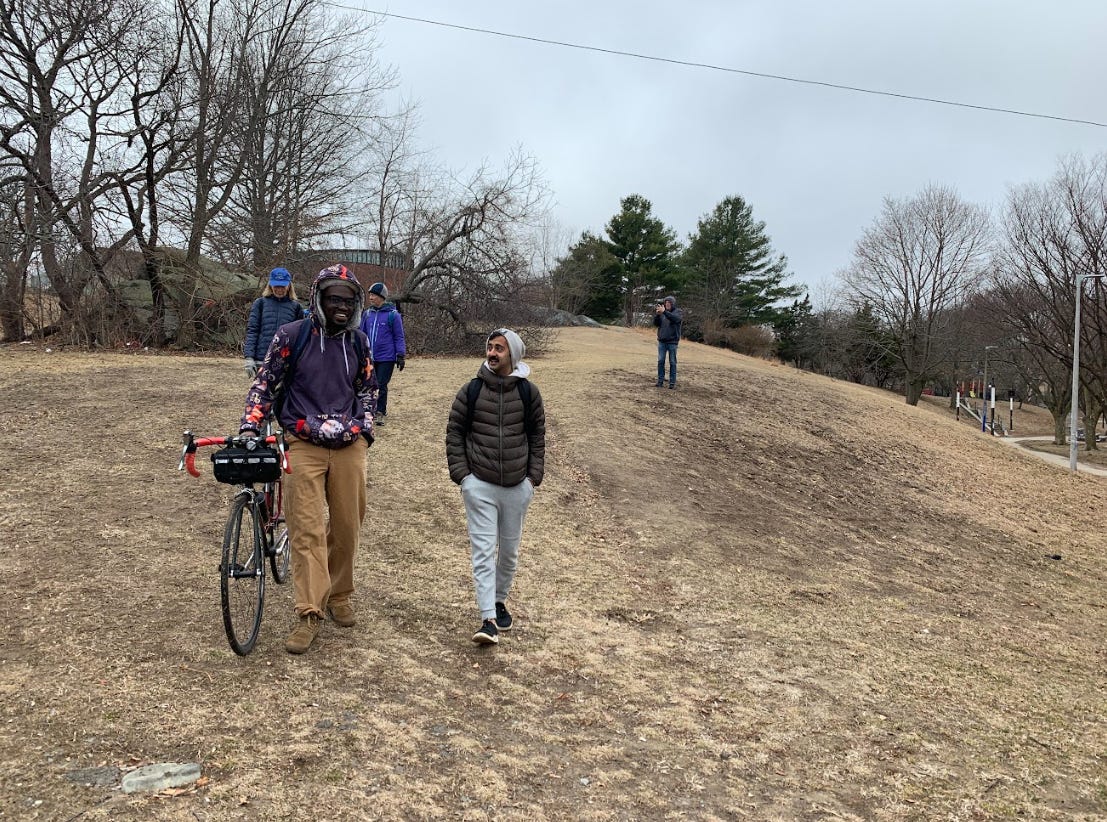
This idea of telling the complete story of the cityscape and what it’s made of—from the naturalistic to the gritty—had an influence on the layout for the City On The Hills Trail. Working with a theoretical map of the route that I put together last summer, after poking around the parks and streets between West Roxbury and South Boston, a crew of us ventured out into the elements this winter to walk, test, and finesse each section of the proposed trail. And the thing that we found ourselves debating most often was the connections between the featured green spaces—connections that involved built environments that are often busy and cacophonous.
For example: the Allston section of the trail decends the open hillside of Ringer Park and then uses Commonwealth Avenue to reach the quieter, greener streets of north Brookline. Initially, I had thought of using a much quieter street that runs parallel to Commonwealth to make the connection to Brookline—knowing that a lot of hikers might prefer to avoid the congestion of Comm Ave. But during our scouting walk, volunteers made a persuasive counter-argument. If the trail was rerouted to Commonwealth Avenue, to get from Ringer Park to Brookline, it would offer people the chance to walk right past the old apartment building where Aerosmith lived and held band practices in the early 1970s. We gave it a try, digging the historic easter egg, and in the process, we found a bonus ecosystemic oddity; a USPS mailbox that Allston’s pigeons appear to have chosen as their neighborhood toilet.
We rerouted the trail.

The “we” here is important, because more so than the Walking City Trail—which began as a solo project and evolved into a collective endeavor, as people attended the public trail walks that I organized—the City On The Hills Trail was a group project from the beginning. Those of us who created the final, cemented version of Boston’s Walking City Trail started talking about the possibility of more trails connecting more Boston neighborhoods as far back as February of 2023. The concept for the City On The Hills Trail was the logical sequel to the Walking City Trail; a companion route that would cover neighborhoods not featured along the latter, with the same foundational theme. And while the rough draft trajectory of the City On The Hills Trail is something that I cooked up on my own, the trail as it now exists reflects a collective imagining. Some of the best turns and gems along the trail—such as a hidden lookout point up on Savin Hill where you can gaze toward Downtown Boston—were suggested by the volunteer urban hikers who came on the scouting walks. The trail is better thanks to their ideas.
I hope a few of you have already grasped what I’m building toward here: You could do this too, in your city or town. You don’t need official permission to create an Instant Urban Trail (as long as it’s made of spaces where the public can walk freely.) You don’t have to do a feasibility study or hold a series of community meetings to discuss the idea. In fact, it’s probably best that you don’t hold any town hall-style meetings about a project like this. Because those kinds of meetings tend to become reactionary. When you ask the public to help you form a consensus about whether a community project should or shouldn’t happen—whether it’s a new affordable housing complex or a new trail—fear of change can suck the oxygen out of the room. Most Instant Urban Trails are created by small groups of people, who invite the wider public into the trail project through events like organized walks along the trail. What this approach says is, “This thing is happening, and we’d love for you to be a part of it. Come take a walk with us.”
So when you embark on your introductory ramble along Boston’s City On The Hills Trail this spring or summer, take a moment to sit with any flashes of inspiration that come. Start asking yourself questions like, “What story would I want to tell with a trail across my hometown?” or “Who would my accomplices be, if I actually decided to build one?” Think about whether your trail would be a local resource, sculpted by input from the walking public, or a secret passageway that you and your co-creators could return to. And if you decide to take the former approach, consider the season(s) when you’d be most excited about spending a lot of time pushing aside branches, tiptoeing around puddles, and scribbling down field notes about the benefits of one path across a park versus another pathway. If you’ve ever created a website—even an extremely simple one—get ready to dust off those Squarespace or Wix skills. And if you haven’t, see if any of your friends have ever dabbled in this space, and think about recruiting them.
There’s so much more I could say about this, and I’ll save it for the guide to building an Instant Urban Trail that I’m working on right now. It should be coming out by June. But for now, enjoy these sultry mornings and afternoons—before the inferno of summer—with a walk across Boston’s greens and grays. Hike the City On The Hills Trail, in as many or as few pieces as you like. And when you’ve finished the trail, do let me know by sending me an email. You will be rewarded for finishing, sometime later this year.

Boston’s City On The Hills Trail
31.1 miles point-to-point
1,834 feet of elevation gain
CLICK HERE for maps and directions
A couple of weeks ago, I sent out a brief survey to Mind The Moss readers with paid subscriptions—with the intent of finding out where exactly MTM readers are reading from, and where they’re likely to walk. This week, I’m sharing that same survey with the entire Moss community. I’d love to get a sharper sense of the geographic reach of the newsletter, so that I can ensure that I’m publishing place-centric writing stories that are useful to most of you. Of course, not every Mind The Moss story is centered around walking destination ideas. But I know this is one of the top reasons why many of you subscribe to the newsletter; to find cool places for walking. Already, thanks to those of you who filled out the survey, I have a better understanding of the locational scope of the Moss community. So if you haven’t completed the reader survey yet and have a minute or two for doing so, I would appreciate it so much. CLICK HERE for the survey. And thank you to all of you for subscribing and keeping the Moss flourishing!
RECOMMENDED READING
- ”You can walk across San Francisco in a day. Here’s how.” (Chaney Kwak, National Geographic.)
- “S.F.’s newest urban hike is 15 miles of pain and bliss.” (Peter Hartlaub, San Francisco Chronicle.)
- “Visit dozens of Seattle’s best parks on this Olmsted walking route.” (Terry Wood, The Seattle Times.)
- “A 27-mile community-made trail brings urban hiking to Boston.” (Alysa Guffey, The Boston Globe.)
- “Instant Urban Hikes Are Popping Up in U.S. Cities.” (Moi, Outside.)

Just wrapped up Section 3 (closest to home), waiting for my Penguin pizza with a beer. Excellent, if damp, use of my morning, big thanks to everyone who built this!